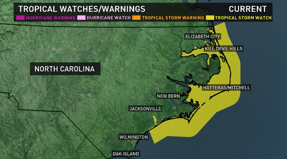
Columbia, SC (WLTX) - Tropical storm watches were issued for parts of the North Carolina coast Sunday afternoon.
The tropical storm watch is from Surf City up to the North Carolina and Virginia border. A storm surge watch is in effect from Cape Lookout to Duck, NC.
A tropical storm watch means tropical storm conditions are possible within the watch area within the next 48 hours.
A storm surge watch means there is the possibility of life-threatening rising water moving inland from the coastline.
While Hurricane Maria is not expected to have a direct impact on South Carolina, it still could cause dangerous rip currents here, and maybe a bit more to the north of our state.
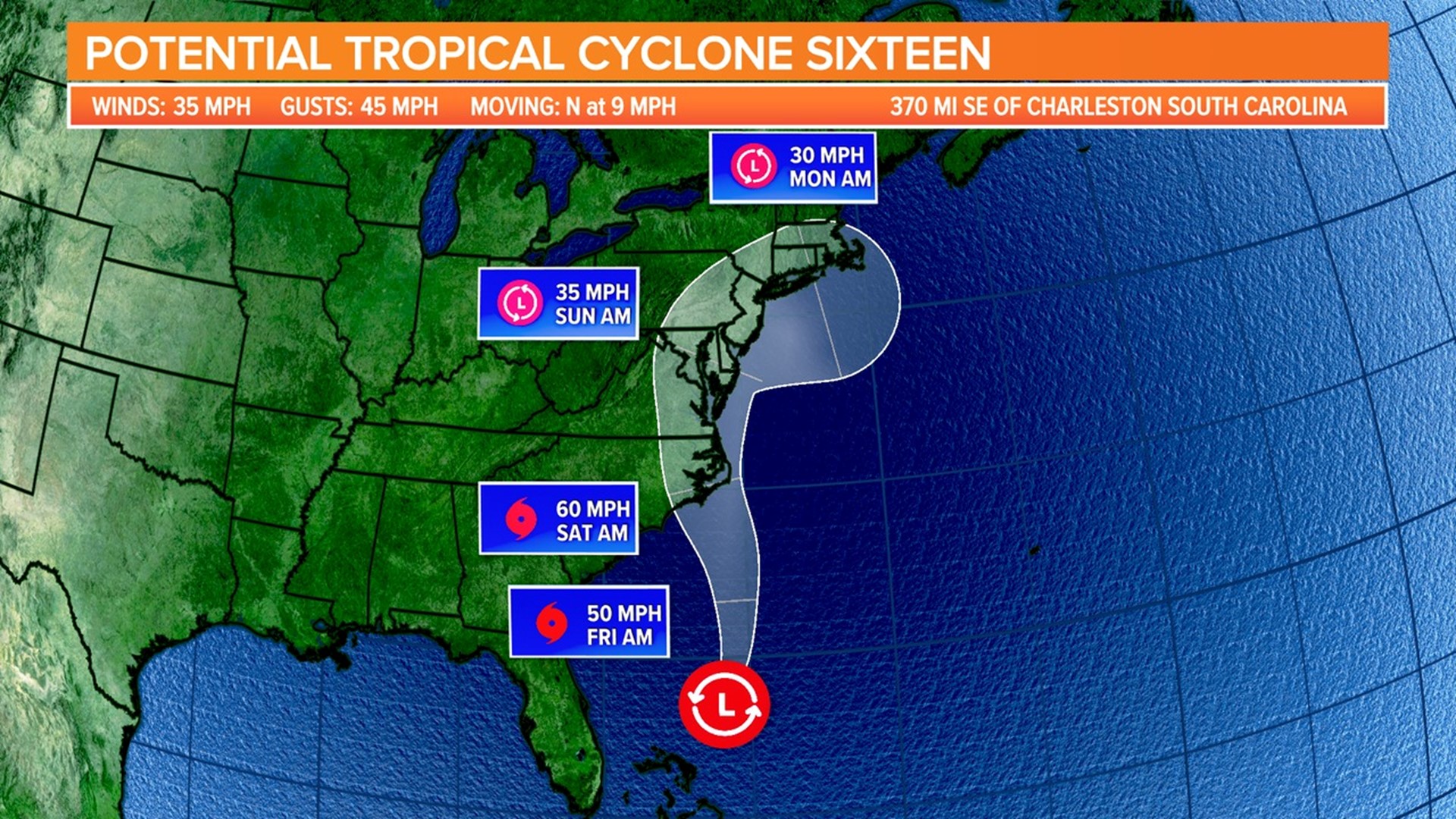
As of early Sunday night, the storm's maximum sustained winds were 90 miles per hour, making it a Category 1 hurricane.
Maria is moving toward the north at 8 MPH.
iPhone app: on.wltx.com/1NTHH98
Android app: on.wltx.com/1NTHvXq
Bottom line: What about South Carolina?
We remain confident that the storm won't have any real impact on South Carolina.
Why do we say that? Well, there's been a lot of consistency with model runs over the last several days that show the storm keeping well off shore. So at this point, it does not appear that our state has much to worry about with Maria, at least directly.
However, there may still be a chance for dangerous rip currents along the coast.
While it's not a 100 percent definitive no, or a complete "all clear," unless something dramatic were to happen (which is unlikely) with the weather forces that are driving the path of the storm, our state should be fine from any broader impacts.
Further to our north may be a different story. The computer models have begun to show that Maria could track much closer to North Carolina and Virginia's coast than previously thought. If that's the case, the Outer Banks of North Carolina and the Mid-Atlantic states could be at risk for possible tropical storm conditions by early to middle of next week.
For that reason, the system will require further monitoring.
As always, our weather team will be keeping you up-to-date on the storm. You'll be able to fine those here on WLTX.com, on air, and on our Facebook page and by following us on Twitter @WLTX