
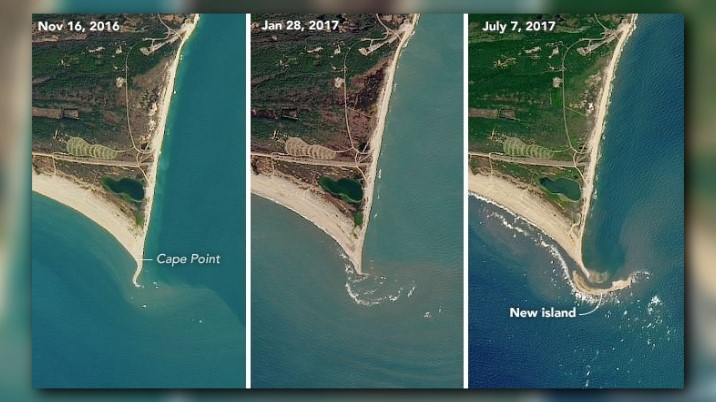
CAPE POINT, N.C. – NASA has released satellite images of North Carolina’s newly formed island nicknamed, “Shelly Island.”
Landsat 8 satellite took the first picture in November 2016. Waves could be seen breaking on the shallow region off the Cape’s tip in the second image.
NASA said where the waves are breaking is where Shelly Island formed which is visible in the third image taken this month.
Andrew Ashton, a geomorphologist at the Woods Hole Oceanographic Institution, talks about the shallow region and how it could be exposed, “A likely process would be a high tide or storm-driven water elevation that piled up sediment to near the surface, and then water levels went down exposing the shoal. Waves then continue to build the feature while also moving it about.”
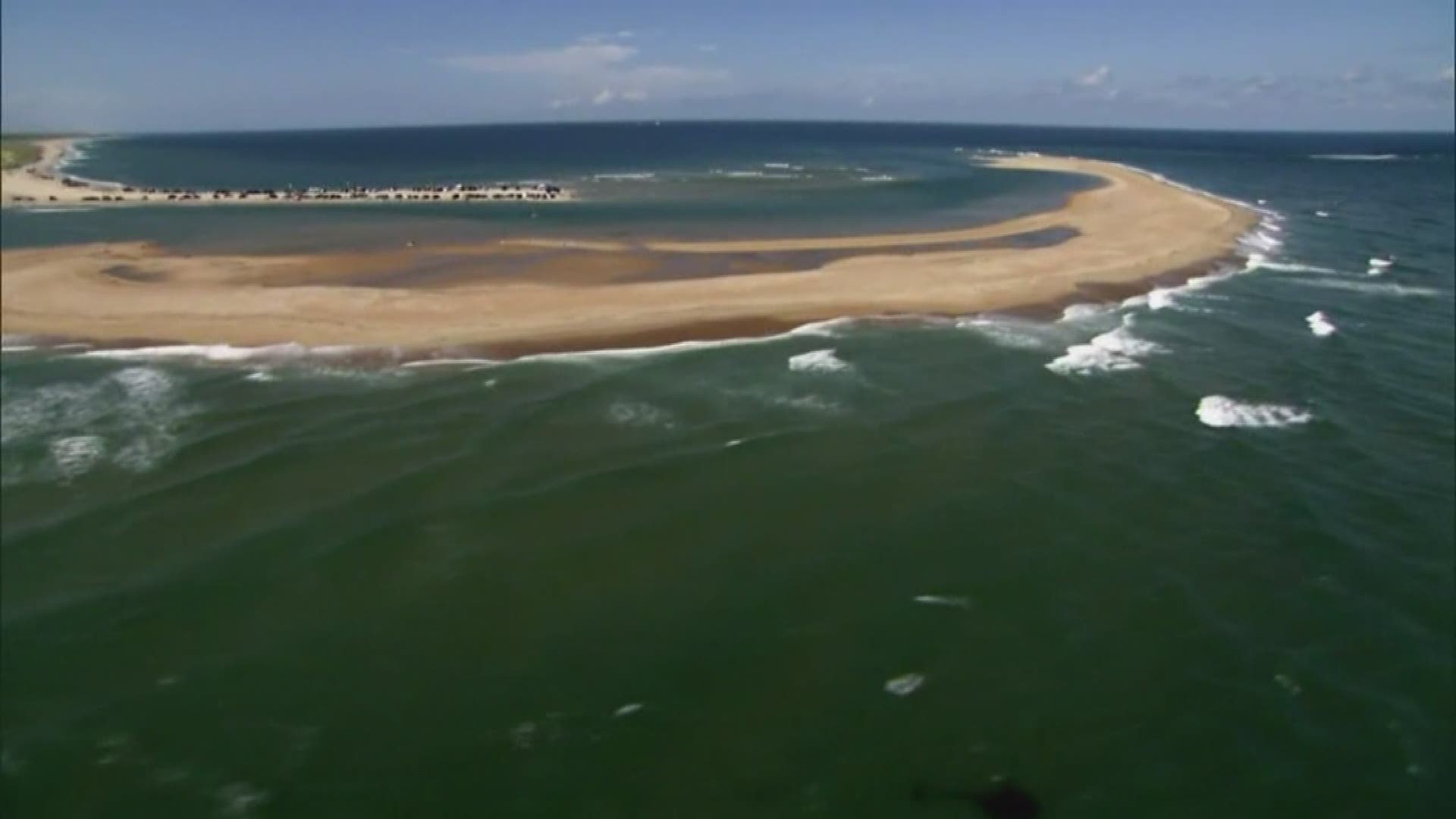
The island is about a mile long and 300 yards wide.
While it’s still mostly unknown how Shelly Island formed, NASA says this phenomenon is not uncommon.
NASA gives an explanation for the phenomenon:
“The shoreline and cape tips along North Carolina’s barrier islands are constantly in motion. Cape tips are sculpted by waves and currents that hit from all directions. Meanwhile, sediment is carried up and down the coastline and often deposited near the cape tips. Each cape has a so-called “cape-associated shoal” lurking underwater. These submerged mounds of sand can extend for tens of kilometers. They are also very shallow, rising to anywhere from 10 meters to a few meters below the surface in places.”
“Tidal flows moving up and down the coast are diverted by the capes and result in a net offshore current at cape tips and deposition at the shoals,” Ashton said. “Occasionally, a portion of the shoal becomes exposed and forms an island.”
►Make it easy to keep up to date with more stories like this. Download the WFMY News 2 App now.
Have a news tip? Email news@wfmy.com, visit our Facebook page or Twitter.