
SARASOTA, Fla. — Technology is constantly changing the way first responders and government entities deal with natural disasters like hurricanes.
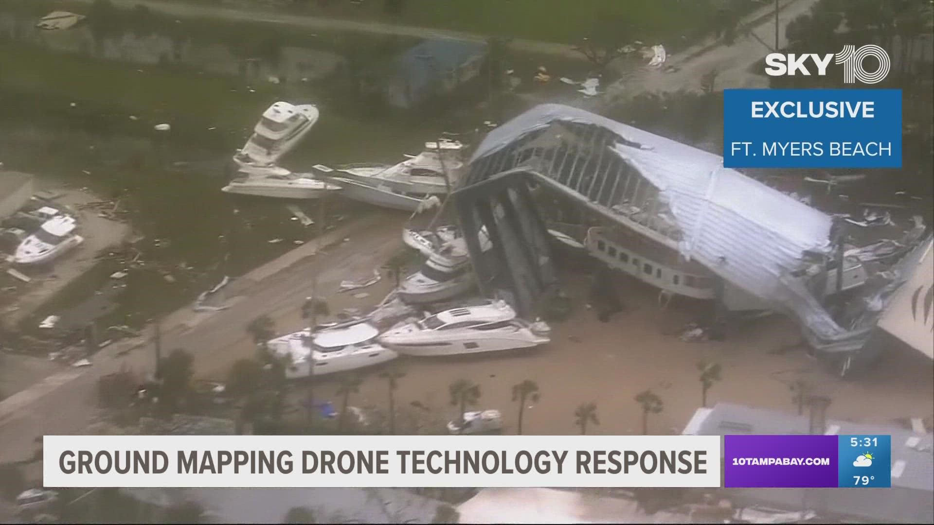
As Hurricane Ian approached and then hit Florida late last month, several drones took to the sky for a bird's eye view of things and to relay information to emergency management teams. Some local drone operators were at the forefront of this effort and spoke about how their work has helped so far with emergency response and recovery.
Before the hurricane made landfall in Lee County, drones were used to map out areas in southwest Florida, including modeling buildings and street locations. It also provided pre-storm images. That information came in handy when the floodwaters took over a vast number of streets and homes.
"We were able to get drones in the hands of agencies that may not have the most experienced drone pilots in the world," said Chris Mauser, drone specialist with Skydio. "But being able to get it in their hands, and being able to accomplish missions in a high-stress environment, kept things very safe for the agencies."
Skydio is an autonomous drone manufacturer, which is based in California. According to a company spokesperson, Skydio's autonomous drone flights are used to generate 3-D models, or digital twins, that help with disaster damage assessments before and after it happens. The technology is being used by different agencies across the country, including the Department of Transportation.
Mauser and his colleagues have been mapping out places like North Port and Ft. Myers where flooding from the storm left homes in more than 3 to 4 feet of water. Their drones were also used by first responders throughout impacted areas in the state.
"People were using our drones to go into the mangroves. Our autonomous flight gives pilots the ability to get really, really close to things and not run into them," said Bryan King, another drone specialist with Skydio.
Using these drones, emergency management centers are able to access a live video feed, which is sent in real-time.
"It [the drones] makes it really useful for law enforcement and makes it possible to do things they couldn't do before," said Mauser.
State and Federal emergency response leaders use the information to make rapid decisions about where to deploy resources and what areas need urgent reconstruction intervention to aid rescue, recovery and relief efforts.
"You had the Piney Island Bridge, you had the Sanibel Island Causeway. Many drones are constantly running up and down the bridges, monitoring the structure, monitoring the progress of the bridges as they're being built back up," said King.
Some of the data is used to assist with insurance claims and to determine whether property, like cars, boats and trailers, could be recovered.
The drones also help first responders assess danger ahead and decide whether or not to go into such places right after a storm
"Before they would have had to send in boats into these really tight mangroves, and people into these tight mangroves, to be in dangerous areas whereas they don't really need to do that anymore," said Mauser.
More than 50 Skydio drones are operating in areas across the state impacted by the hurricane.