COLUMBIA, S.C. — The dry weather will continue through the beginning of the workweek. Some much-need rain is possible starting Tuesday. Temperatures will be closer to normal too.
Friday was very warm across the area. Columbia reported a high temperature of 82 degrees. That broke the daily record high for December 3. The old record of 79° was set in 1979 and tied in 1991. The 82° temperature Friday was only the 31st time Columbia has recorded a high of 80° or higher in the month of December.
The all-time record high temperature for December is 83 degrees. That record has been hit three times, December 16, 1971, December 4, 1978, and December 8, 1978.

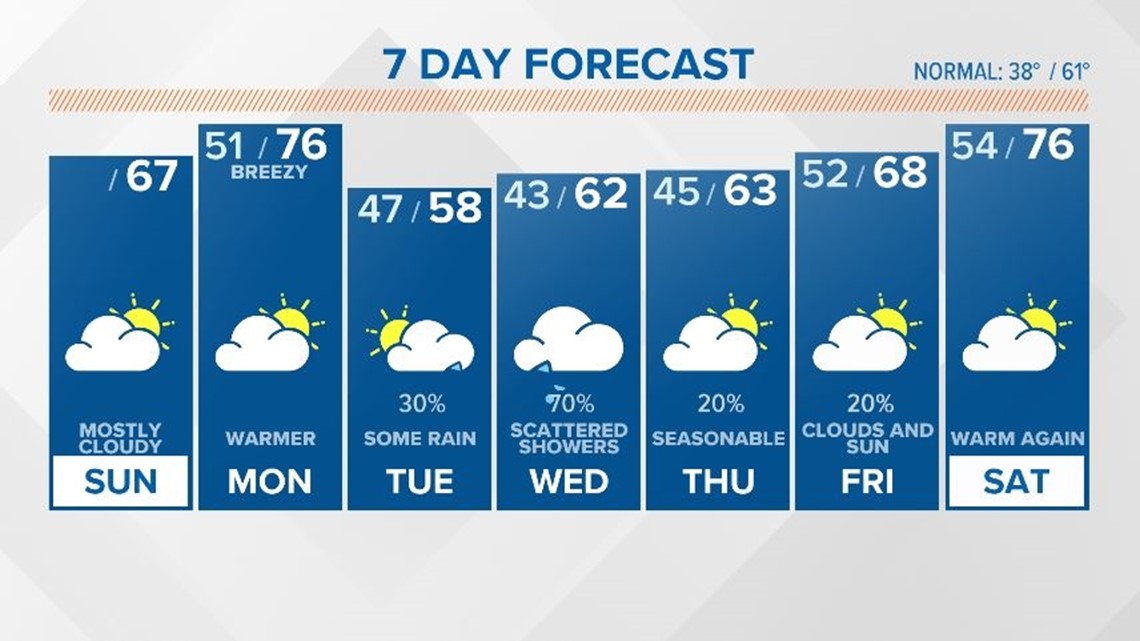
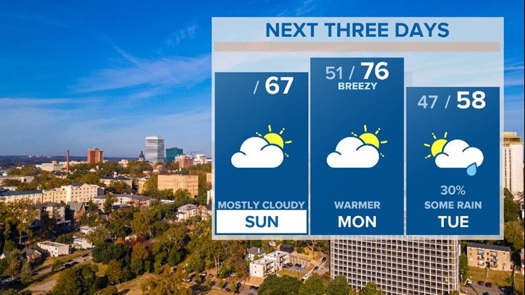
Saturday highs hit the lower to middle 70s with a mix of sun and clouds. Sunday morning started off foggy with lows in the lower 40s.
Temperatures will be a little cooler today, compared to yesterday, but still above normal with highs in the upper 60s.
The winds will pick up on Monday. This may enhance the fire danger, but moisture will be increasing too. Highs will be in the middle 70s under mostly cloudy skies.
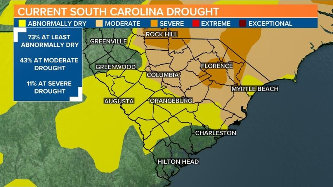
A few showers are forecast for Tuesday, but the best chance for rain appears to be late Tuesday and Wednesday. Models have not been very consistent with this potential rainmaker, but we certainly do need the showers. The drought continues to worsen across the state.

There will be a slight chance for rain Thursday, but Friday appears to be mostly dry. Temperatures will be near-normal Tuesday through Thursday but warming back up Friday.

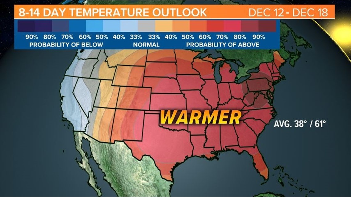
The 8-14 day temperature outlook is indicating warmer-than-normal conditions for the Southeast.