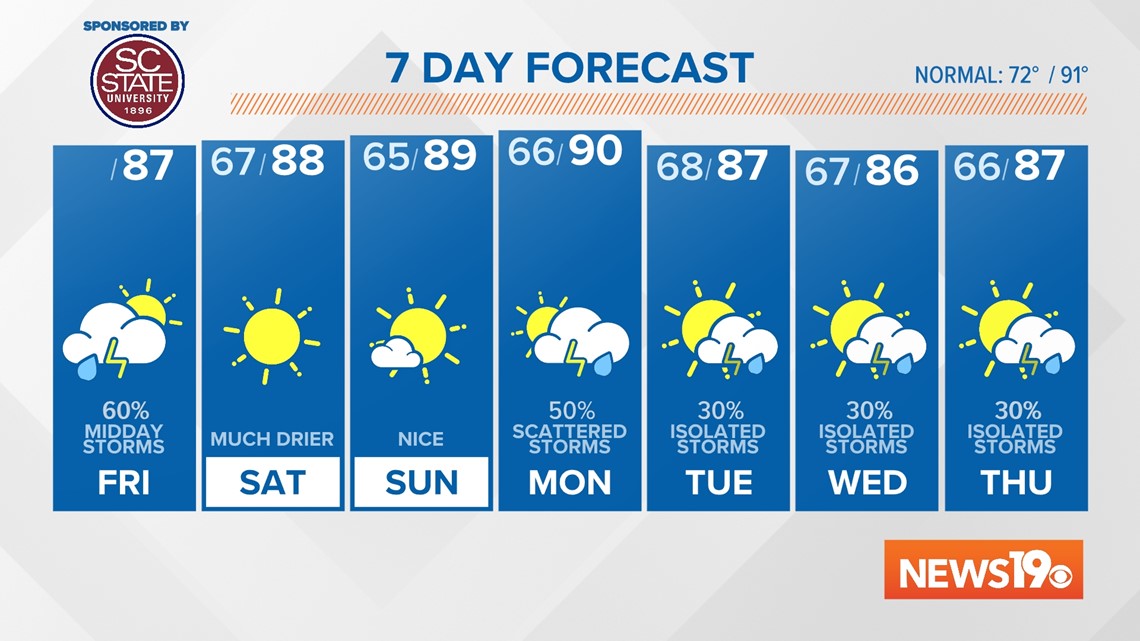
COLUMBIA, S.C. — Showers and storms are already moving through the South Carolina Midlands this morning.
Rain will continue through the early afternoon before we see some much nicer weather moving into the Midlands just in time for the weekend to arrive.
A cold front over North Carolina is bringing rain across the Midlands and will continue to fire off storms in the area. Right around midday, we expect storms to be scattered across the Midlands. Any rain will continue south with precipitation leaving the viewing area as late as 2 to 3 p.m. this afternoon. Highs will be expected in the upper 80s with some sunshine in the afternoon.


Behind this cold front, we are looking at some really nice weather just in time for the weekend. While temperatures will be somewhat cooler with highs in the upper 80s, the biggest change will be in our humidity. Our dewpoints will be dropping from the 70s on Friday into the 50s this weekend.
This will be only the second time this entire summer we have seen air this dry across the region. This will allow for some really comfortable weather on Saturday and Sunday with plenty of sunshine.


As we look at next week, models have begun to center on another cold front that will move through the Midlands on Monday. This will bring storm chances back to the region. Behind the front, we do keep some isolated rain chances around but temperatures look to drop down into the middle 80s which will be some of the coolest weather we have seen in a while.