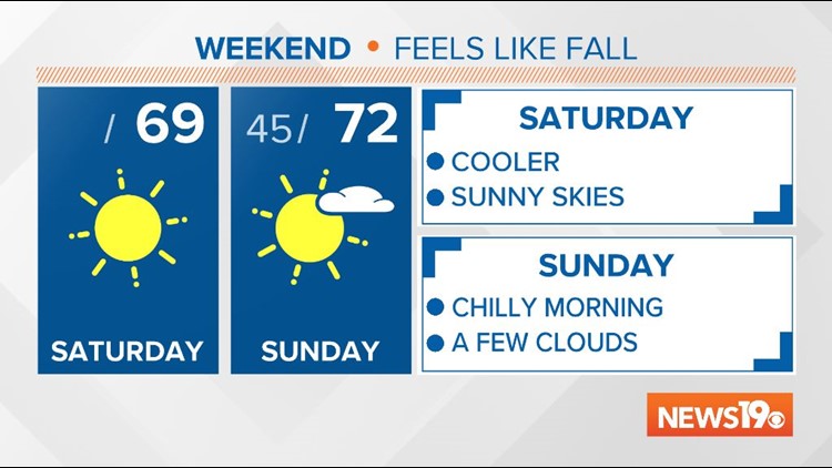
COLUMBIA, S.C. — Fall has arrived this weekend with much cooler and drier weather in place across the Midlands.
This cooler weather is ushered in with high pressure behind a cold front that moved through the Midlands yesterday. This high pressure will keep skies clear and sunny today and mostly sunny tomorrow.
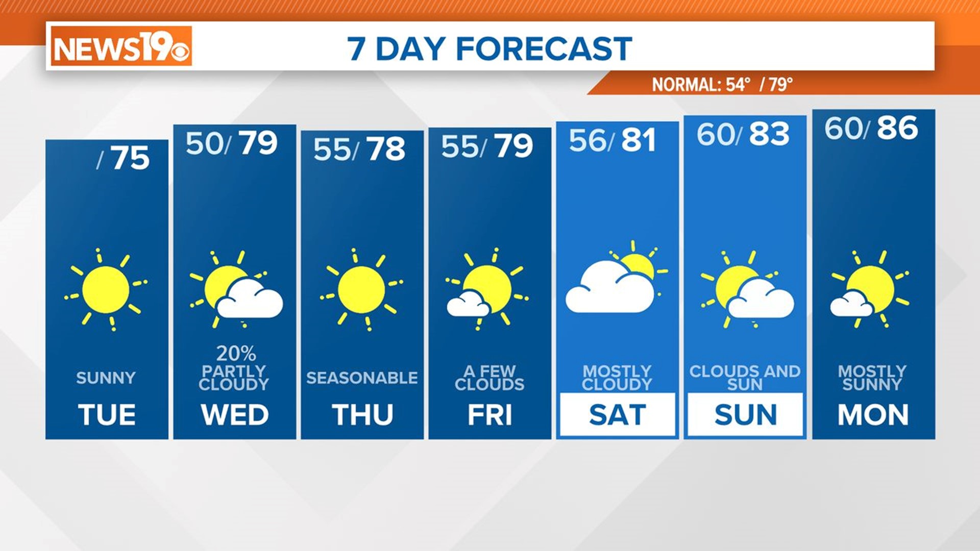
High temperatures this afternoon are expected to run about 10 degrees below normal, topping off in the upper 60s.
Overnight, clear skies will prevail with temperatures dropping into the 40s, once again about 10 degrees below the average for the middle of October.
After tomorrow, temperatures will start to moderate a bit and warm each day. High temperatures Sunday afternoon will be in the low 70s under mostly sunny skies.

By the work week, our highs will be back near 80 degrees with partly cloudy skies. Additionally, our humidity will increase a touch through midweek.
Mostly dry weather is expected through the work week, with a chance for rain potentially returning by next weekend.
RELATED: Local Forecast
Looking at the tropics, there are two areas that the National Hurricane Center is monitoring for potential development.
The first area in the Atlantic has a 90% chance of developing over the next few days. This system is expected to slowly strengthen as it meanders in the Atlantic. If named, it would be Epsilon.
The second area to watch in the Caribbean has a 30% chance of development over the next five days as the system slowly pushes north. Models are not currently in good agreement on the development of this system or where it might go. Currently there are no risks for the Southeast, but it is something we will continue to monitor.

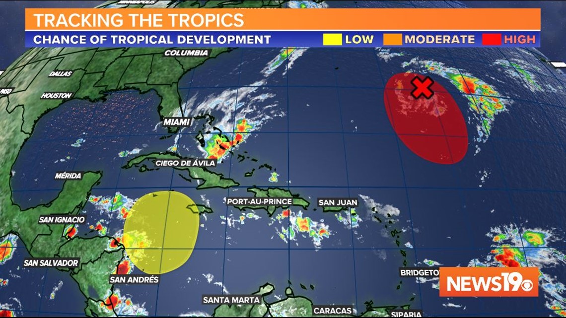
Hurricane season officially extends through the end of November.