COLUMBIA, S.C. — A cold front will cross the area late Tuesday or early Wednesday. This will bring us a chance for severe weather tomorrow, and much-cooler temperatures Wednesday.
The weekend was unseasonably cool. Highs on Saturday and Sunday were generally in the lower to middle 70s. Some areas got a little rain Sunday, but the showers were pretty light.
More rain is possible today with a few rumbles of thunder. The highest chance for rain will be in the southern and eastern half of the Midlands. No severe weather is expected today. High temperatures will still be below normal, topping out in the upper 70s to lower 80s.

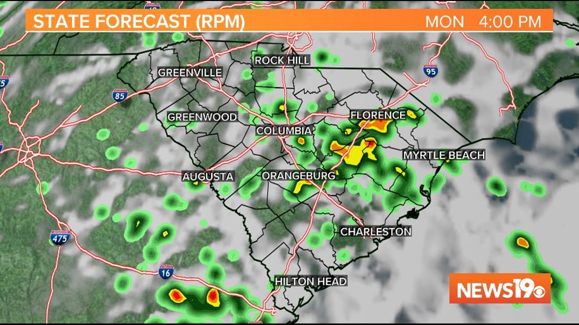
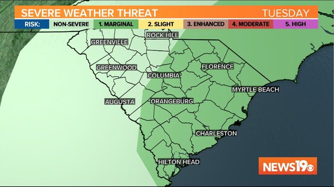
A cold front will move across the area late Tuesday or early Wednesday. Showers and storms will be likely across the Midlands Tuesday afternoon and Tuesday evening.
The Storm Prediction Center has most of the Midlands under a marginal risk for severe weather Tuesday. The greatest threat will be damaging wind gusts. Locally heavy rainfall will also be possible Tuesday afternoon and Tuesday evening.
High temperatures before the rain moves in will climb into the upper 70s to lower 80° range.

The clouds may persist for part of the day Wednesday. A few showers are possible early in the day too. High temperatures will struggle into the upper 60s and lower 70s.
RELATED: Local Forecast
Another front will move through the area late Thursday. This front will bring in a reinforcing shot of cooler air for Friday and the weekend.
High temperatures will be in the lower to middle 70s. Low temperatures will be in the upper 40s and lower 50s.
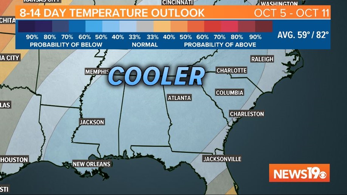
Long-Range Forecast:
The Weather Prediction Center is indicating a good chance for cooler-than-normal temperatures for South Carolina October 5 through October 11.

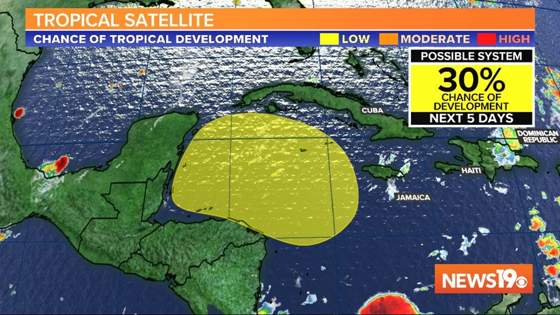
Tracking the Tropics:
A broad area of low pressure is expected to form over the western Caribbean Sea in a few days.
Some gradual development of the disturbance will be possible after that while the system moves slowly west-northwestward over the northwestern Caribbean Sea.
The National Hurricane Center gives this area a 30% chance of further development over the next five days.