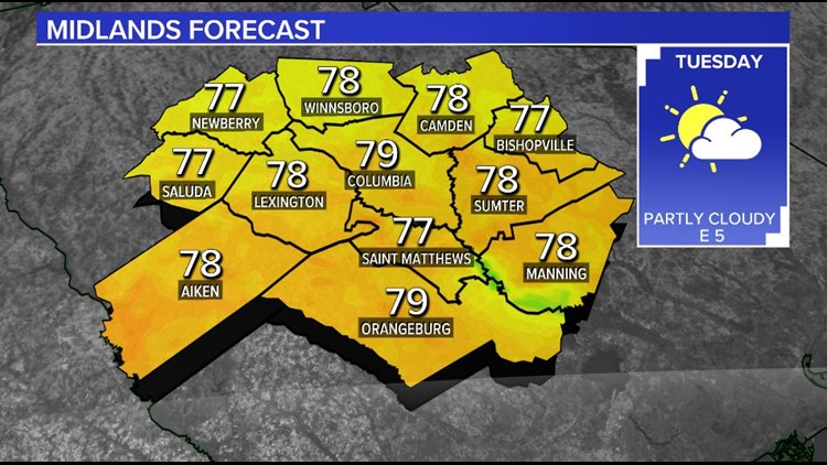
COLUMBIA, S.C. — The warm, dry weather will continue Tuesday as weak high pressure continues to keep the showers away.
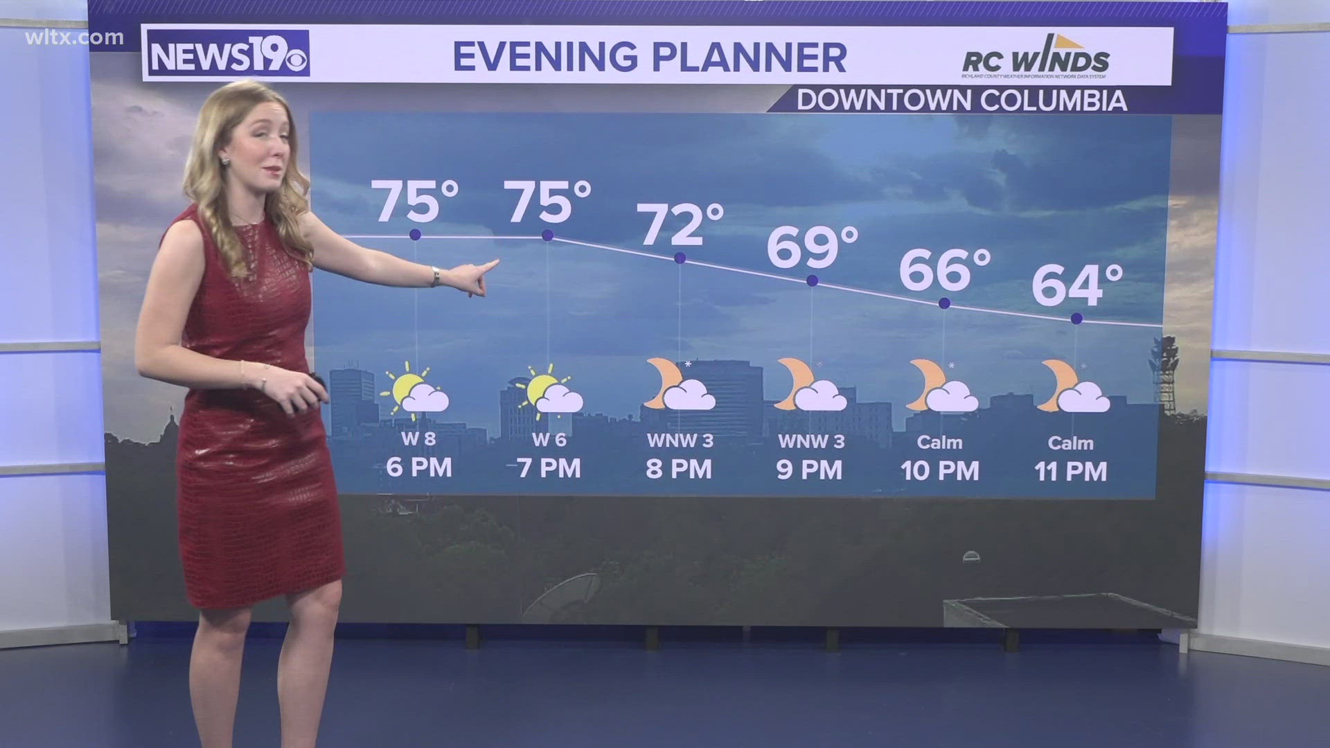
Monday was warm. The day started off cloudy, but skies cleared enough for temperatures to climb into the lower and middle 70s.The Columbia airport had a high temperature of 75 degrees.
Lows Tuesday will start off in the middle to upper 50s. Some patchy dense fog will be possible early Tuesday, but the fog will mix out by mid-morning.
Skies will become partly cloudy by the afternoon hours. Tuesday will be a little warmer than Monday with high temperatures in the middle to upper 70s.
Our normal high temperatures should be in the lower 70s. Our normal lows should be in the upper 40s.
Rain will return by Wednesday as deep tropical moisture from Zeta pushes into the Southeast. Afternoon showers will be possible Wednesday. Highs will be in the lower 80s.

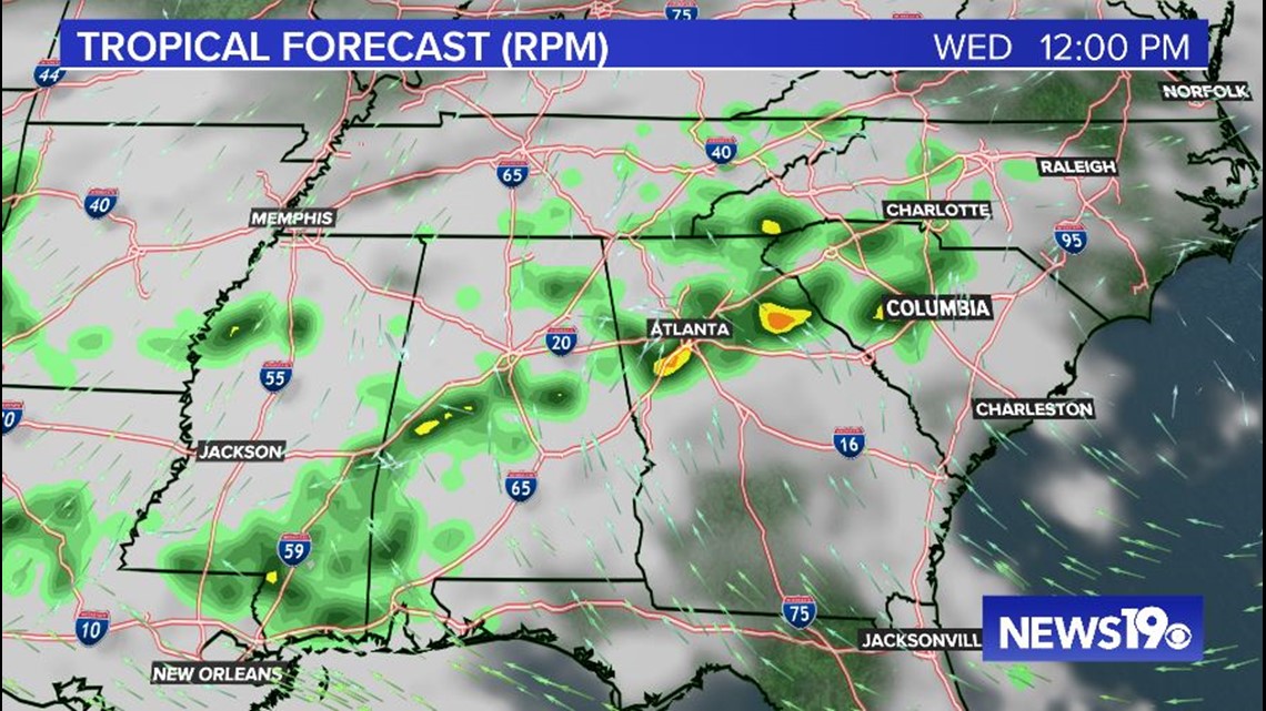
We will have to monitor the chance for severe weather Thursday as the remnants of Zeta move across the southern Appalachians.
It looks like the heaviest rainfall will stay north and west of the Midlands, but strong storms will be possible.
The greatest risk from any strong or severe thunderstorm will be damaging wind gusts. An isolated tornado cannot be ruled out either.
Some showers will be possible very early Wednesday, but high pressure will be build into the region.
Friday afternoon will be mostly sunny and cooler with highs in the lower to middle 70s.
Halloween will be sunny and cooler. Highs Saturday will be in the middle 60s.