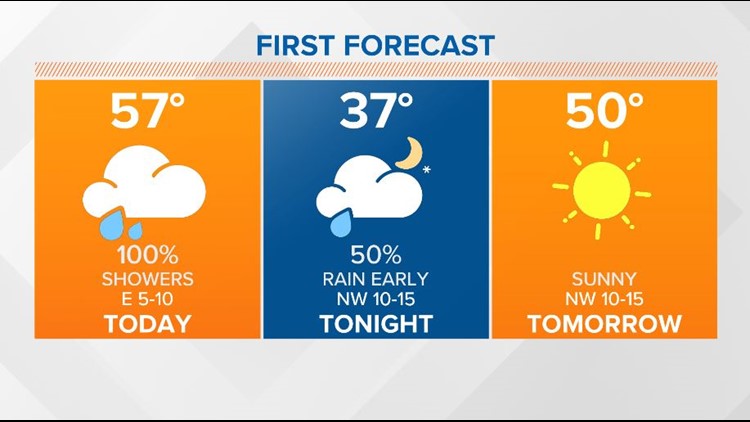
COLUMBIA, S.C. — Showers will continue this afternoon and into tonight. High pressure will build in Thursday and dry weather will return to the Midlands.
Rain will be likely today as a cold front and low move through the Southeast. With the showers and clouds in place, highs will be in the lower to middle 50s for most of the area. Some parts of the Midlands may be a touch warmer.
The chance for rain will continue through at least midnight. The clouds should gradually move away overnight. Lows Thursday morning will be in the middle 30s.
Thursday will be sunny, cooler and breezy. High temperatures will be in the upper 40s to near 50 degrees.
Thursday night will be clear and cold. Low temperatures are forecast to fall into the middle to upper 20s by Friday morning.
The dry, sunny, cool weather will continue for the last day of the workweek. Highs will be in the lower 50s Friday afternoon.

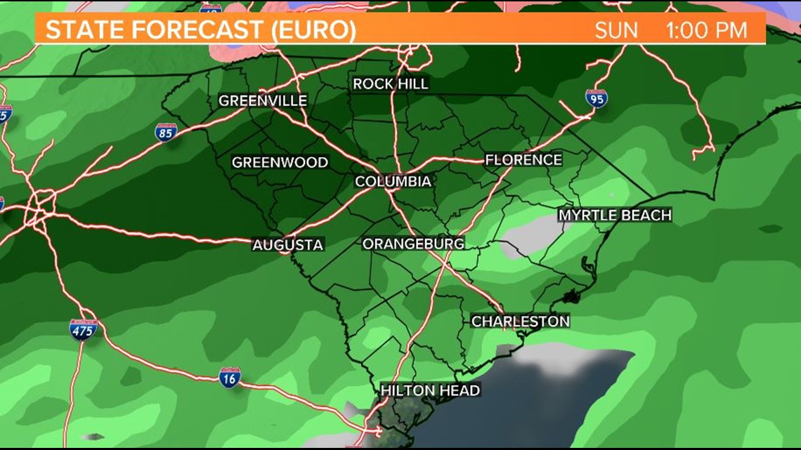
Saturday will be partly cloudy and seasonable, but the clouds and moisture will start to return to the area Saturday night.
Showers are expected Sunday. There may be a wide-range of temperatures Sunday. One of the longer-range forecast models is indicating a cool-air wedge pattern. If this is the case, temperatures may struggle for northern parts of the Midlands.
Rain may linger into the Monday. High temperatures will be the lower to middle 50s.
Weak high pressure will move back into the area Tuesday. Skies will clear for the second day of the workweek with high temperatures in the lower 50s.