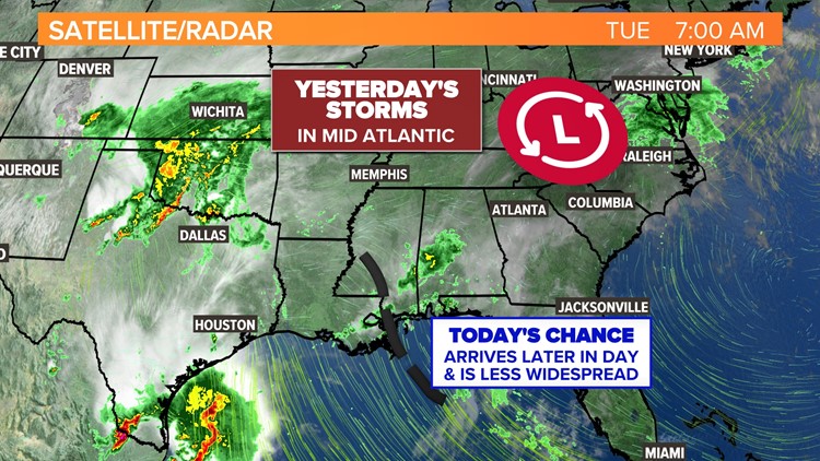
COLUMBIA, S.C. — A tropical, humid weather pattern persists in South Carolina for the next few days fueling a chance for storms into Friday. On Tuesday morning, the low pressure system responsible for Monday's messy weather was pushing northward, reduced to an area of showers in the Mid Atlantic. However South Carolina still sits on the edge of a ridge of high pressure over the Atlantic, which will be a highway for storms.


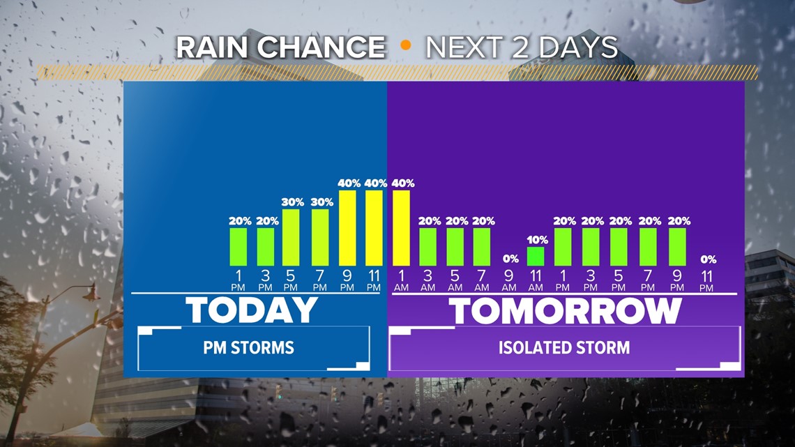
A weak disturbance over Louisiana on Tuesday morning will push into our area this evening, bringing our best chance for rain in the Midlands after 4 p.m.. Overcast skies are likely to persist to the west, but farther east, high pressure will clear skies and bring enough sunshine to trigger pop up thunderstorms along and east of I-20.
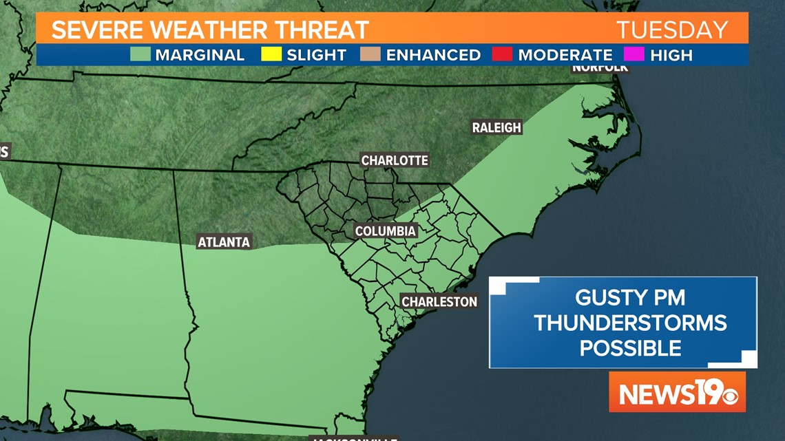
The Storm Prediction Center has issued a marginal risk for severe weather along and east of the I-20 corridor in South Carolina. The primary risk with the stronger storms is for damaging wind and frequent lightning.

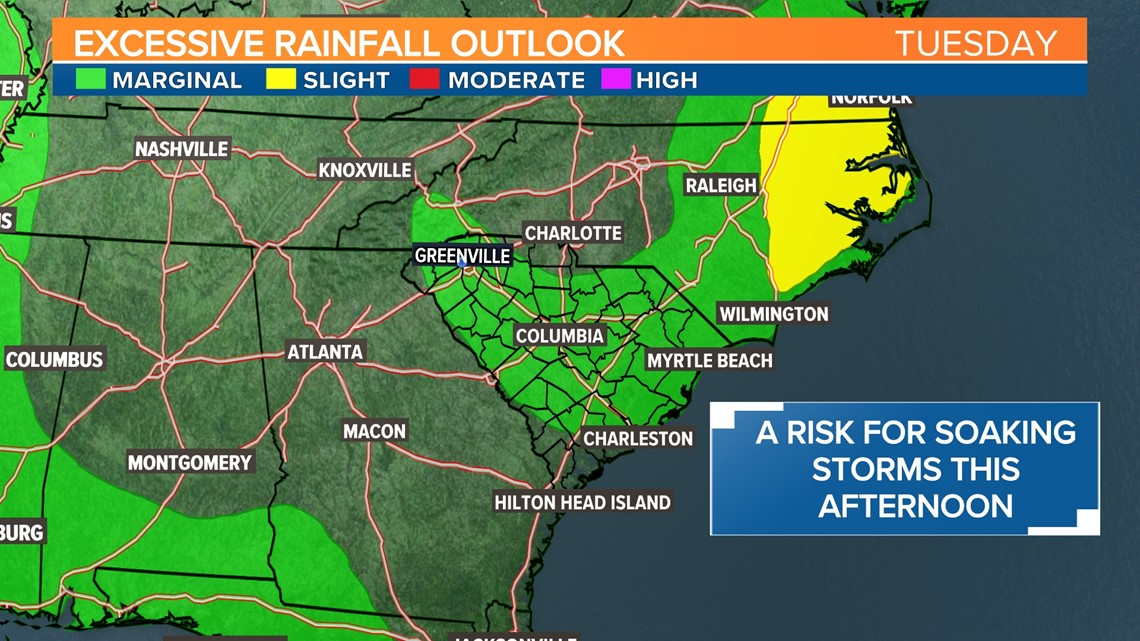
The Weather Prediction Center has a majority of South Carolina under a marginal risk for excessive rainfall. This indicates a 5% risk for flash flooding within 25 miles. It's the lowest level on their 1 to 4 level risk scale, but still indicates enough moisture is present for storms late this afternoon through the evening to contain heavy rainfall.

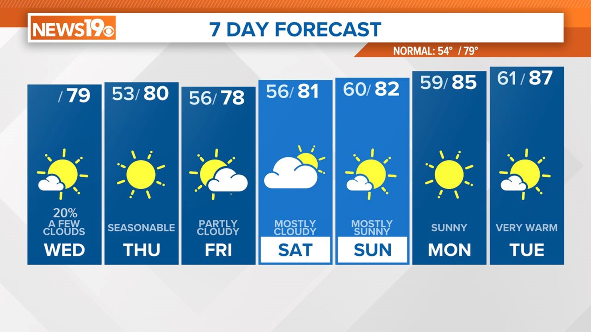
Rest of the week
The rain chance is lower on Wednesday, but scattered showers are still possible Wednesday morning or in the evening. Heavy rainfall or severe weather is not expected on Wednesday because there are no atmospheric disturbances to trigger intense storms.

However, we are tracking a cold front for Thursday and Friday which will trigger a risk for strong storms starting Thursday afternoon. Storms will once again be capable of damaging wind, heavy rain, and frequent lightning. The cold front will stall over the area on Friday bringing another wet day to the Midlands.
The cold front should move east on Saturday bringing a lower chance for rain, but there is a chance it will persist into Saturday, so we will keep an eye on it. At the moment our forecast is trending toward just a slight chance for rain on Saturday and lower chances for Sunday and next Monday.