COLUMBIA, S.C. — Some rain will be possible through the morning hours as Tropical Depression Claudette leaves the area. A front will approach the Midlands Tuesday. This will bring us more showers and storms.
The Midlands received some heavy rainfall Sunday in association with Tropical Depression Claudette, but the flash flood watch was cancelled.
The Columbia airport got 1.38" of rain Sunday. Richland County reported nearly 4" of rain near Chapin.
A few showers or thunderstorms will be possible through early Monday morning, but the threat of severe weather or flooding is small. Low temperatures will start off in the lower 70s.
As Claudette leaves the area, some drying will occur behind the tropical system. Skies will be partly cloudy. There will be a chance for a few showers and storms Monday afternoon.
High temperatures Monday will be in the upper 80s and lower 90s. The humidity will make it feel even hotter at times. Heat index values may climb into the lower 100° range.


A front will approach the area Tuesday. Showers and storms are likely Tuesday afternoon and Tuesday evening. The Storm Prediction Center has the Midlands under a marginal risk for severe weather Tuesday. Damaging wind gusts will be the greatest threat from any severe thunderstorm.
The front will stall to the south of the area. The clouds may stick around Wednesday. Highs will be in the lower 80s.
More sunshine is expected for Thursday, but the chance for afternoon showers and storms will return to the area Friday and into the weekend.
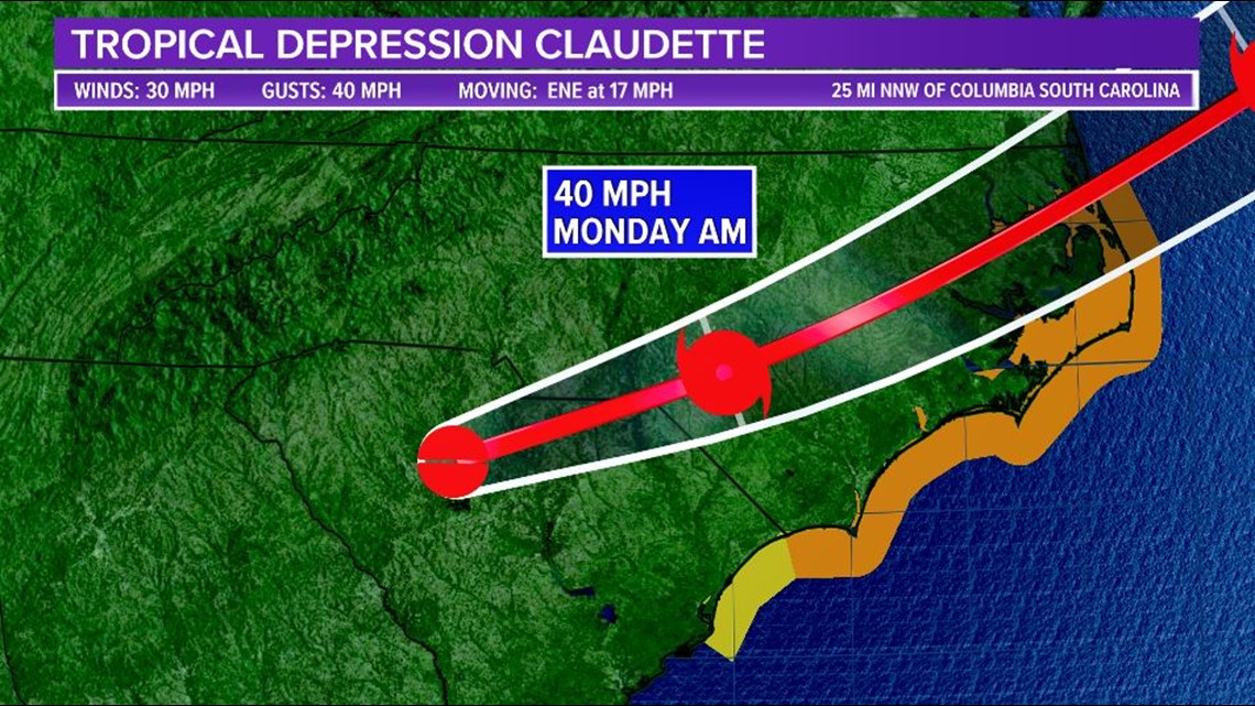
Tracking the Tropics:
As Claudette approaches the coast overnight and Monday morning, it is expected to strengthen, and the storm is forecast to regain tropical storm status before it exits the coast of North Carolina.
Some additional strengthening is forecast while Claudette moves over the warm waters of the Gulf Stream and the shear remains low.

Elsewhere in the Atlantic, tropical activity is not expected over the next five days.