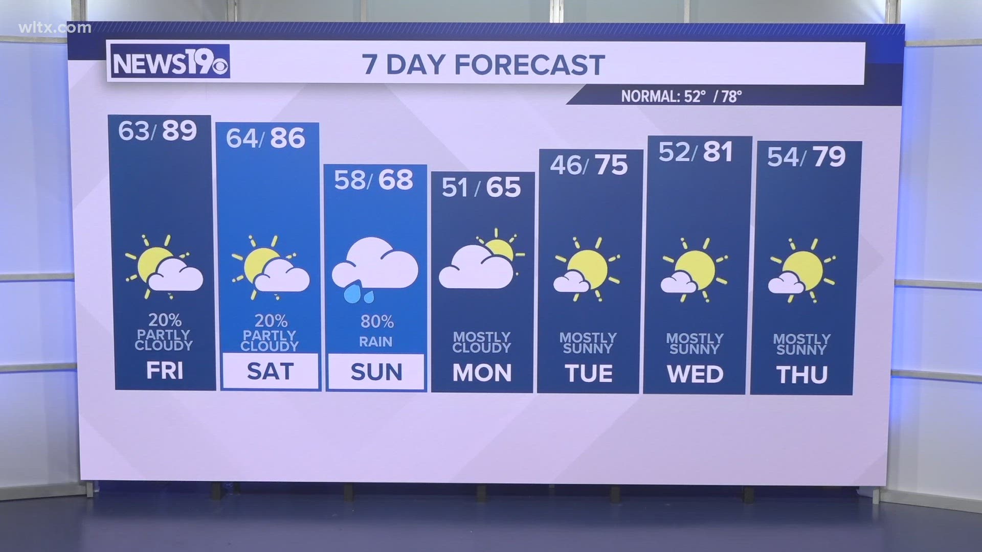
COLUMBIA, S.C. — It’s a very humid and wet first week back to school for many students in the South Carolina Midlands. A storm system to our north and Tropical Storm Fred to our south are enhancing a humid easterly flow of air off the Atlantic and into South Carolina. This will fuel thunderstorms with soaking rain for the next few days, particularly Monday afternoon and Tuesday morning.
Forecast in the Midlands
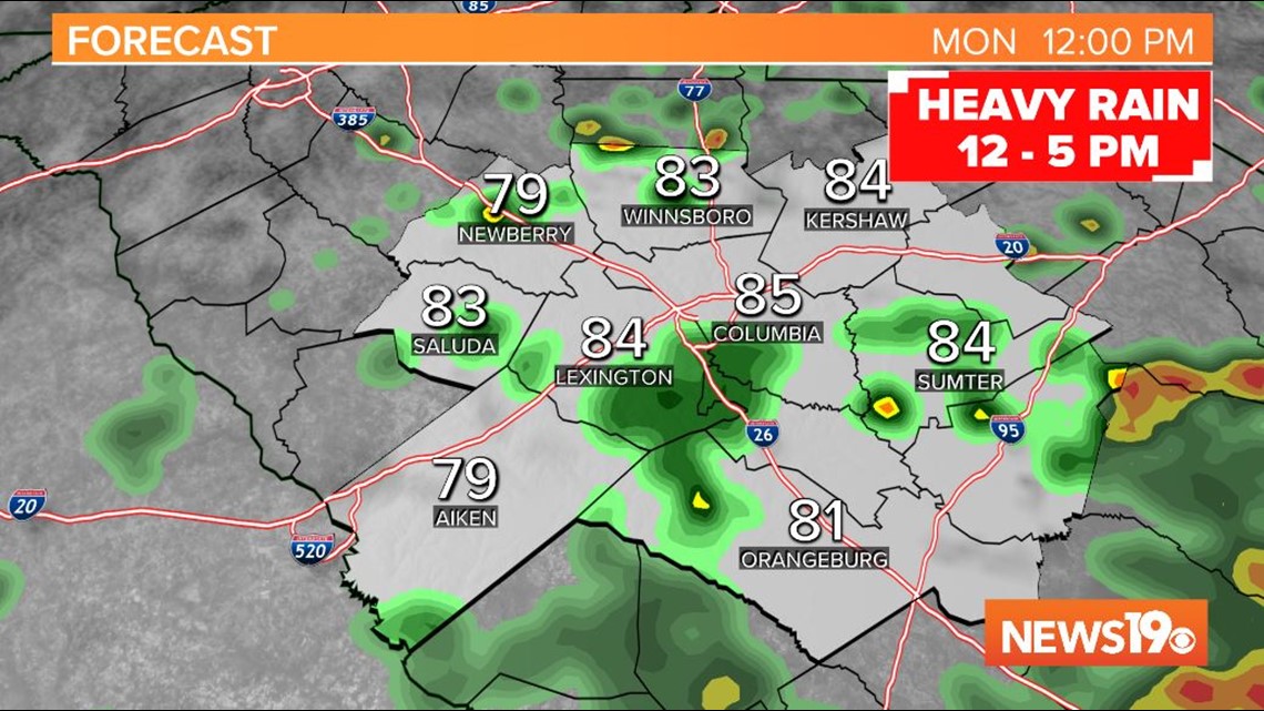
The best chance for rain on Monday will be in the afternoon from noon to 5 pm. Downpours will be scattered, but localized flooding is possible in thunderstorms. Scattered showers will develop in the mid to late morning from east to west with the most widespread coverage initially to the east of I-95.

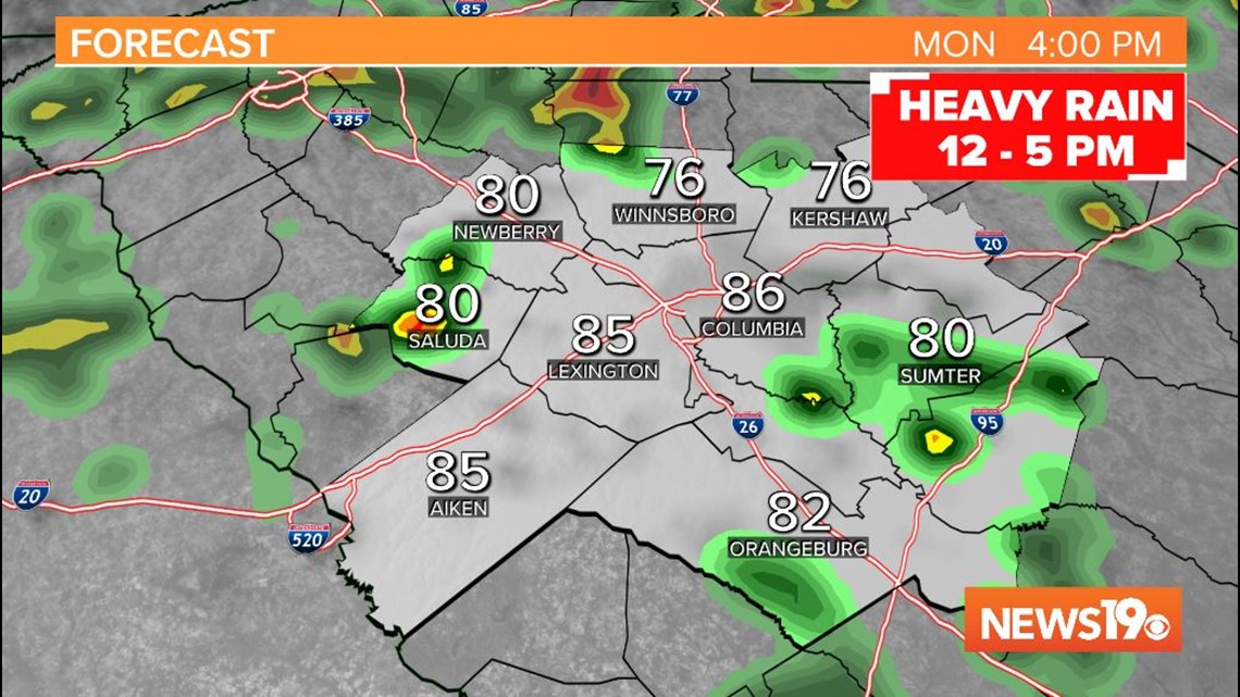
Showers and storms will be on and off through the afternoon on Monday and become less widespread in the evening. Overnight rain will briefly taper off with mostly cloudy skies expected.

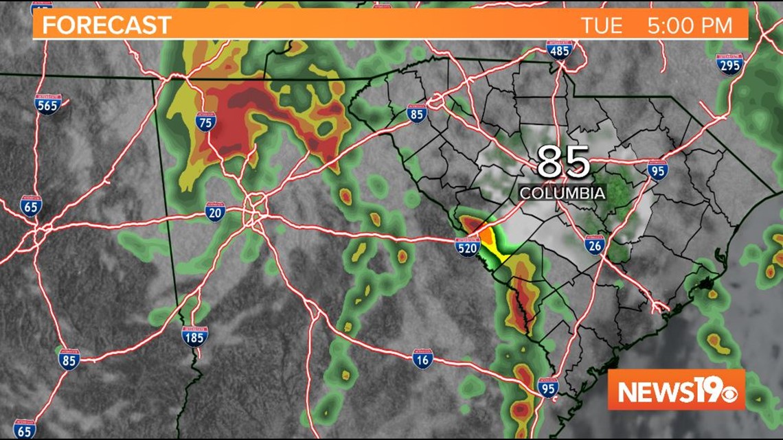
Heavy rain will move in from south to north on Tuesday morning as early as 4 or 5 am, but more widespread for the mid morning. The best chance of rain on Tuesday will be in the morning, but a passing shower or storm is expected in the afternoon as well. Skies will again be mostly cloudy.

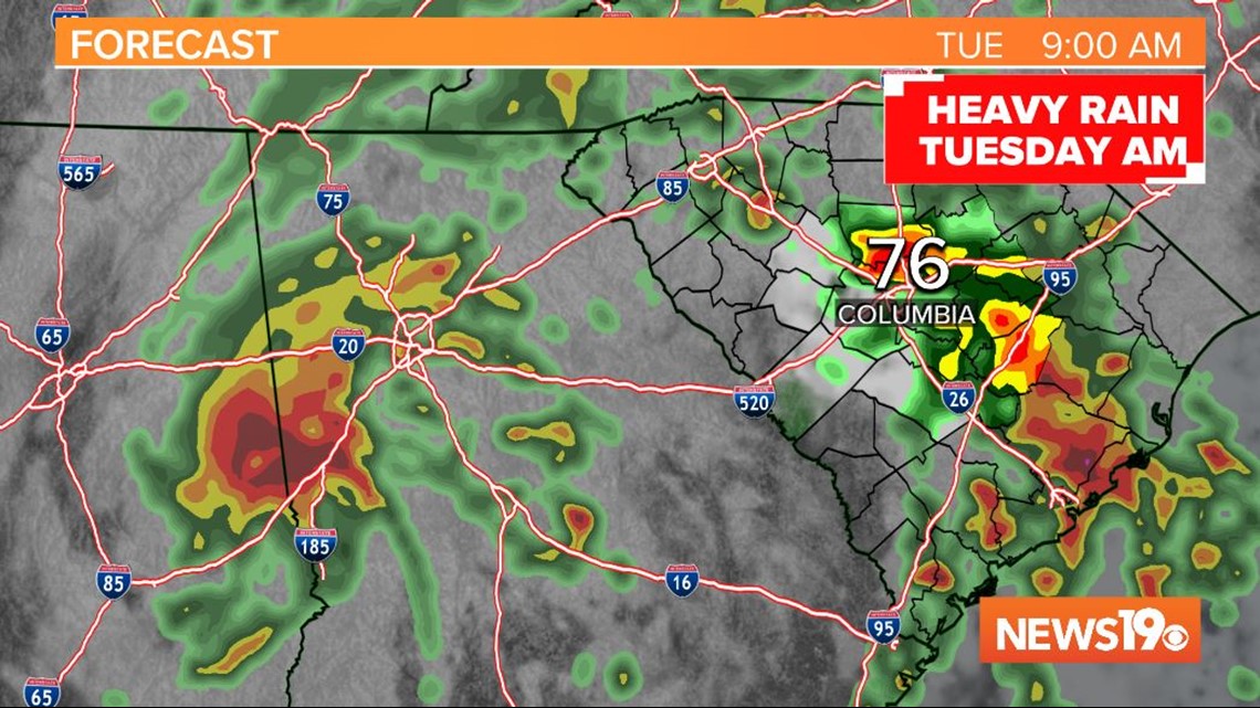


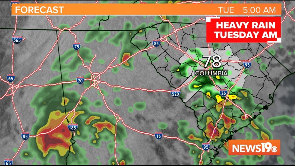
The Weather Prediction Center has issued a marginal risk for excessive rain across the Midlands for Monday afternoon and a slight risk, which is a level higher, for Tuesday. A marginal risk means there is a 5-10% risk for flash flooding within 25 miles. With a slight risk, the chance for flooding within 25 miles is 10-20%. Up to an inch of rain is expected in stronger storms. Damaging risk is possible, but a lower risk than the rain.
A morning storm is possible on Wednesday, but rain will mainly be limited to pop up storms in the afternoon on Wednesday with a mix of clouds and peeks of sun.
In the Tropics
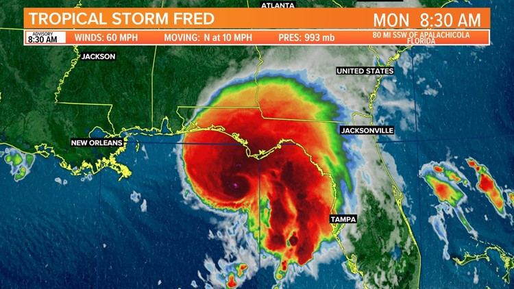
Tropical Storm Fred was located 90 miles south of Apalachicola, Florida at 8 am ET on Monday morning. At 8:30 AM, the NHC increased Fred's estimated maximum sustained winds from 50 mph to 60 mph. The storm is better organized this morning and is moving north at 9 mph, which is slower than yesterday. The next full advisory with an updated forecast track from the National Hurricane Center at 11 am ET.

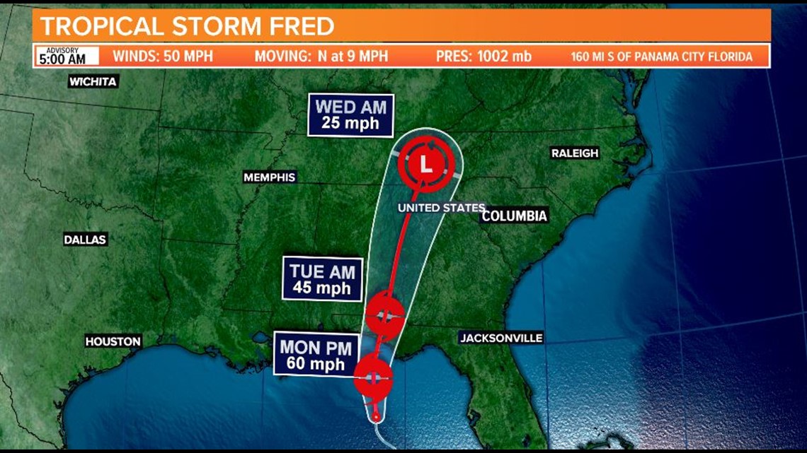
Tropical Storm Warnings are in effect for the Florida panhandle along the coast from Navarre to the Wakulla/ Jefferson County line. Storm Surge Warnings are in effect for Florida’s big bend coastline from Indian Pass to Yankeetown. A Tropical Storm Warning means that tropical storm conditions are expected somewhere within the warning area, in this case within the next 12 hours, according to the National Weather Service. A Storm Surge Warning means there is a danger of life-threatening inundation, from rising water moving inland from the coastline, during the next 36 hours in the indicated locations.
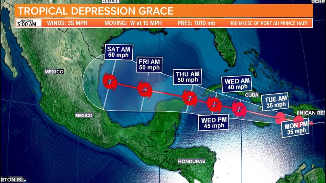
Meanwhile, Tropical Depression Grace is bringing rain to the Dominican Republic and Hispaniola. Winds are sustained at 35 mph. Grace was downgraded from Tropical Storm status at 8 pm on Sunday evening after estimated sustained winds dropped below 39 mph. Grace is expected to remain weak through Tuesday and then strengthen to tropical storm status in the Gulf of Mexico as it moves closer to Northern Mexico this weekend.

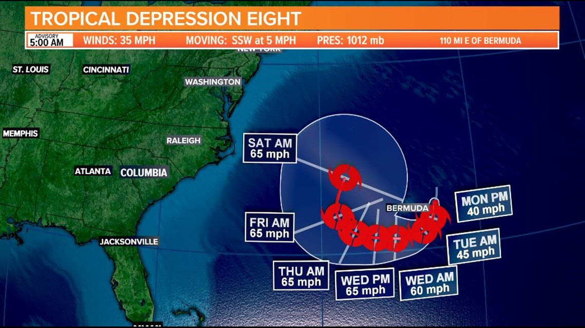
Tropical Depression Eight developed late Sunday night near Bermuda. The storm has sustained winds of 35 mph and is expected to intensify through Monday and Tuesday before encountering wind shear from a storm system that will keep the system away from U.S. direct impacts. There is a possibility this storm will reach hurricane status which would increase waves along our coast through the middle and end of the week.

Elsewhere, the Atlantic Basin is quiet and additional storms are not expected to organize in the next 5 days.