COLUMBIA, S.C. — Another hot, dry day across the area. Temperatures will be well-above normal. The humidity levels will be increasing as moisture returns to the Midlands. Showers and storms will be possible starting Saturday. Some rain will be likely through Thursday. High temperatures will return to normal levels next week.
This morning started off very warm. Columbia had a low of 71 degrees. Sumter only dropped to 72. Orangeburg reported a low temperature of 69 degrees. The average low this time of the year is 62.
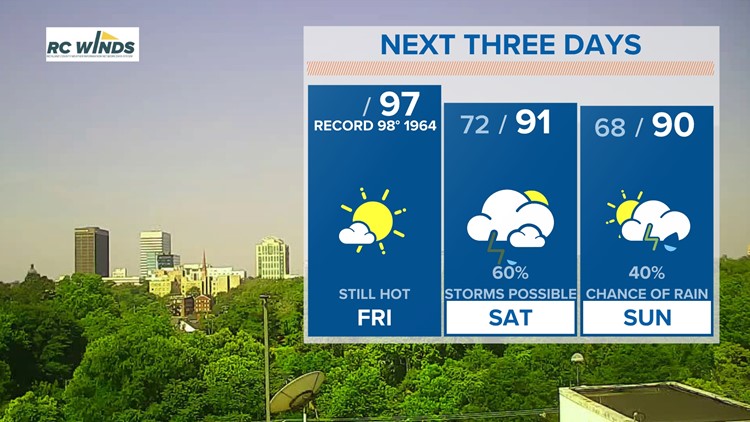
The unseasonably warm weather will continue this afternoon. Highs are expected to climb into the middle to upper 90s. The record high in Columbia today is 98° set in 1964.

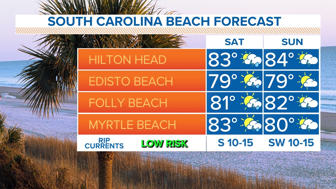
Saturday will still be hot, but showers and storms are forecast to develop. Some rain will be possible in the morning, but the better chance for showers and storms will be during the afternoon hours. High temperatures will be in the lower 90s.
Sunday will still be hot and humid. Some showers and storms will be possible again, especially during the afternoon and evening hours. Highs will be in the upper 80s to lower 90s.

A front will shift over the area for the start of the workweek. Showers and thunderstorms will be possible each day. Most of the rain will fall in the form of afternoon showers and storms, a typical summer-like pattern.
High temperatures will be closer to normal for the workweek, topping out in the middle 80s Monday through Thursday.


Tracking the Tropics:
Hurricane season officially begins on June 1. As of now, tropical activity is not expected over the next five days.