
COLUMBIA, S.C. — Ian is getting closer to become a major hurricane as it nears Cuba toward an eventual landfall in Florida, a path that will eventually cause it to have some effects on South Carolina's weather.
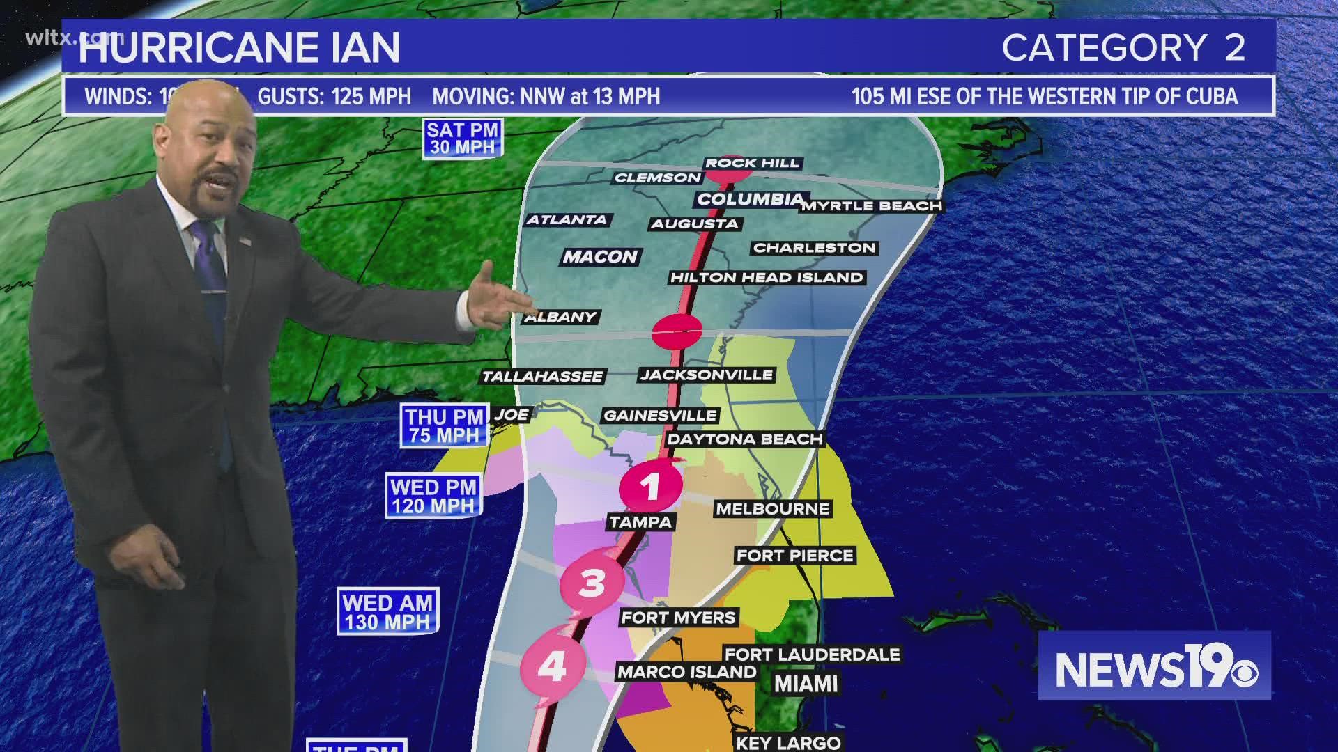
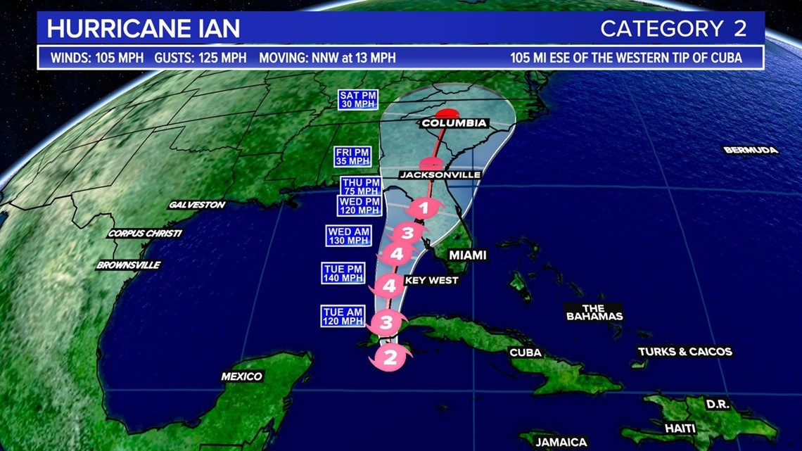
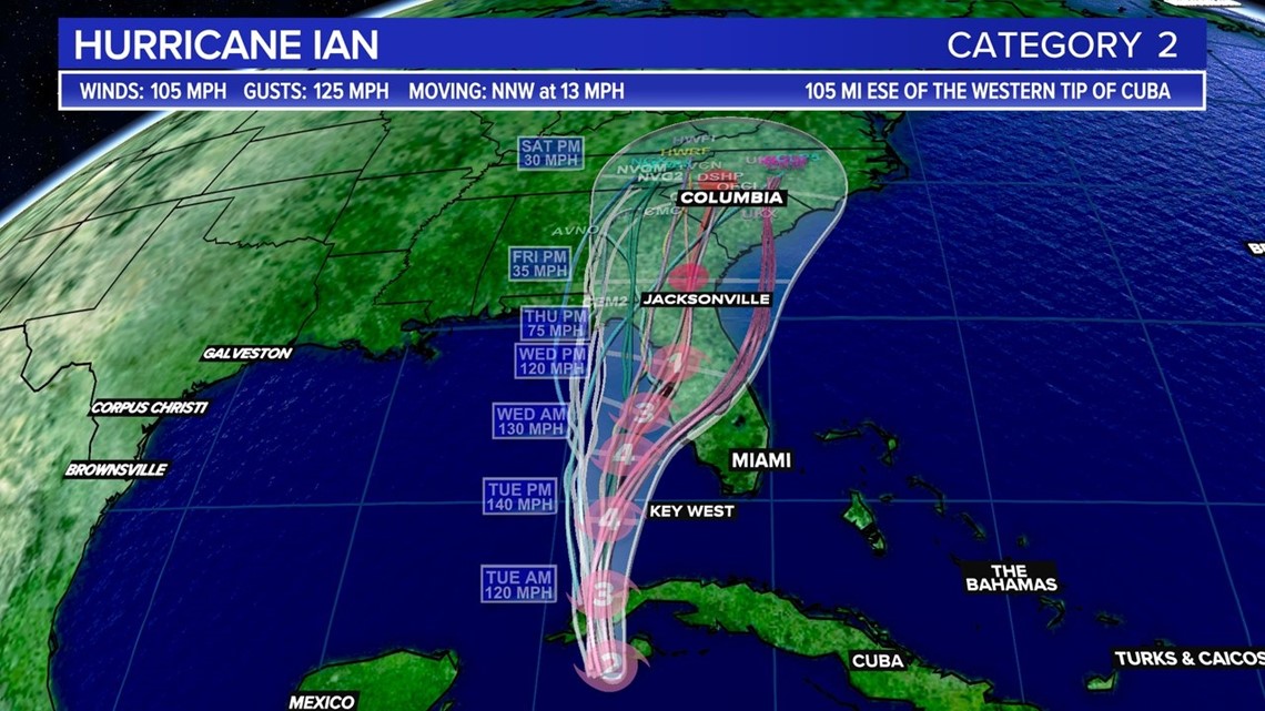
As of 11 p.m. Monday, Hurricane Ian was located about 105 miles from the western tip of Cuba. It had winds of 105 mph with stronger gusts. The storm was moving towards the north-northwest at about 13 mph.
The center of Ian is expected to move near or over western Cuba overnight and early Tuesday. Ian will then emerge over the southeastern Gulf of Mexico on Tuesday, pass west of the Florida Keys late Tuesday, and approach the west coast of Florida on Wednesday into Thursday.
A hurricane watch is in effect for Englewood to the Anclote River, including Tampa Bay. A tropical storm watch is in effect for Little Cayman and Cayman Brac, also for Englewood southward to Flamingo in Florida.

Ian continues to become better organized on satellite images with intense deep convection and numerous surrounding banding features. The overall cloud pattern is quite symmetric with well-defined upper-level outflow. Observations from both Air Force and NOAA Hurricane Hunter aircraft indicate that the central pressure is falling, and the intensity is increased to 90 kt based on a recently reported 700 mb flight-level wind of 101 kt from the Air Force plane.

Ian will be moving over the warm waters of the northwestern Caribbean and remain within very low shear conditions today. These very conducive environmental factors along with the improved structure of the storm are likely to result in rapid intensification today.
Ian is forecast to be a major hurricane when it moves near or over western Cuba. It would be the second major hurricane of the season.
Ian is expected to be a major hurricane in the eastern Gulf of Mexico during the middle of this week. Regardless of Ian’s exact track and intensity, there is a risk of a life-threatening storm surge, hurricane-force winds, and heavy rainfall along the west coast of Florida and the Florida Panhandle by the middle of the week.
RELATED: We could get some affects from Ian in South Carolina. Here's what the state says you should do now
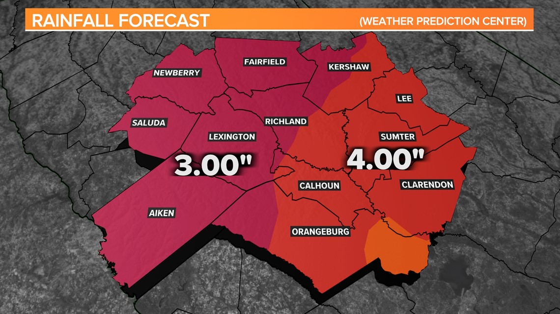
Midlands Impacts:
For the Midlands, it is too early to know if we will see severe weather or strong winds from Ian. It does look like we will have some heavy rainfall Thursday night through possibly early Saturday. The Weather Prediction Center does have the state under a slight risk for excessive rainfall on Friday.

Temperatures this week will gradually decrease as the clouds continue to build into the area as Ian moves northward.