
COLUMBIA, S.C. — The South Carolina Emergency Management Division is urging residents to keep up with developments on Hurricane Ian, as the storm is expected to affect the weather of the southeastern U.S. later this week.
The agency said Monday that it's notified key local and state agencies to be ready to respond if the need arises.
STAY UP TO DATE: Download the WLTX app: Android | iPhone and sign up for the WLTX Daily Dive Newsletter.
They're urging people to review this plan and consider what action they will take if the storm threatens the state. They said people particularly in low-lying areas and along the coast should monitor the storm via local media.
“Much of what South Carolina experiences will depend on where and when Hurricane Ian does makes landfall,” SCEMD Director Kim Stenson said, “While we are not expecting the full force of a hurricane-strength storm, everyone in South Carolina, from the Upstate to the Midlands, the Pee Dee and the Lowcountry should be prepared to take personal safety precautions if advised to do so by your local emergency managers.”
RELATED: We could get some affects from Ian in South Carolina. Here's what the state says you should do now
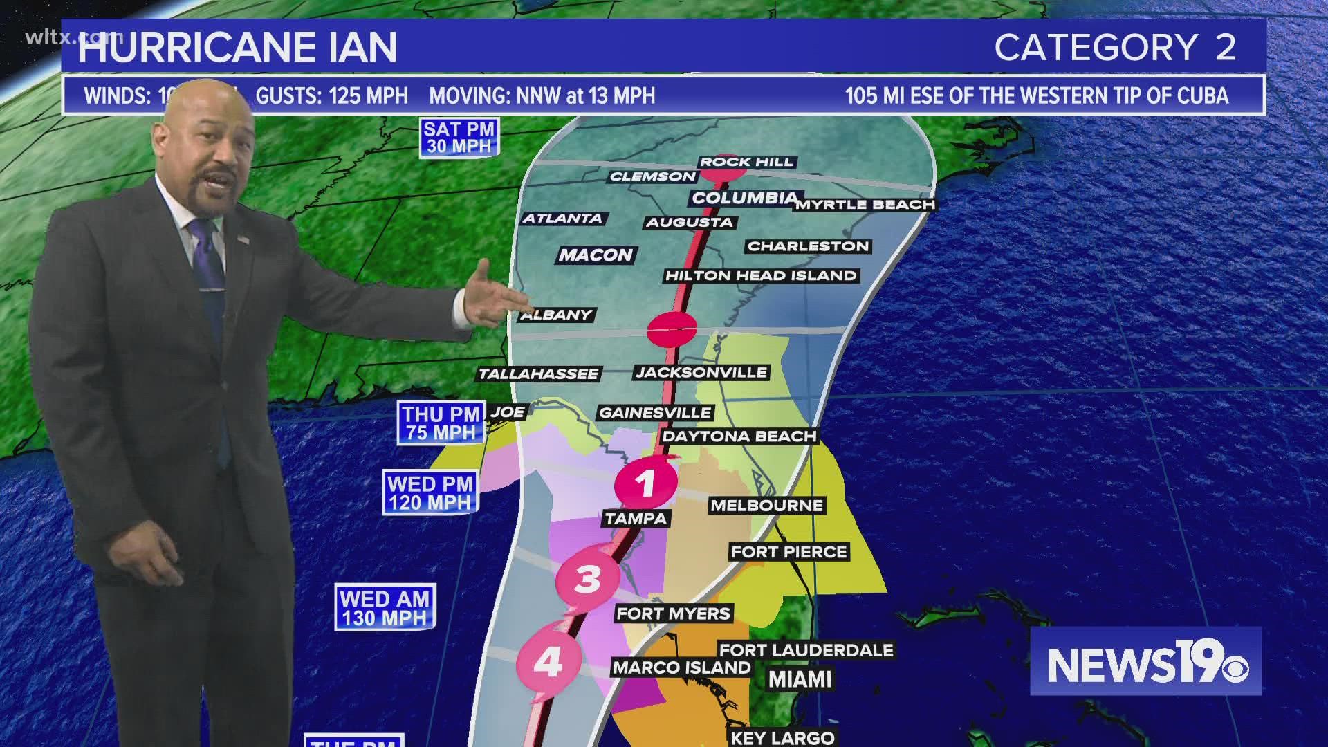
The latest forecast from News19's meteorologists, combined with the National Hurricane Center, shows a lot of uncertainty about what exact effects South Carolina see. The storm will make landfall in Florida, so we will not see a high wind event that one might typically expect from a hurricane. In fact, the center of the storm may not actually move into the state at all. The storm will first push into that state and into Georgia, and as it does, it will trigger rain in South Carolina, some of which may be heavy. By the time it gets close to our state, it would be a weak tropical storm or tropical depression, or perhaps even a post-tropical system.
There remains, however, a chance that it could also trigger severe thunderstorms with a chance of some isolated tornadoes. However, that's going to depend a lot on the track 3-4 days from now, which there still is considerable uncertainty about.
People can keep up with the latest on the storm by downloading the WLTX app: Android | iPhone and sign up for the WLTX Daily Dive Newsletter.