
COLUMBIA, S.C. — After a very warm December, we saw a very active and cold January that brought a wide variety of weather events to the Midlands. Let's go over all of the notable weather days we saw to start off 2022:
JANUARY 1ST:
Unlike the rest of January, we started off very warm. In fact, the offical high temperature in Columbia of 80°. This would tie for the 4th hottest daily high recorded for the month of January.
RELATED: Local Forecast
JANUARY 3RD:
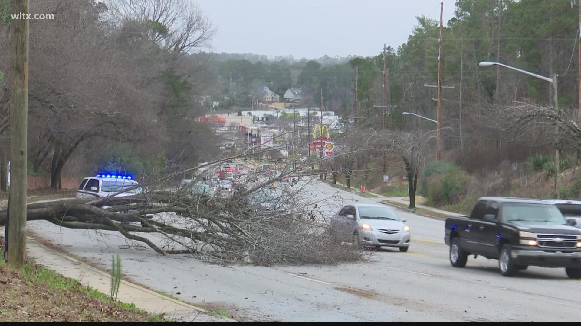
An area of low pressure moved through the southeast and brought some serious winds to the Midlands. As the cold front pushed through in the early morning hours, winds gusted 50-60 mph. Widespread damage from the windy weather brought over 100,000 power outages to the Palmetto State.
JANUARY 16TH:
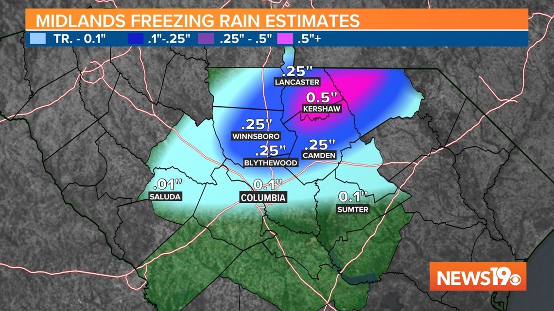
January 16th was the first of multiple winter weather events to effect the Midlands this past month. Freezing rain was the biggest impact from this system that moved through the southeast. Around .25-.5"+ of freezing rain accumulated north of I-20 with the highest accumulations in Kershaw county. Power outages were scattered in the counties that saw the highest accumulations.

JANUARY 21ST:
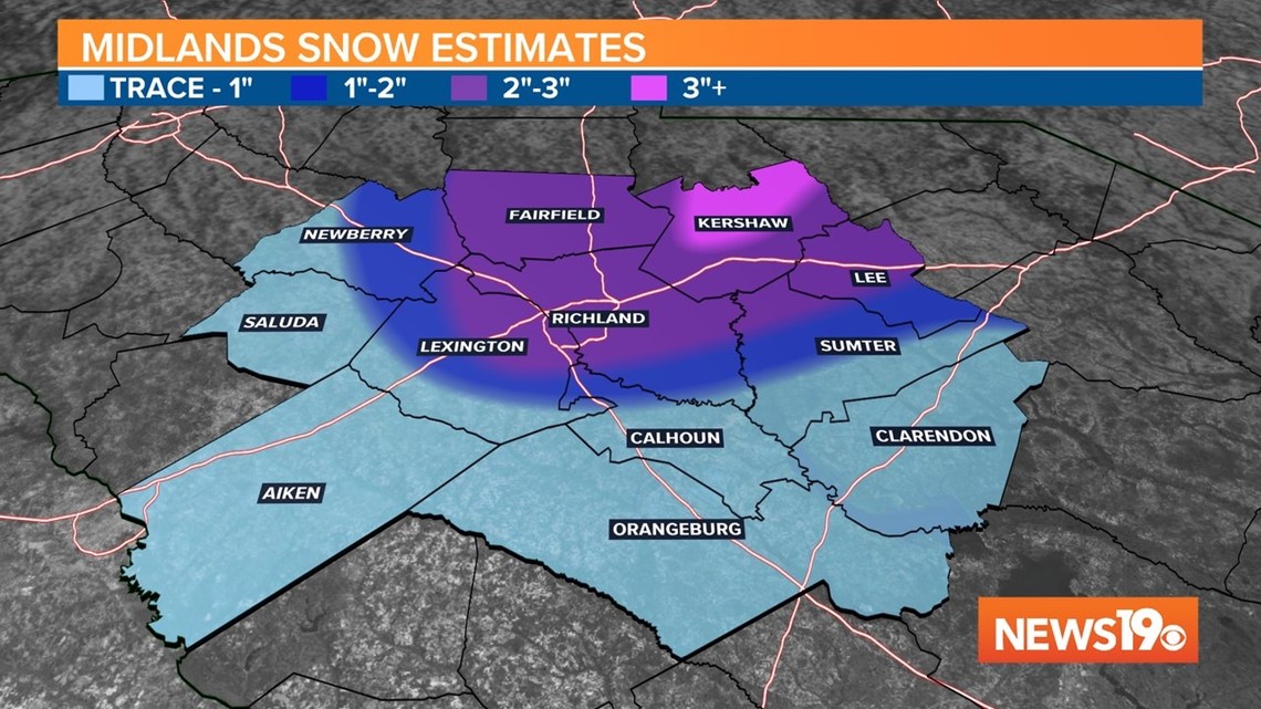
Snow returned to the Midlands!!! After a snow drought of 5 years in Columbia, Columbia Metro Airport officially recorded 2" of snowfall. Some areas picked up closer to 2.5"of snow in Richland county with areas of the NE Midlands picking up over 3 inches. In all, almost the entire Midlands saw snowfall that night at some point.

JANUARY 29:
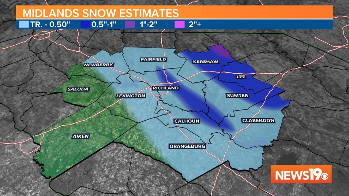
Another low pressure system brought snowfall to portions of the Midlands. The storm which would create blizzard conditions in New England, brought some isolated accumulations to some communities. At night, we saw the dewpoint reach -3° which is the driest we have been in almost 7 years here in the Midlands.

JANUARY 30:
The morning of January 30th broke another drought for Columbia. With an official low of 19° it was the first sub-20° low since 2018 for the city.
FEBRUARY OUTLOOK:
Looking at the next few week, the pattern looks to remain active. That means we will have plenty of chances for precipitation through the middle of the month. The biggest question right now is if there will be any colder air in place when these systems move through.