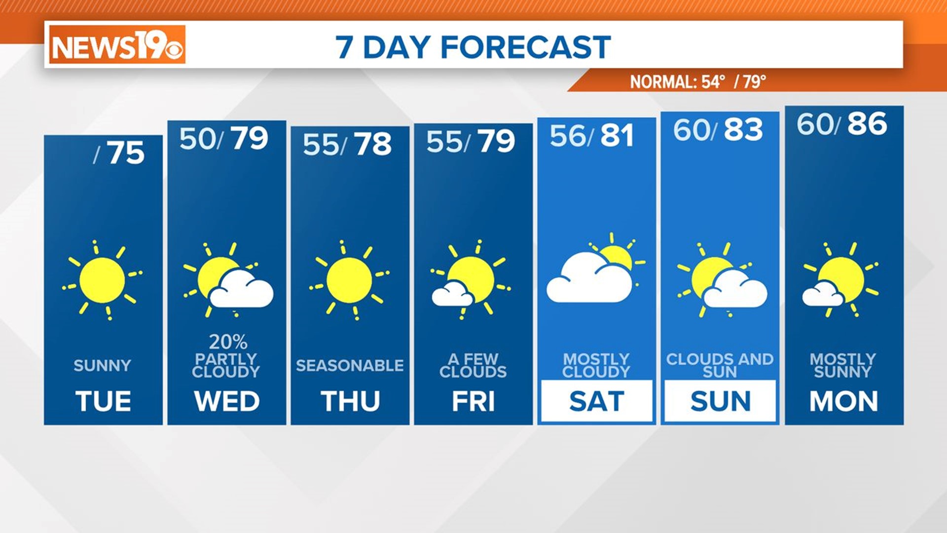
COLUMBIA, S.C. — High pressure will be in place for the last day of the workweek. Skies will be mainly sunny today. It will be seasonably hot, but not as humid as yesterday. A few showers and storms are possible Saturday. An isolated storm is forecast for Sunday. The heat will build into the area next week.
High pressure should keep us dry today. Skies will be mostly sunny. High temperatures will top out in the upper 80s to lower 90s, this is seasonable for this time of the year. Yesterday, dewpoint temperatures were in the upper 60s to lower 70s, it will not be as humid today.

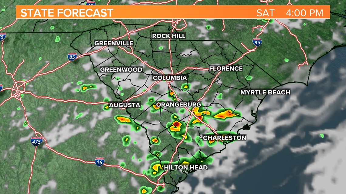
There will be a chance for showers and storms Saturday afternoon and Saturday evening. The best chances for rain will be in the southern and eastern parts of the Midlands. High temperatures will be in the upper 80s to lower 90s Saturday afternoon.


High pressure will begin take hold of the area on Sunday. Temperatures will be warming. Highs will be in the lower to middle 90s. There will be a small chance of a pop-up shower or storm Sunday afternoon.
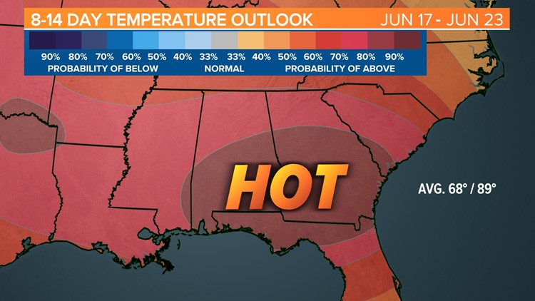
Temperatures will really begin to climb for the workweek. High temperatures Monday through Wednesday will be in the upper 90s to near 100 degrees.

Thursday will be a little cooler, but temperatures are still expected to climb into the middle 90s.
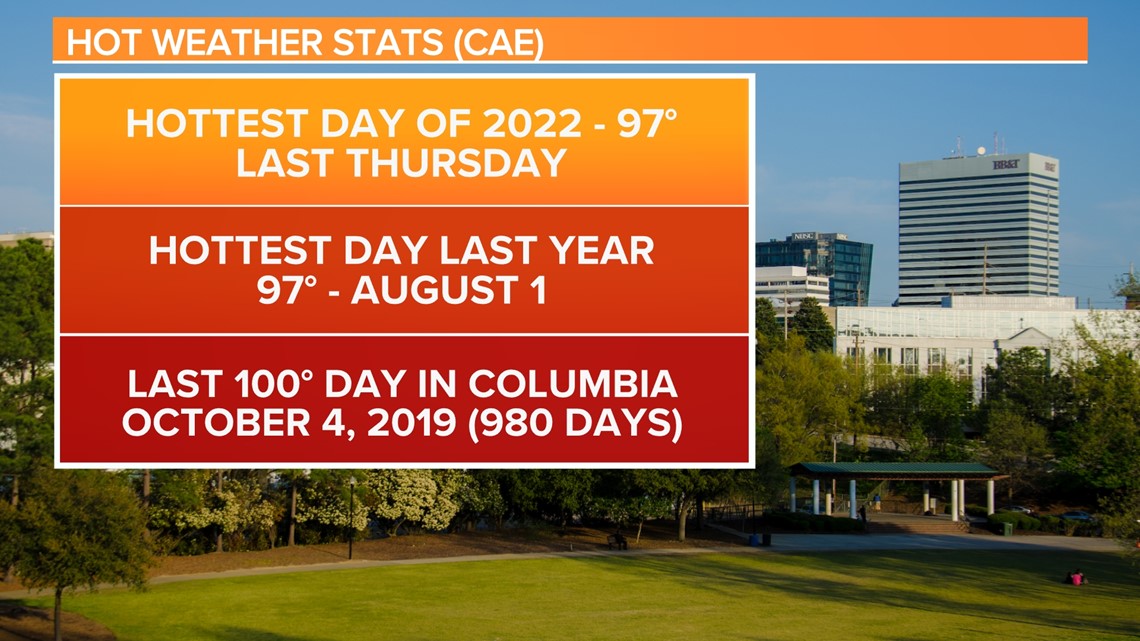
The Columbia airport has not hit the triple digits since October 4, 2019, but that will likely change next week.

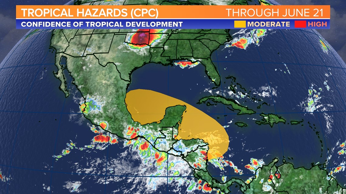
Tracking the Tropics:
No tropical activity is expected over the next five days, but through June 21, we will have to monitor the potential for tropical action near the Yucatan Peninsula.