

COLUMBIA, S.C. — Columbia broke a daily record set back in the late 1950s as the South Carolina started a streak that could see more records fall over the next nine days.
Columbia officially hit 103 degrees at 2:59 p.m. Monday afternoon at the National Weather Service's official reporting station, located at the Columbia Metropolitan Airport.
The previous record was set on June 13, 1958--64 years ago. The last time triple digits were recorded at the Columbia airport was back on October 4, 2019.
Temperatures are forecast to be well-above normal over the next couple of days. There will be small chances for a pop-up shower or storms during the heat of the day as well.
Monday morning, temperatures only dropped into the middle 70s under mostly clear skies.

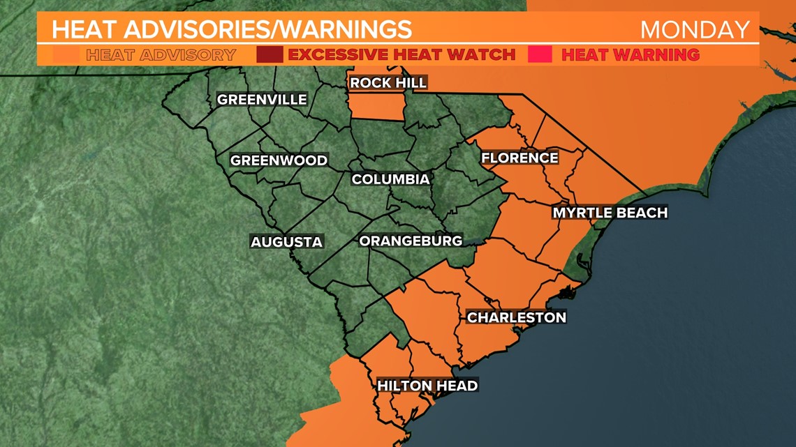
With the humidity, it was felt hotter than the air temperature, but heat index values are still below heat advisory criteria.
We could see even higher temperatures Tuesday and Wednesday. Gradually, however, temperatures will be a little cooler for Father’s Day weekend.
Tuesday is forecast to be even hotter with highs in the 100s again. Heat index values on Tuesday may climb into the 110° range.
Some isolated showers and storms will be possible during the heat of the day Tuesday. The Storm Prediction Center does of the Midlands under a marginal risk for severe weather. This is the lowest risk level.
This is issued when strong to borderline severe storms are possible. Thunderstorms are expected to be limited in organization and only last a short time with a marginal risk level. If a severe thunderstorm were to develop tomorrow, the greatest threat would be damaging wind gusts.
Similar conditions are forecast for Wednesday. Highs may reach record levels. There will be a chance for afternoon showers and storms during the heat of the day.

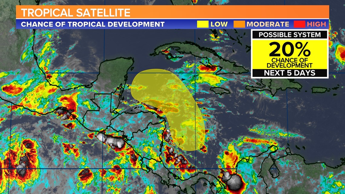
Tracking the Tropics:
An area of low pressure is expected to develop by the middle part of this week over the southwestern Caribbean Sea.
Some slow development of this system is possible while it drifts northwestward off the coasts of Nicaragua and Honduras.