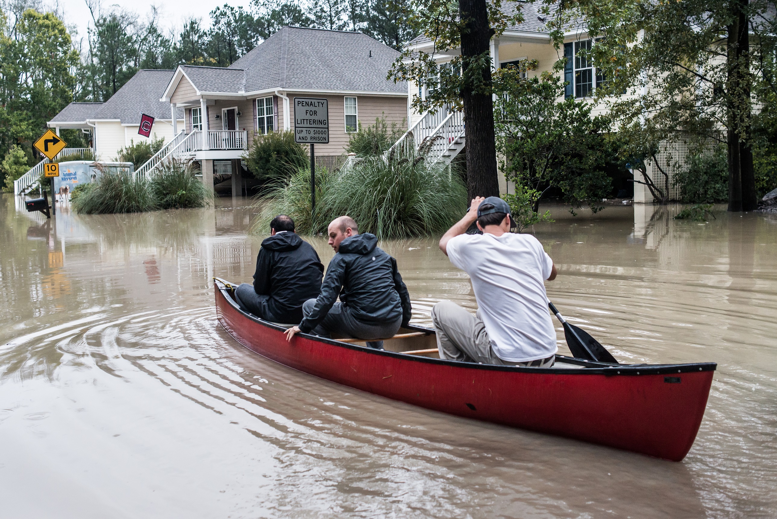
(WLTX) - South Carolina is still scarred and recovering from the October flood. The rainfall that the state experienced on October 2-5, 2015 was historic by any measure. In Columbia the rainfall for October 3rd through the 5th broke 1, 2, and 3-day records. The same records were broken in Charleston, but for the period of October 2-4. An analysis of all of the rainfall data has been done by the National Weather Service and shows that all of South Carolina saw substantial rain with the heaviest from the coast into the Columbia area.
What were the events that lead to this flood? First, rainfall of 1 to 3 inches in late September helped to saturate the soil. Then a cold front passed through South Carolina and stalled just offshore. The atmosphere remained very moist just east of the front. Meanwhile, an upper-level low pressure system dived into the Southeast in early October and briefly stalled over southern Georgia and the Florida Panhandle. This acted to pull moisture over the stalled front and send rain inland focused on South Carolina. Finally, the outer circulation from Hurricane Joaquin, which was well offshore, added tropical moisture toward the end of the event.
Have we seen this kind of event before? An analysis by the Carolina Integrated Sciences & Assessments (CISA) at the University of South Carolina showed that a similar weather event occurred in 1990. Over 8 inches of rain fell between October 10 and 13 in the eastern part of South Carolina with isolated amounts to 12 inches. There was considerable flooding of the river basins in North and South Carolina and eastern Georgia.
It seems that the combination of the weather systems described occur more often in October. Both the 1990 and 2015 floods involved the interaction of a tropical system with a mid-latitude weather system. This is more likely to occur late in the hurricane season.
The October 2015 flood has frequently been described as a 1000-year flood, but no one could tell me how this was determined. I asked for help from the experts at Climate Central. Their analysis showed that the 2 and 3-day rainfall could be characterized as a 1-in-a-800 year event in Charleston. However, it was a greater than 1-in-a-1000 year event for Columbia using the data from the National Weather Service at the Metropolitan Airport. There were greater amounts of rainfall in the Charleston and Columbia areas, but those records did not extend over a long enough time period to do the analysis.
A l-in-a-1000 year event means that the chance of seeing that much rainfall in such a short amount of time in any given year is 0.1%. The table below lists the 1, 2, and 3-day rainfall records observed and their expected return periods.
As heavy as the rainfall was, stream gauges on many of the rivers and streams did not break records. According to the USGS only three peak flows recorded new records. They were Gills Creek in Columbia, the Saluda River at Columbia, and the Black River at Kingstree. The flooding on Gills Creek was made worse by the cascading failure of three dams which made the flooding downstream of Lake Katherine much worse.
The South Carolina Emergency Management Division reports that 36 dams failed as a result of the heavy rains and flood statewide. Another 167 dams were damaged and in need of repair.
South Carolina Department of Health & Environmental Control regulates 2370 dams statewide. This does not include the 34 larger, federally regulated dams. It is estimated that there are about 10,000 dams statewide, many of which are small unregulated dams. Dams are important and have decreased the frequency and intensity of floods. However, it is necessary to make sure that they properly protect communities and property downstream.
It is important to remember that this was a rare event. However, it does not mean that this will not occur for another 1000 years. It could occur again next year, but the likelihood is quite small.
Recovery may be made more difficult by this year's El Nino in the Tropical Pacific Ocean. It is one of the strongest El Nino on record and will likely impact our winter weather. The winter outlook for South Carolina is for a cool, wet winter. The added rainfall may slow the reconstruction efforts.