COLUMBIA, S.C. — Scattered showers and storms are expected Tuesday. The slow-moving storms may produce some heavy rainfall. Some of the hottest weather of the year is forecast for Thursday and Friday as high temperatures soar into the middle to upper 90s.
A few showers will be possible through the overnight hours. Most of the rain will likely stay north of I-20, the southern Midlands will likely remain dry. Temperatures will start off in the lower to middle 70s Tuesday morning.
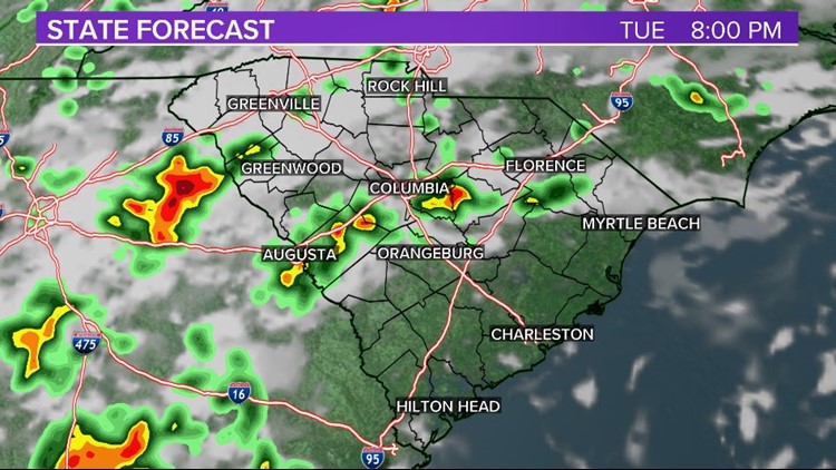
A weak cold front will approach the area, moisture may be slightly enhanced by the tropical low off the Georgia coast. Scattered showers and storms will develop during the afternoon and evening hours.
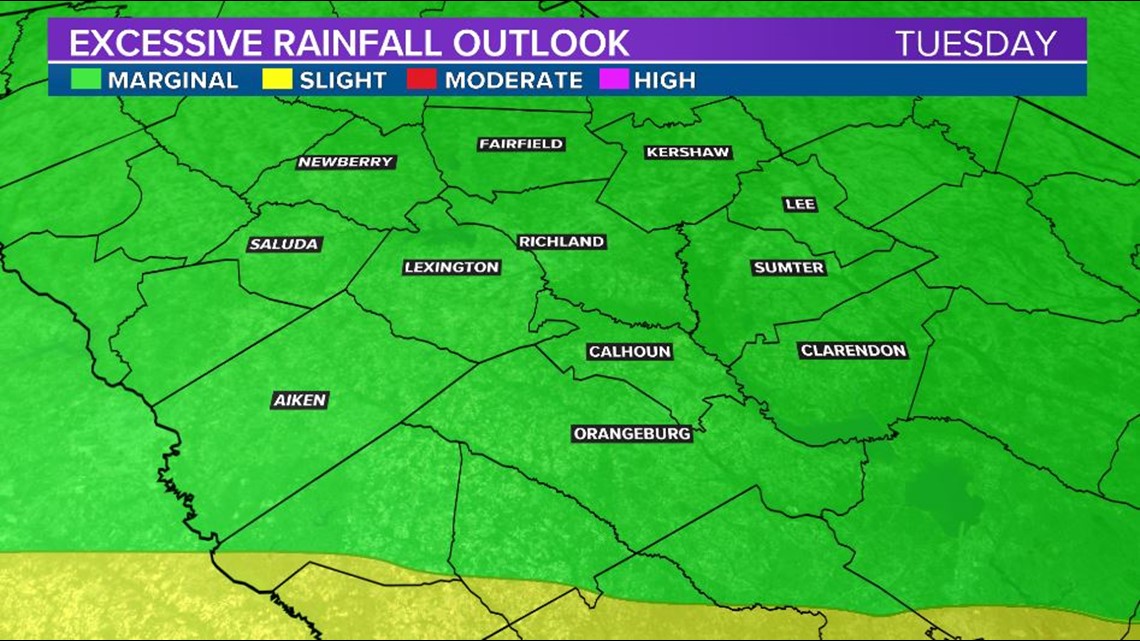
The threat of severe weather is low, but heavy rainfall will be possible. This could lead to some flash flooding across the Midlands. The Weather Prediction Center has the Midlands under a marginal risk for excessive rainfall as the slow-moving storms could produce rain.

High temperatures will top out in the lower 90s Tuesday afternoon with the showers and clouds in place.
Forecast models still show the potential for a few storms Wednesday afternoon, but the better chance for rain will be in the southern portions of the Midlands. High temperatures will climb into the lower to middle 90s.
Thursday and Friday should be dry and hot, possibly the hottest weather we have had so far this year. High temperatures for the last two days of the workweek are forecast to hit the middle to upper 90s.

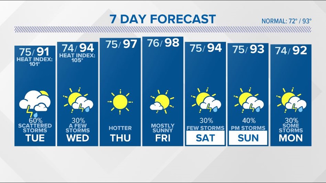
A cold front will approach the area by the end of the workweek. The front may linger around the area through the weekend. Showers and storms will be possible each day. Highs will be in the lower to middle 90s.
Tracking the Tropics:
Satellite imagery and radar data indicate the low pressure system off the Southeast is moving onshore near the border between Georgia and Florida.

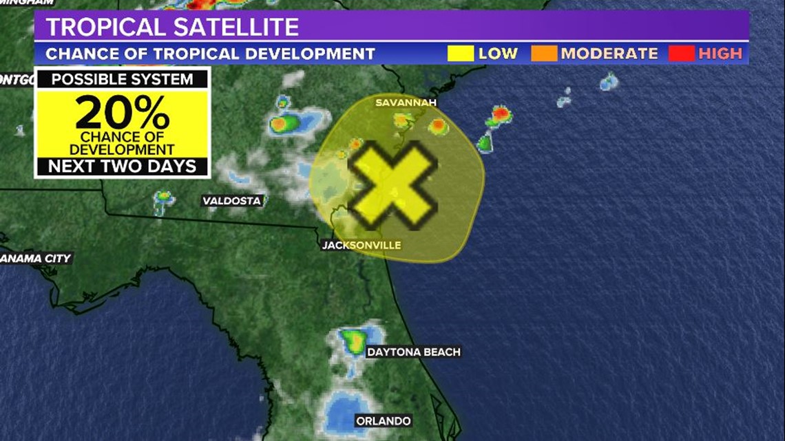
Shower and thunderstorm activity associated with the low remains disorganized and development of this system is unlikely as the low moves just inland over the Georgia coast tonight.
Locally heavy rainfall remains possible over portions of the northeastern Florida and Georgia.