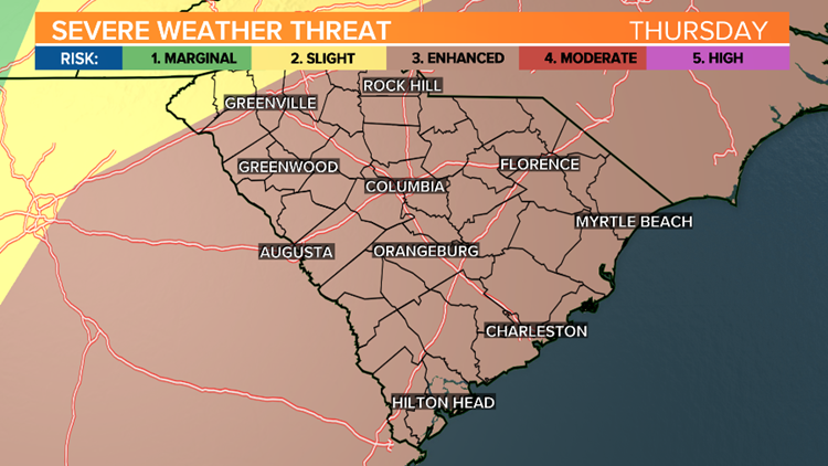
COLUMBIA, S.C. — There's an increase chance that the Midlands of South Carolina could see severe weather in the area Thursday.
The dry streak ended Tuesday across the Midlands, as showers began to move into the region. The Columbia airport did not report any measurable rainfall twelve straight days. This was the longest rain-free streak of 2021.
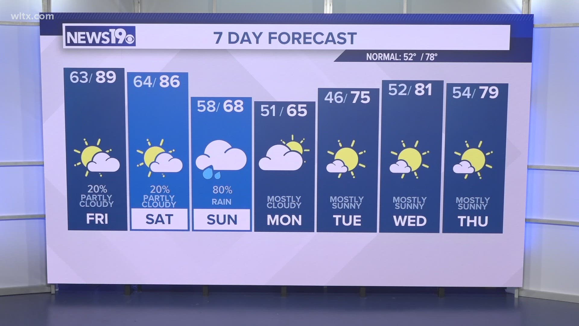
We are starting a new streak today, but this time it is with rain. Showers will continue this afternoon and this evening. Rain is possible Wednesday. Storms are expected Thursday.
It will be cool today. Highs will only be in the lower to middle 50s. Lows tonight will fall into the upper 40s to lower 50s.
More rain is possible Wednesday afternoon and Wednesday evening. Temperatures will be a little warmer. Highs will be in the middle to upper 60s under mostly cloudy skies.
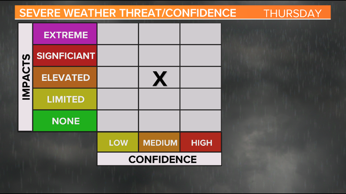
Severe weather is possible for Thursday. The Storm Prediction Center has the state under an enhanced risk for severe weather, which is the third highest level.

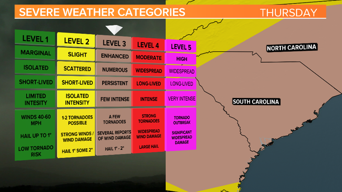
The enhanced risk is the third highest risk category the Storm Prediction Center issues.
A strong cold front will approach the area. Numerous, persistent, strong thunderstorms are expected during the afternoon hours. However, the exact timing is still uncertain.
Confidence is increasing that the area will be impacted by a severe weather event Thursday. Damaging wind gusts, large hail and a few tornadoes will be possible.

The storms and any severe weather will move out of the area by Thursday night.
Cooler, quiet weather returns to the Midlands Friday through the weekend. Highs Friday will be in the middle 60s.
Saturday will be a little cooler with afternoon temperatures in the upper 50s to near 60 degrees.