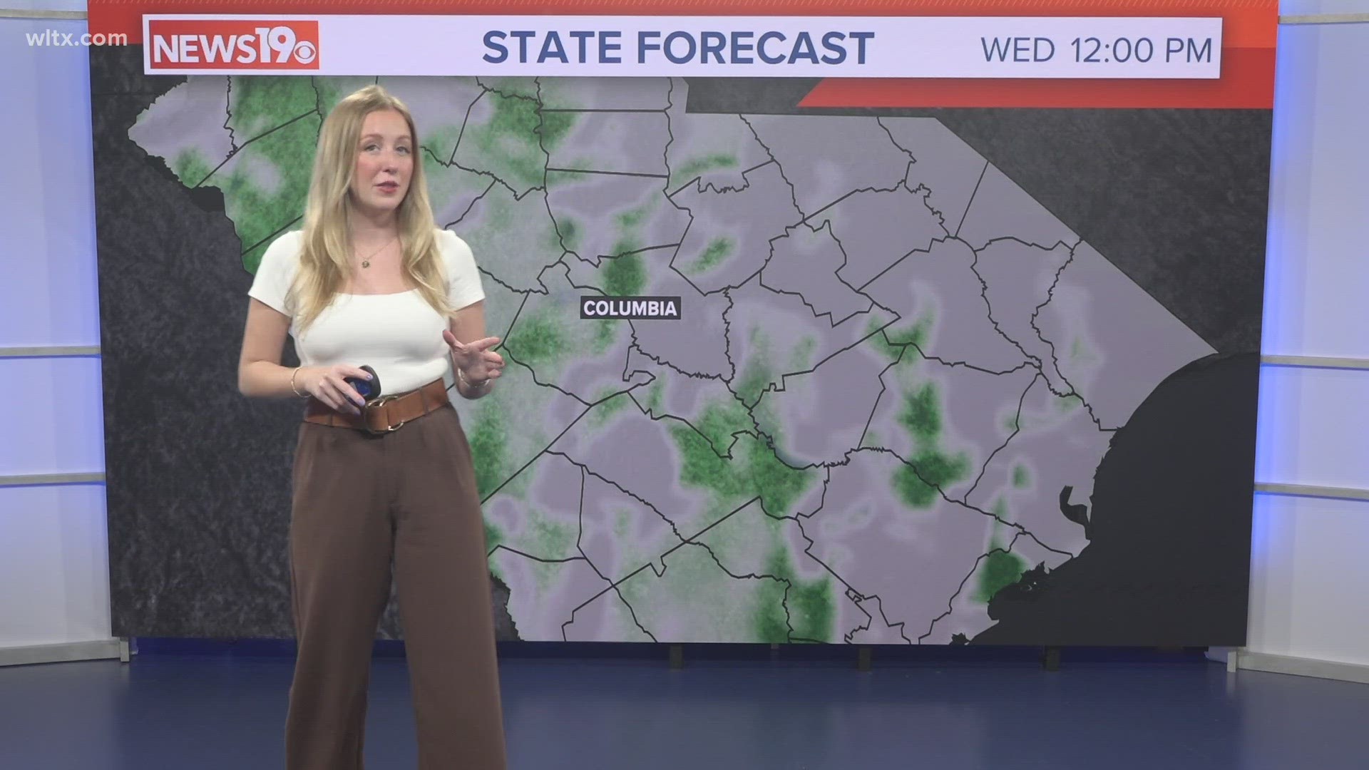
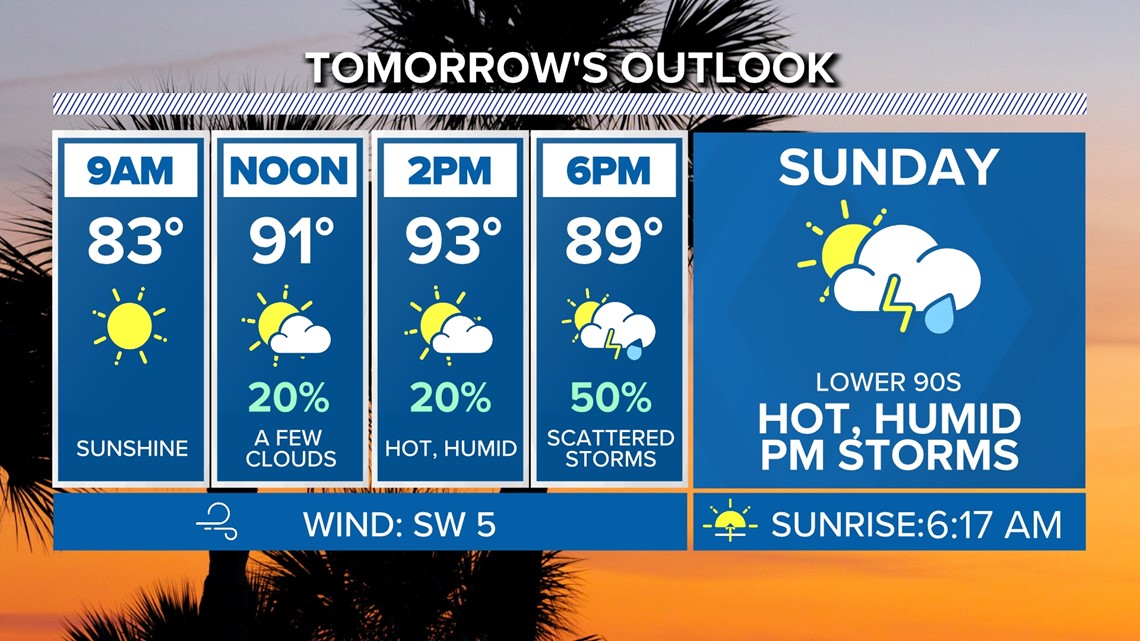
COLUMBIA, S.C. — Moisture will remain over the area through the next several days. This will lead to daily chances for showers and storms. High temperatures will be near normal over the next seven days.
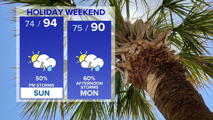
Tropical Storm Colin will continue to move towards the northeast. The storm did not and will not make an impact to our area. Drier air has moved into the Midlands. Skies will be partly cloudy overnight. Lows will be in the lower to middle 70s Sunday morning.
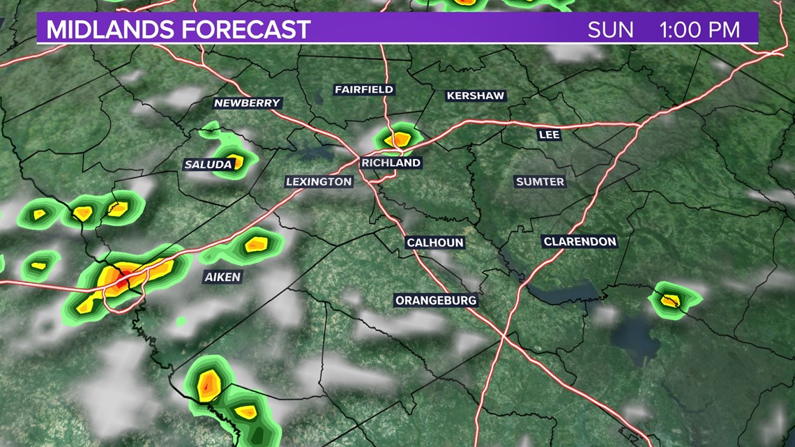
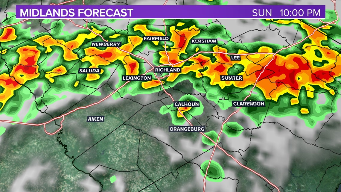
A weak front will move towards the area Sunday afternoon and Sunday evening. This will bring us a good chance for showers and storms during the afternoon and evening hours.

Showers and storms will develop, but it will still be hot. Highs will be in the lower to middle 90s. Heat index values will make it feel like the lower 100s.
The Storm Prediction Center does have the Midlands under a marginal risk for severe weather Sunday. This is the lowest risk level. This is issued when strong to borderline severe storms are possible.

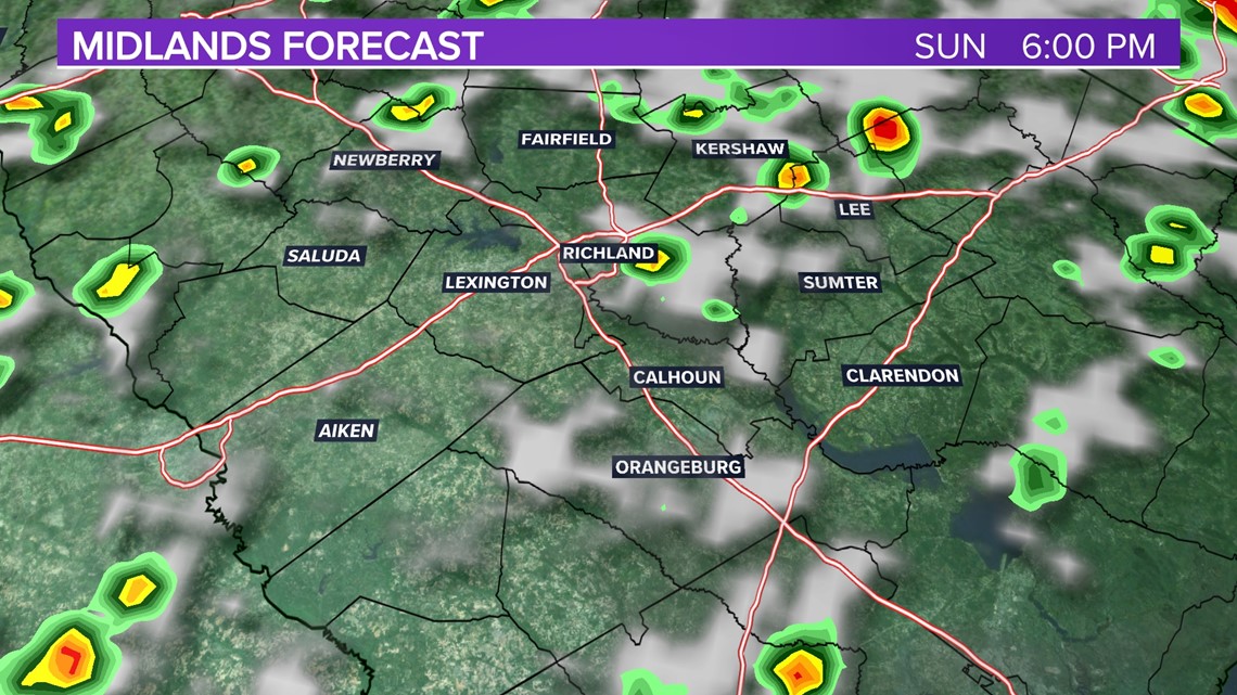
If there is a strong or severe thunderstorm Sunday afternoon, the greatest threat would be damaging wind gusts. Any of the storms that do develop could produce heavy downpours, this could lead to some flooding issues. Once we lose the daytime heating, the chance for rain will decrease.

More showers and storms are possible Independence Day afternoon. Locally heavy rainfall will be possible. The threat of severe weather appears to be small. High temperatures will be near 90 degrees.

Temperatures will remain in the lower to middle 90s Tuesday through Saturday. Showers and storms will be possible each day.
Tracking the Tropics:
Tropical storm conditions, especially in gusty winds, are expected within the warning area along the North Carolina coast through tomorrow.
Rough surf and rip currents are likely to continue along the North Carolina coast through Sunday.

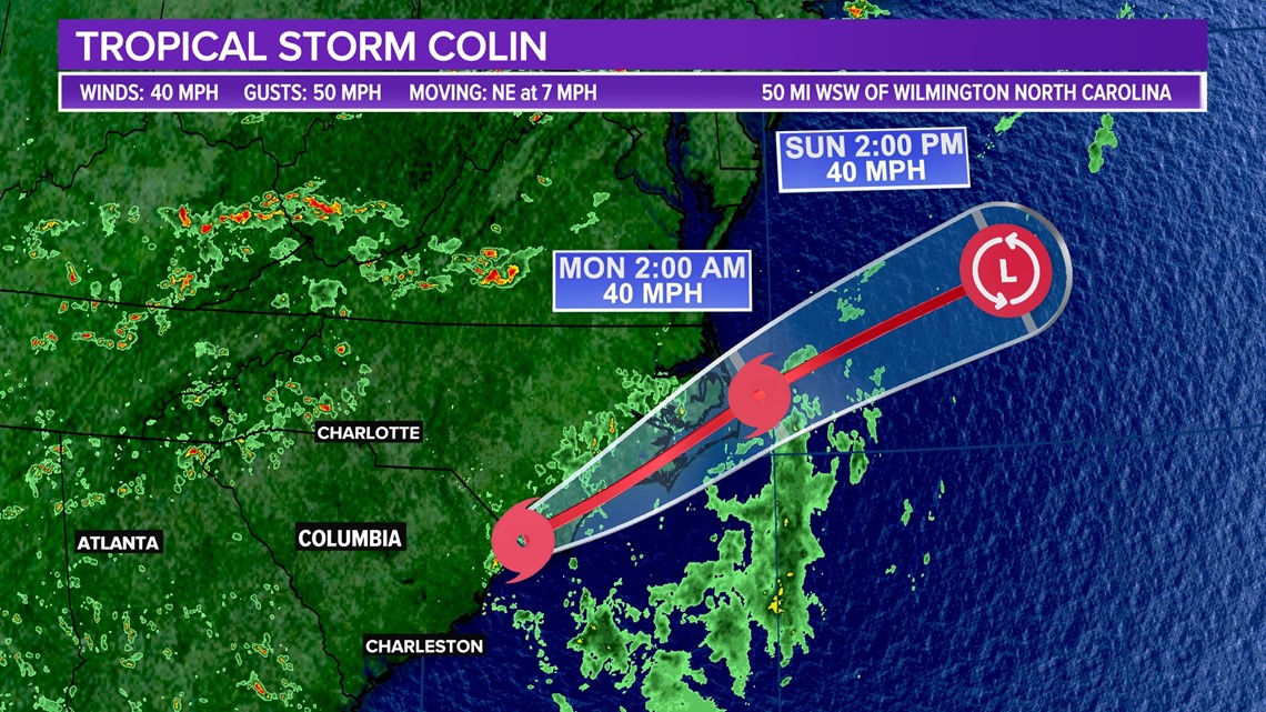
Areas of heavy rainfall may result in localized flash flooding across portions of coastal North Carolina through Sunday morning.
A tropical wave will continue to produce disorganized showers and thunderstorms over the eastern Caribbean Sea, Puerto Rico, the Virgin Islands, and portions of the Leeward Islands.
The shower activity has increased a little today, significant development of this system is still unlikely due to strong upper-level winds.