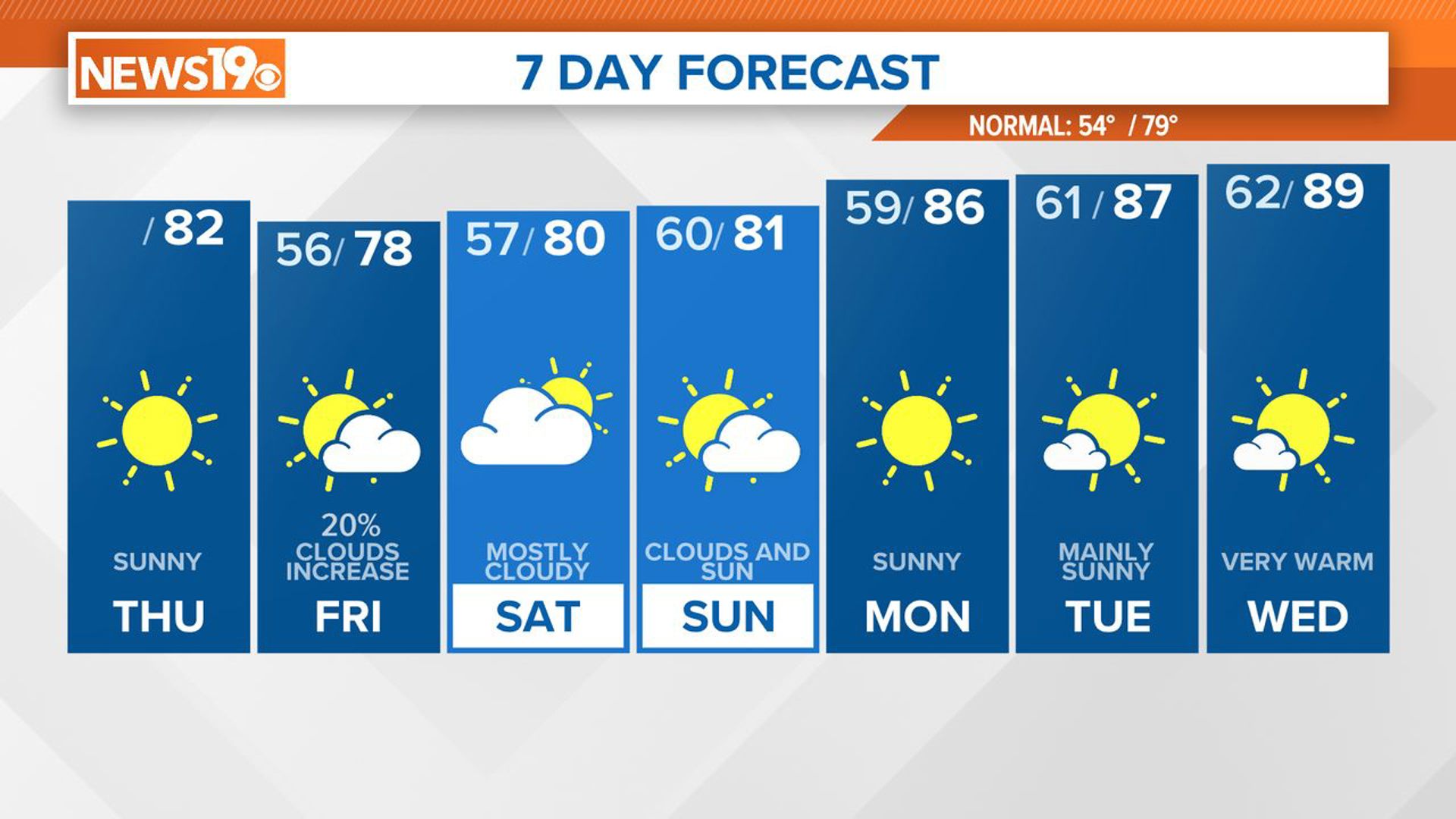
COLUMBIA, S.C. — We have a beautiful December day in store for our Tuesday with plenty of sunshine.
High pressure is moving into the Southeast and will leave skies clear and afternoon temperatures warm. High temperatures this afternoon will be in the low 60s.
Clear skies and high pressure also leads to colder nights. Radiational cooling will help our temperatures drop even colder tonight with lows Wednesday morning expected in the low to mid 30s.
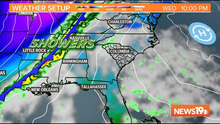
This area of high pressure slides off the coast on Wednesday, which will lead to southerly winds and increase cloud cover later in the evening. Afternoon high temperatures will be a few degrees warmer than today. This will also precede a cold front moving in from the west.


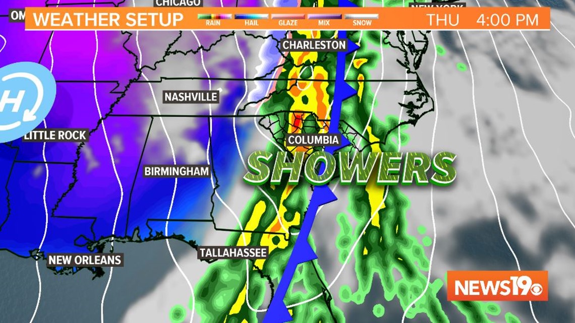
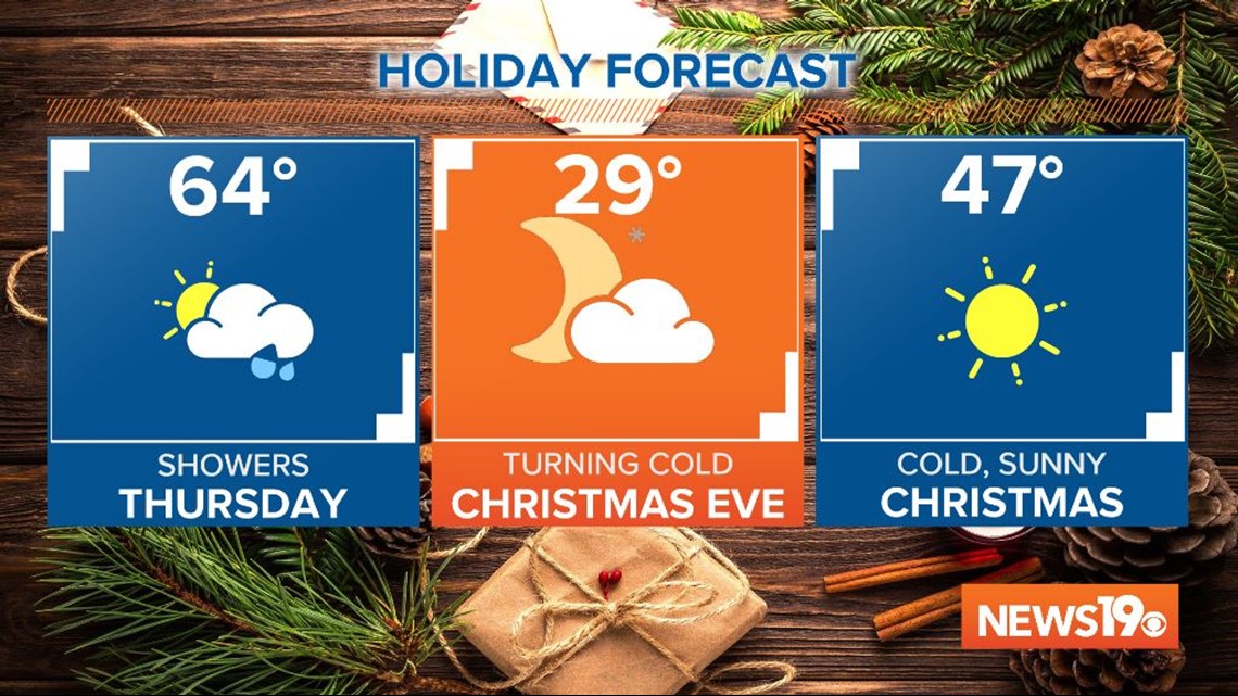
Skies will continue to be mostly cloudy through early Thursday morning. Showers, at times heavy, are likely Thursday morning through the early evening as the front moves through.
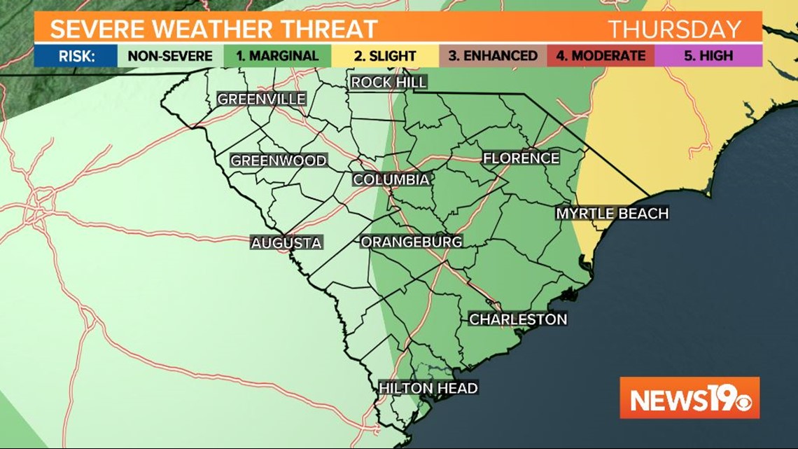
Along with the rainfall, windy conditions are expected with this strong front as it moves east. A few rumbles of thunder cannot be ruled out either. The Storm Prediction Center has placed the eastern Midlands under a marginal risk for severe weather, so we will have to watch and see if any storms are able to develop.

The event will remain all rain for us, though the mountains in North Carolina and areas north may see some light snowfall on the tail end of the system.

Christmas morning will be dry, windy, and quite cold behind the front. Low temperatures will be in the upper 20s to low 30s. Skies will be sunny in the afternoon, though temperatures are only expected to warm into the mid 40s.

The chilly and dry conditions will continue through the weekend after Christmas.