

COLUMBIA, S.C. — After a snowy Friday night and early Saturday, the sunshine will return today, but it will still be chilly with highs only in the upper 30s to lower 40s. It will be clear and cold tonight. Lows may drop into the teens for a few areas.
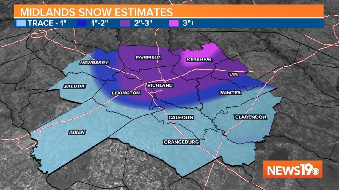
Many areas got snow Friday night across the Midlands. The Columbia airport reported 2” of snow. This was the largest snowfall the airport has gotten since February 12, 2014. Friday was the first time the airport has reported more than a trace of snow since January 7, 2017.
The highest reported snowfall as of early Saturday morning was in Kershaw County. Camden received 3” of snow Friday night. Many areas reported at least some snow.

The sunshine will return to the Midlands today, but high temperatures will only be in the upper 30s to lower 40s.
Tonight will be clear and very cold. Lows are forecast to fall into the lower 20s to upper teens. This could be our coldest morning we have had so far this season.
Sunday will be a little warmer. It will be sunny too. Highs will top out in the upper 40s Sunday afternoon.


The start of the new workweek will be sunny and a little warmer, but still below normal. High temperatures Monday will be in the upper 40s to near 50 degrees.
Scattered showers are forecast Tuesday. Wednesday and Thursday will be dry, but then we will have to watch the potential for another system to impact the area Friday or Saturday.