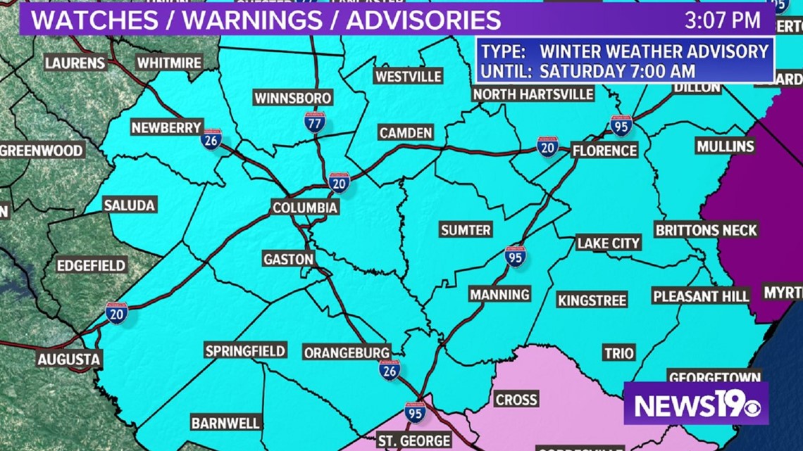
COLUMBIA, S.C. — A winter weather advisory has been issued for the Midlands of South Carolina. Freezing rain, sleet and some snow is possible Friday through early Saturday. This may lead to some slippery road conditions.
A winter weather advisory means that periods of snow, sleet, or freezing rain will cause some travel difficulties. Be prepared for slippery roads and limited visibilities, and use caution while driving.
Light amounts of freezing rain are possible early Friday, with a brief mixture of freezing rain and snow possible Friday night into early Saturday morning.

The forecast will continue to change and evolve as we get closer to the event. Pay attention to the weather, small changes in actual conditions, can lead to big changes in what we get.
Here is a timeline of when we can expect to be impacted by the wintry mix.
8 AM Friday:

Friday morning temperatures will be at or below freezing across most of the area. Light freezing rain will be possible along with some sleet north of I-20.
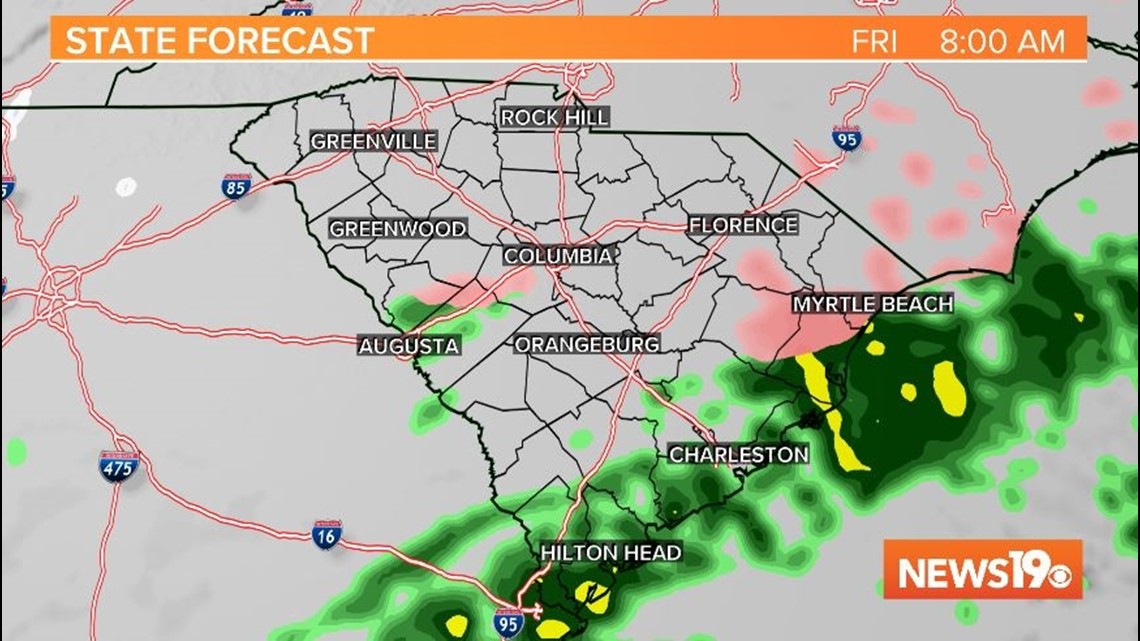
12 PM Friday:

Light freezing rain is forecast by midday. Some sleet and maybe a few snowflakes will be possible north of I-20, but freezing rain will be the biggest wintry weather issue.
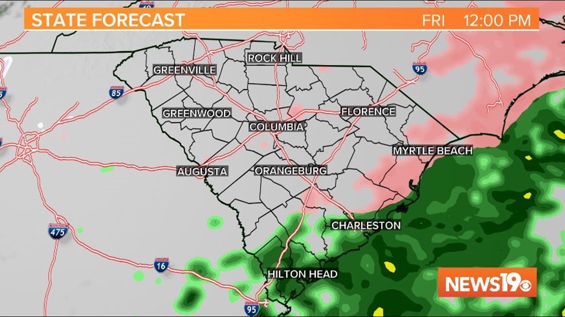
4 PM Friday:

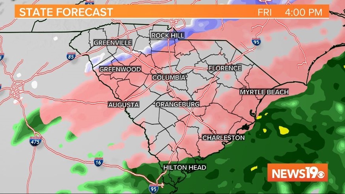
Widespread freezing rain is possible across the area. Some sleet and maybe a few snowflakes will be possible north of I-20, but freezing rain will continue to be the biggest wintry weather issue.
8 PM Friday:

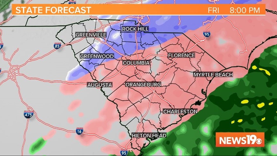
Widespread freezing rain will continue across into the evening. Some sleet and maybe a few snowflakes will be possible north of I-20, especially in the northwestern parts of the Midlands.
12 AM Saturday:

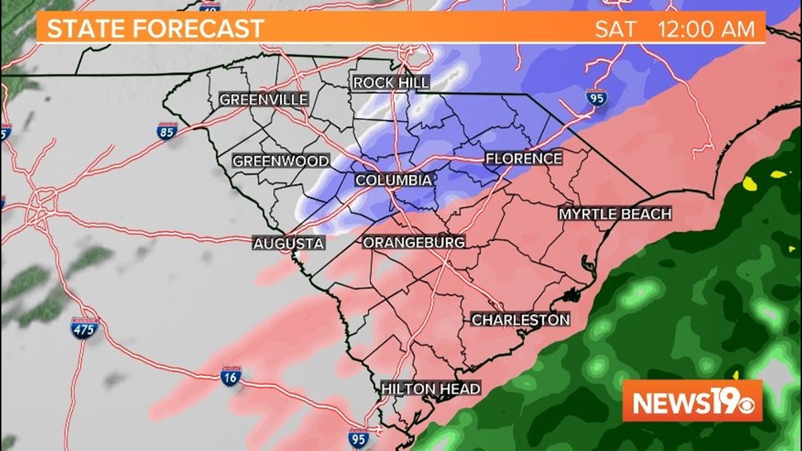
Freezing rain will continue, especially south of I-20. Some sleet and some snow will be possible north of I-20.
4 AM Saturday:

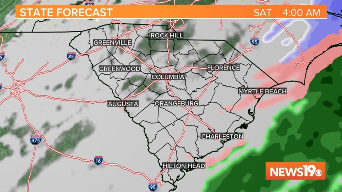
The precipitation should move out of the Midlands early Saturday morning. Dry air will move back into the region, but temperatures will remain below normal.