
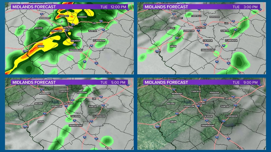
COLUMBIA, S.C. — A cold front will move through the Midlands from the west on Tuesday, bringing showers and a few storms across the area through the early afternoon on Tuesday.
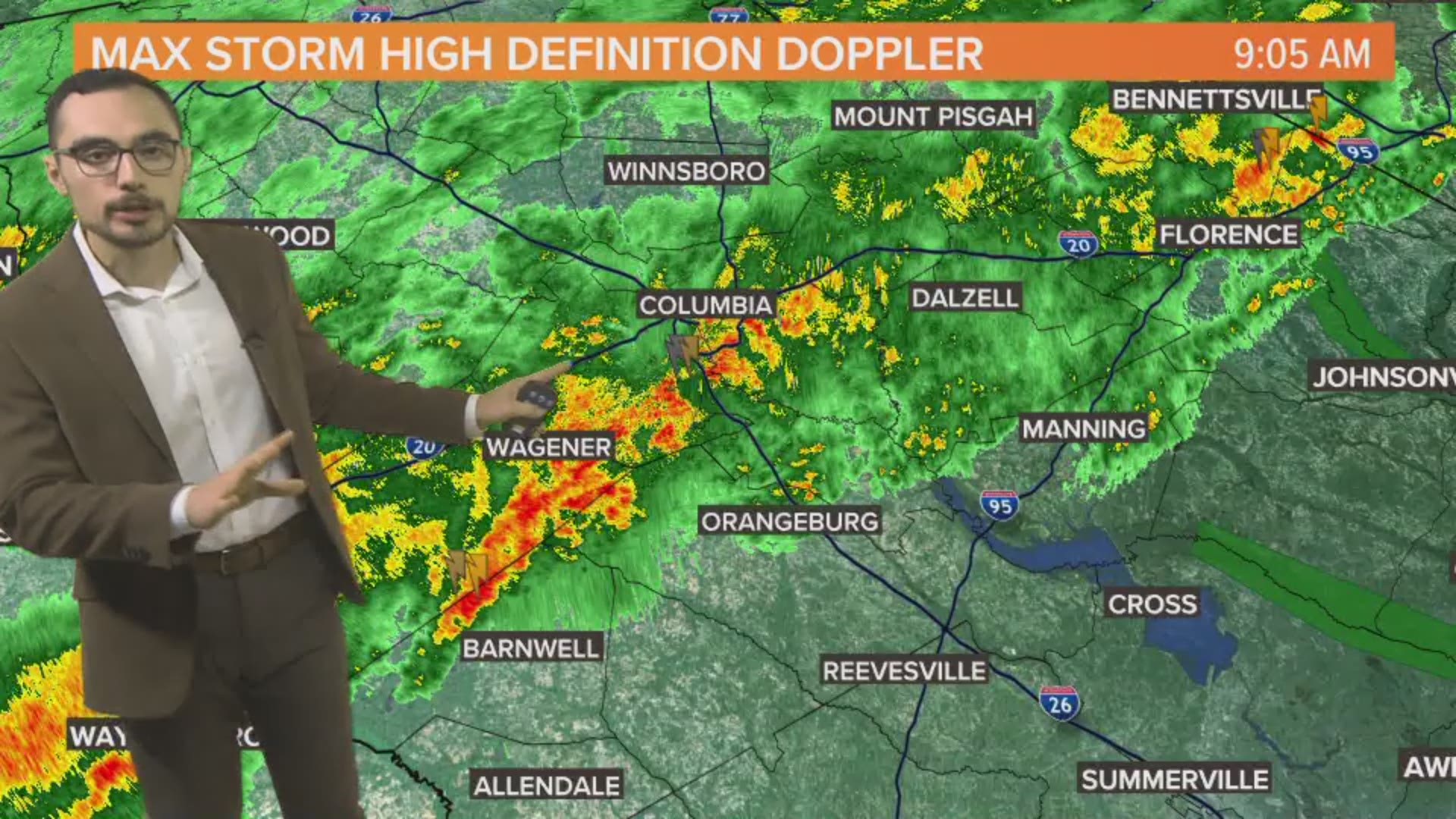
The storms began rolling in overnight, dropping heavy rain and some occasional gusty winds. As of 9 am, Saluda has already picked up an inch of rain which much of Richland County reporting half an inch of rainfall.
Rain chances will increase in eastern counties through the morning hours. The best chance for damaging wind today is in areas of the eastern Midlands that did not see rain earlier this morning.
Most of the area will begin clearing out in the early evening.

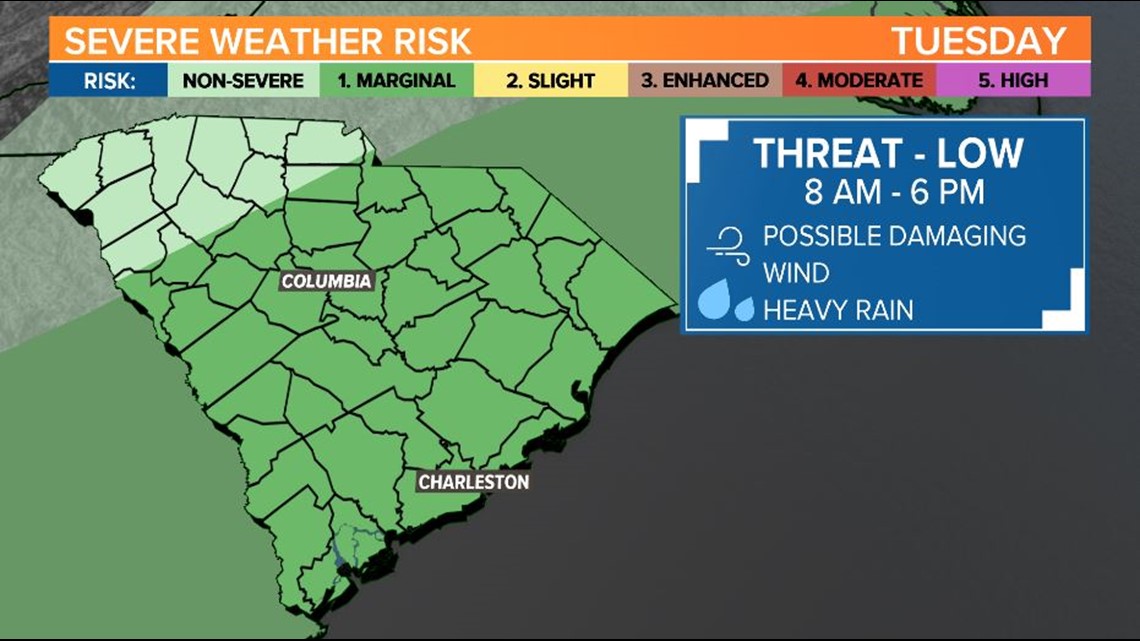
The Storm Prediction Center has placed a majority of the Midlands under a marginal risk for severe weather as the front moves through. This is a 1 out of 5 on the severe weather scale. Heavy rain and damaging winds are possible with a few of the storms that develop.

Storm totals will range from around half an inch to an inch and a half in some places where the heavier showers line up.
High temperatures will remain steady in the upper 60s and low 70s this afternoon; however, temperatures will drop into the mid to upper 30s for Wednesday morning.
The rest of the work week will be dry with partly sunny skies. High temperatures will be seasonable, in the mid 50s. Lows on Thursday and Friday morning are forecast to reach the upper 20s and low 30s.
Looking ahead to next weekend, another storm will develop off the coast and will bring a few showers across the Midlands.
RELATED: Local Forecast