
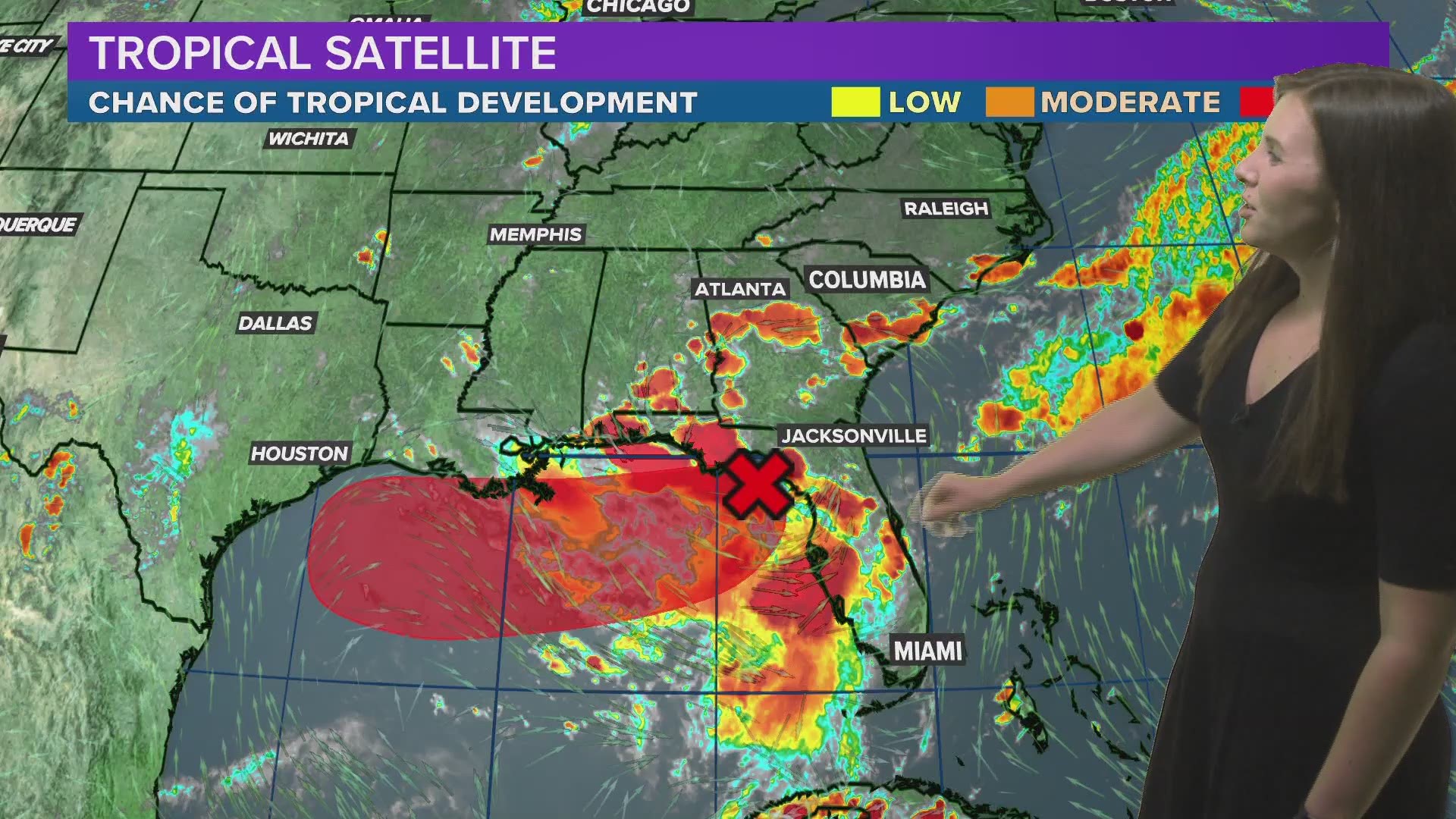
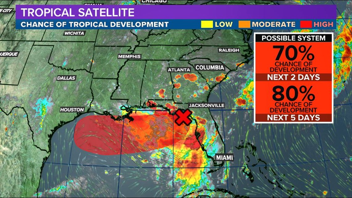
COLUMBIA, S.C. — The National Hurricane Center has issued a high chance of development for an area of low pressure over the northeastern Gulf of Mexico. Over the next 48 hours, the NHC forecasts a 70% chance of tropical development and an 80% chance of development over the next 5 days.
Download the WLTX app: Android version | iPhone version
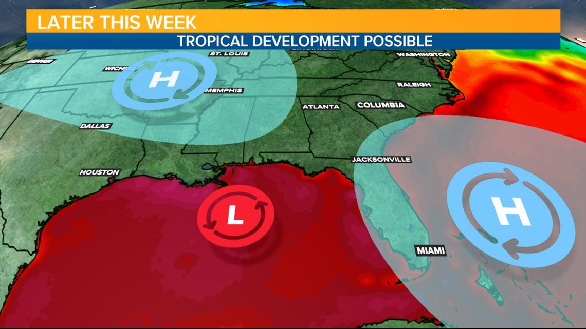
The disturbance, which originated over the Tennessee valley, has traveled south and into the Gulf. Water temperatures there are warm enough to help fuel the storm and a lack of intense upper level winds could help the storm better organize.
Over the next few days, the area of low pressure is forecast to slowly travel west along the Gulf Coast. The National Hurricane Center is advising everyone from the Upper Texas Coast to Florida Panhandle to be vigilant of heavy rainfall caused by this system.
Beyond the next 48 hours, an exact path for this system is harder to forecast. Two areas of high pressure, one located in the Atlantic and one over the southwest United States, will be the steering mechanisms for this storm. This far out, it is hard to forecast the exact location of these highs and which one will have the greatest affect in steering this storm.
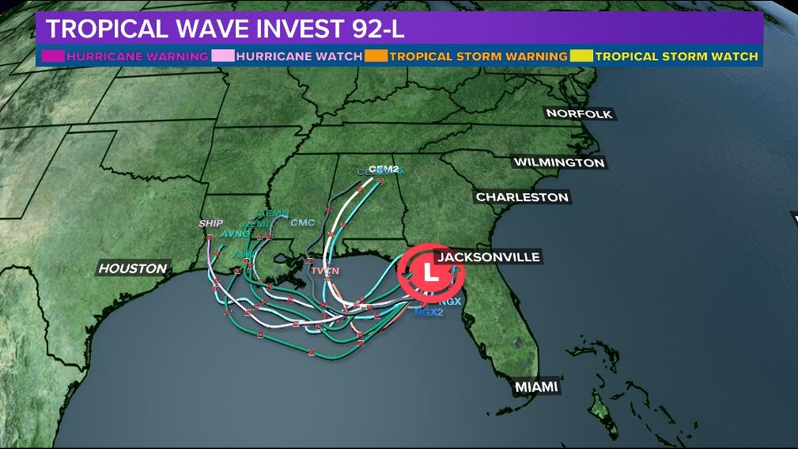
Model spaghetti plots show the disagreement on storm path, seen below by how far apart each path is from the others. All states along the Gulf Coast need to monitor this system and have a hurricane safety plan in place should the storm intensify and make landfall.
The Midlands are currently not under any immediate risks regarding this storm. However, the WLTX Weather Team will continue to monitor the storm's location and impacts in the coming days.
Even if this storm does not reach the Midlands, it is always a good idea to keep a hurricane safety kit at home and ready to go should a storm strike. Keep in your kit water, food, flash lights, and batteries among other necessities.
You can always get the latest conditions by downloading WLTX's apps or signing up for our text alerts.
Weather App Phone: on.wltx.com/WLTX_Weather_iPhone
Weather App Android: on.wltx.com/WLTX_Weather_Android
iPhone app: on.wltx.com/1NTHH98
Android app: on.wltx.com/1NTHvXq
Sign Up for WLTX Text Alerts: Text Alert Signup Page