
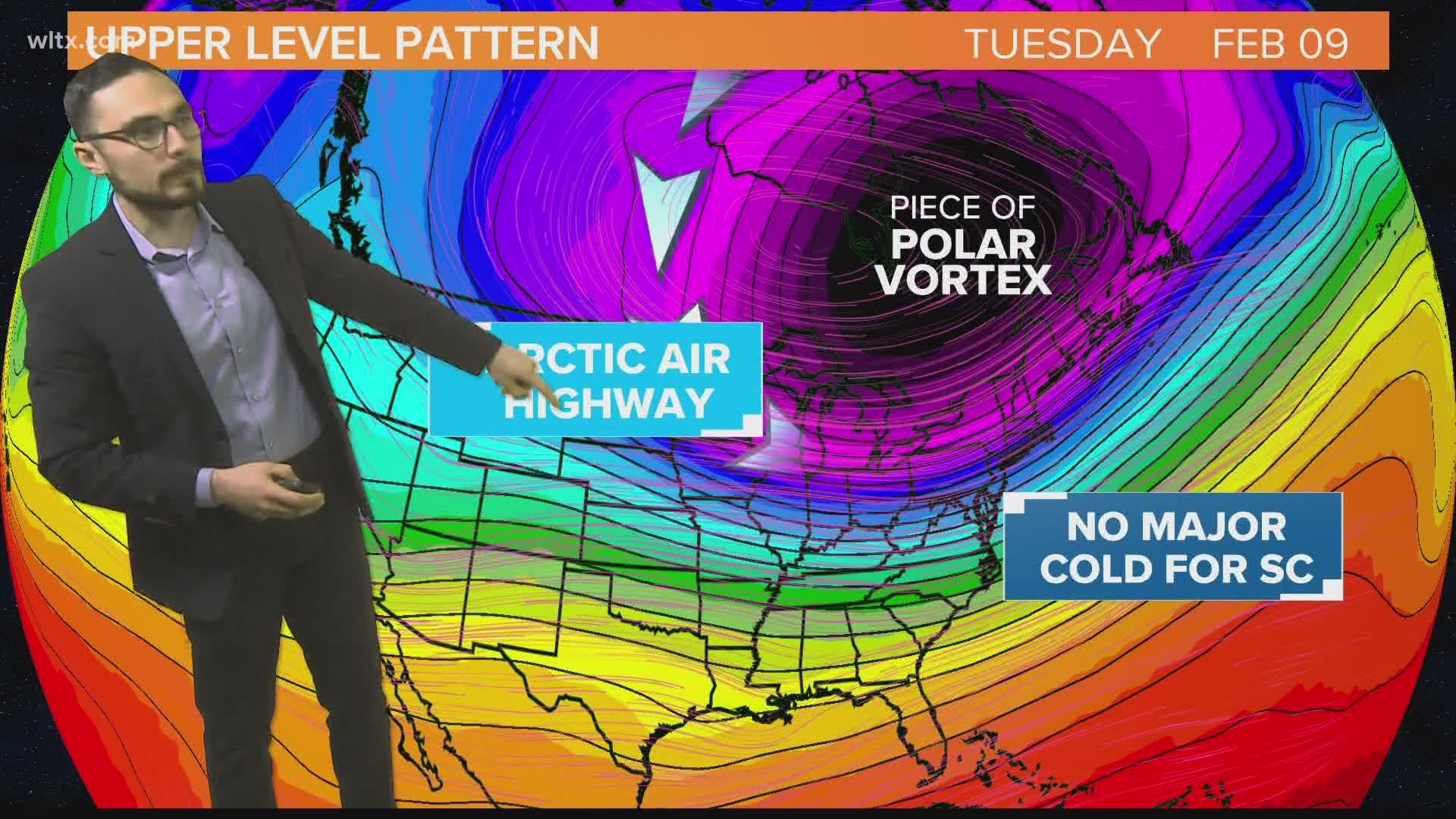
The coldest air of the season is moving into the United States and some parts of the northern United States could see morning temperatures drop as low as -20F, all courtesy of the polar vortex. The buzz word has gotten a lot of attention in recent years, but a strong polar vortex actually keeps cold air locked in the arctic. Next week, a piece of the polar vortex will move closer to our part of the world, but latest guidance indicates it may not bring the cold air all the way to South Carolina.
How the Polar Vortex Works
During the winter, the Arctic receives no sunlight for weeks. Without any source of warm air, the cold builds which increases the atmosphere's pressure by the ground. High in the atmosphere, low pressure develops over the cold air producing a tight current of rapidly moving air that keeps everything mostly locked in place. The tight current of air, known as the jet stream, occasionally is disturbed and dips southward opening up the gates to arctic cold outbreaks here in the United States.
Next Week's Arctic Outbreak
Arctic cold air will begin to move into the northern plains for Sunday morning. Temperatures in places like Montana and Minnesota will drop into the negative teens and as much as -20F. The cold will push farther south toward the Great Lakes and Midwest for Monday and Tuesday morning, but the latest model guidance keeps the southeast out of this cold air.

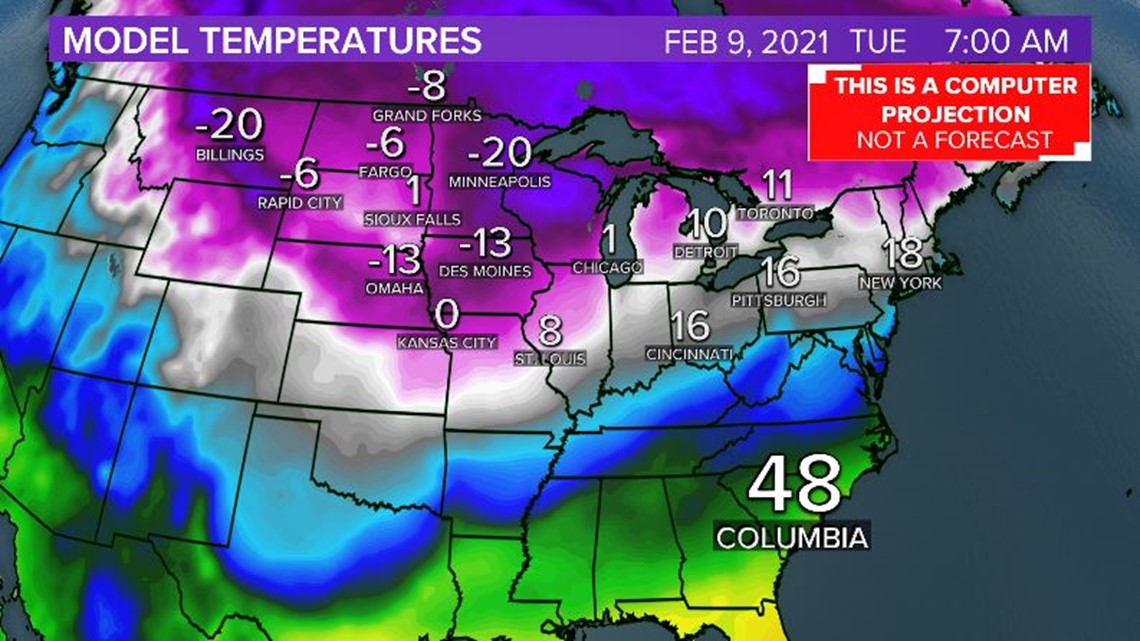
Weather model data was originally trending very cold for the Southeast US on Monday and Tuesday morning, but the latest guidance keeps temperatures near to even slightly above average here early next week. Some of the cold air could leak into the Midlands toward the middle of next week, but extreme cold is not in the forecast. However, an active storm pattern is expected to ride between the cooler air mass to our north and the milder air over us bringing opportunities for rain and even snow for colder parts of the south.
February is an active month for Winter Weather

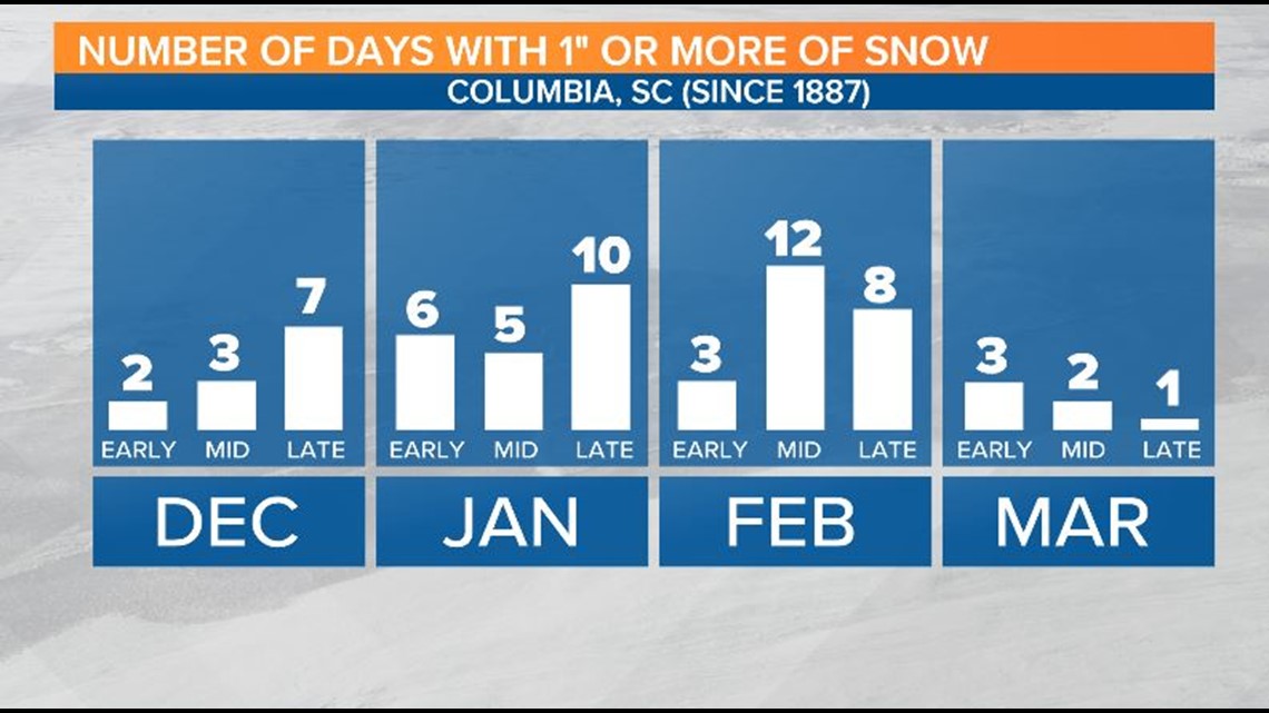
January is the coldest month of the year for the South Carolina Midlands on average, but February is historically the best chance for snow in our area. Four of the 5 biggest snow events in Columbia happened in Mid February, most recently the 8.6" of snow Columbia reported on February 12, 2010. On February 2nd several towns recorded wet snowflakes in the Midlands, but temperatures were too warm for any accumulation. Although there is no winter weather in the forecast, it's important to keep an eye over the next few weeks, particularly with the active storm pattern in place.