
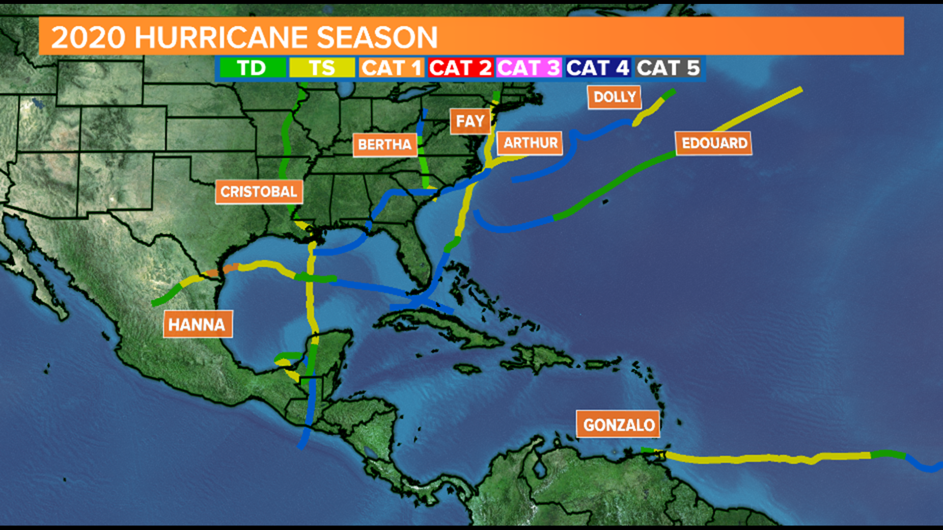
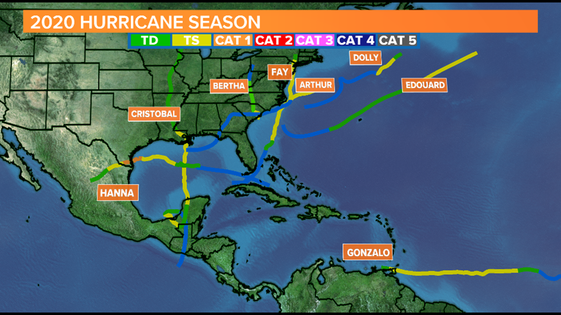
COLUMBIA, S.C. — The 2020 Hurricane Season has barely begun and already we've broken five records for the earliest "C" E F G and H storms. On average, only one named storm develops by late July, and we've had 8 named storms as of July 27. At this rate, it's possible we'll go through the entire alphabet of named before the season is over, which has only happened one other time in the 70 years of storm naming.
On Monday morning, we're watching a disturbance in the Central Atlantic that could impact parts of the northeastern Caribbean by Thursday. If the storm get's a name it'll be called "Isaias" (pronounced ees-ah-EE-ahs), the earliest "I" storm on record by more than a week.
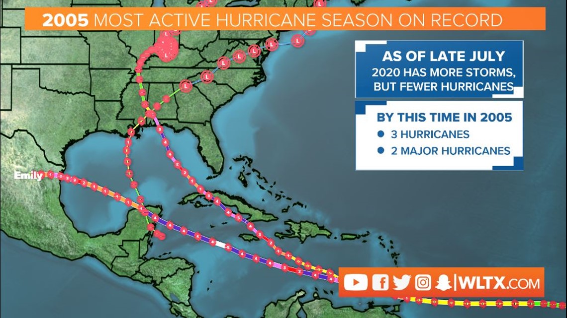
Most of the previous records for "earliest named storm" were set back in 2005, which was by far the most active hurricane season on record to date. The 2005 season brought devastating storms like Rita, Dennis, Wilma, and Katrina. Unlike 2020, the storms in 2005 were powerful even early in the season. Rita and Dennis both reached major hurricane status in July and the named were retired. Of our 8 named storms in 2020, only one became a hurricane.

What does the rest of 2020 look like?
The stormy start to 2020 will likely continue, and stronger storms will likely develop as we head into August. A rainier than average pattern will make it easier for storms to form and warmer than average temperatures across the Atlantic will give these storms more fuel to rapidly intensify.

The Main Development Region is waking up in the Atlantic. This part of the Central Atlantic is a launching platform for tropical disturbances that emerge off of Africa. This area is always a concern because storms have a lot of room to grow in the Main Development Region before it threatens land. There have already been two tropical disturbances in the Main Development region before August, which is a sign that things may become even busier when conditions are more favorable in a few weeks.
The National Hurricane Center Outlook
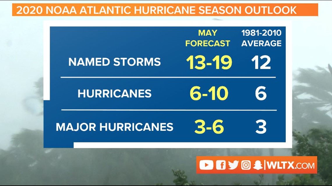
Back in May, the National Hurricane Center projected a busier than usual hurricane season with 13-19 named storms, 6-10 hurricanes, and 3-6 major hurricanes. If this outlook verifies, we can expect 5-9 more hurricanes and 3-6 major hurricanes. The National Hurricane Center typically releases their revised mid-season outlook each year in mid-August.
If the National Hurricane Center uses all 21 names on the Atlantic Hurricane Season list, the agency will have to begin to name storms using the Greek Alphabet (starting with Alpha, then Beta and Gamma), which they resorted to during the end of the 2005 season.

It's important to take each hurricane season seriously. Some active seasons, like 2005 featured no direct impacts to South Carolina, but the most infamous storm in South Carolina's history, Hugo, in 1989 occurred in an average season. This season will likely be one of the most active on record. While this doesn't guarantee a bad storm will make landfall, it increases the chances. Hurricane season is most active from mid August through Mid October. The historical peak activity occurs in early September.