
For the best viewing experience, view this article on a desktop or our mobile website by clicking here
Columbia, SC (WLTX) - Hurricane Nate has made landfall in the United States, as the storm begins pushing inland with its powerful winds.
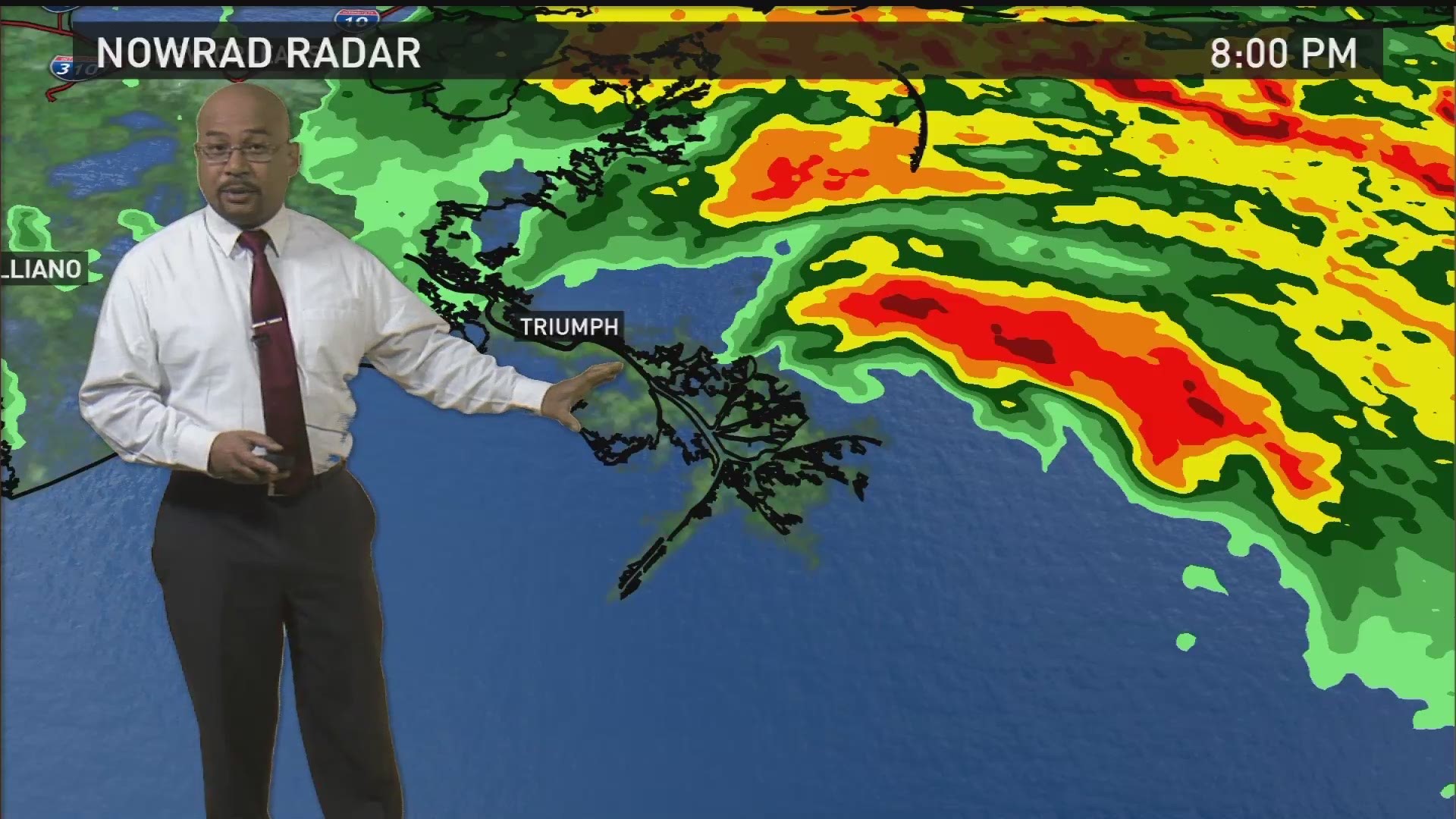
The National Hurricane Center said just before 8 p.m. Saturday that the storm had came ashore near the mouth of the Mississippi River, around Plaquemines Parrish.
Nate had maximum sustained winds of 85 mph, making it a Category 1 storm. It had slowed down just a bit, but was still moving rapidly at 20 mph to the north-northwest.
Hurricane warnings are in effect from Grand isle, Louisiana to the Alabama/Florida border. That includes the New Orleans metropolitan area.
Bottom line: How Could It Affect South Carolina?
This is what we feel we can say at this point.
Now that it's made landfaull, Nate is expected to track through Louisiana, Mississippi, Alabama, and Tennessee over the next day or so.
Depending on if it tracks a little more to the left or right, the Midlands could see rain, and some gusty winds. However, the rainfall is now not expected to be significant because the center of circulation will be far away from the center of South Carolina.
WLTX's weather team will continue to track the storm, and we'll post updates here, as well as have them on our Facebook page and our Twitter account @WLTX