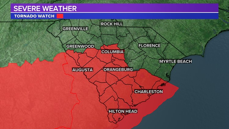
COLUMBIA, S.C. — The National Weather Service has issued a tornado watch for most of the Midlands in anticipation of another round of severe weather in the region.
The watch is for the following Midlands counties: Calhoun, Lexington, Orangeburg, Richland, and Saluda. The watch is in effect until 11 PM.
A tornado watch means those conditions could form in the watch area during the time of the storm. A tornado warning means a tornado has been spotted on the ground or has been indicated by radar.
The remnant boundary south of Columbia will be the focus again for shower and thunderstorm activity. This boundary will gradually move north. Showers and storms will be possible again this afternoon. Some of the storms could be strong or even severe, especially in the southern part of the state.

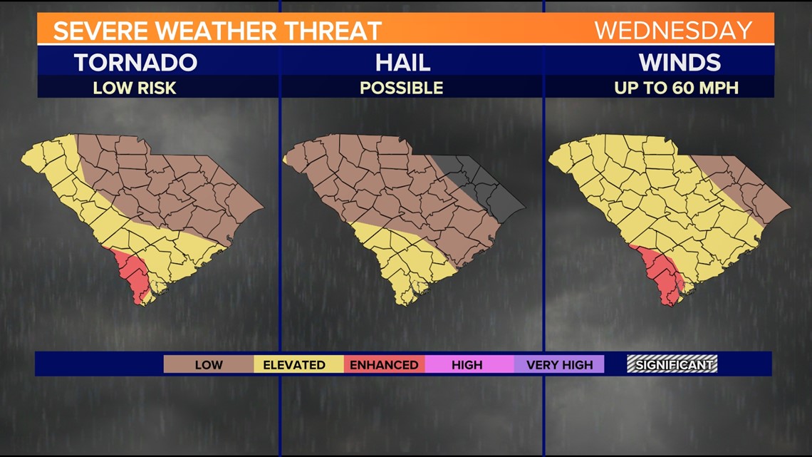
If severe thunderstorms were to develop. Damaging wind gusts and some hail will be the main threat, but we cannot rule out a tornado.


However, the clouds this morning should help limit instability and the upper-level winds are not as strong as yesterday.

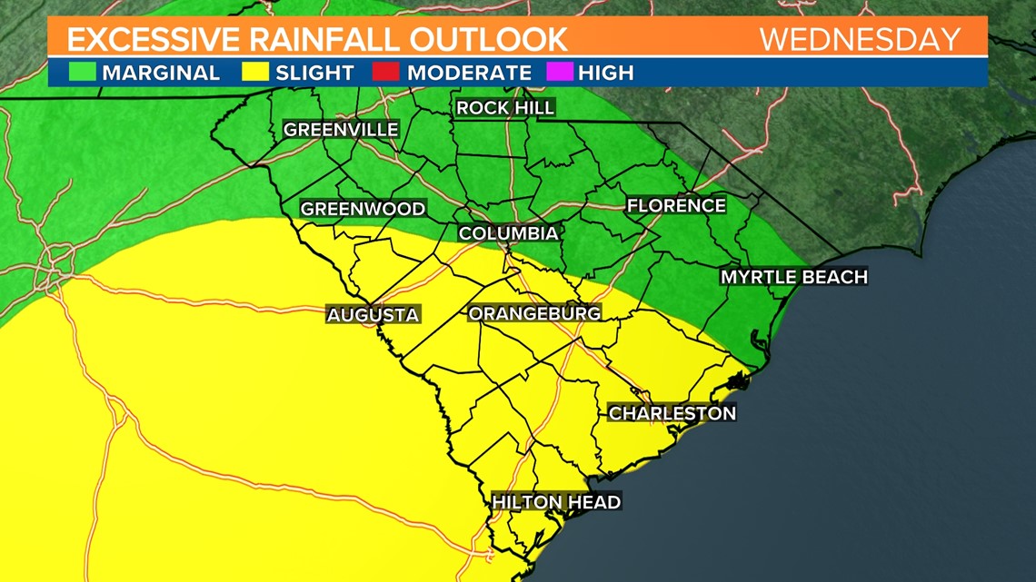
Excessive rainfall could be an issue with the storms that form. Heavy rainfall along with saturated soils from yesterday rain could produce some flash flooding.
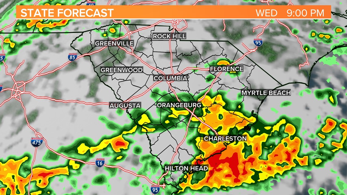
Here is the timing of storms today
8 PM Wednesday
More showers and storms impact parts of the southern Midlands and central Midlands.

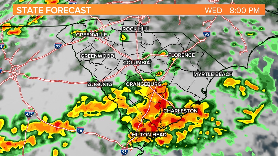
9 PM Wednesday
The activity begins to die down, the threat of severe weather should decrease at this point.

The main cold front will move through the area early Thursday morning. A few showers will be possible during the morning hours. A stray thunderstorm will be possible in the extreme eastern part of the Midlands.
Friday will be mostly sunny, breezy, and cooler. Highs will be in the middle to upper 60s. Friday night will be chilly with lows dropping into the upper 30s to lower 40s.
Saturday will be unseasonably cool with high temperatures in the lower 60s under mostly sunny skies.