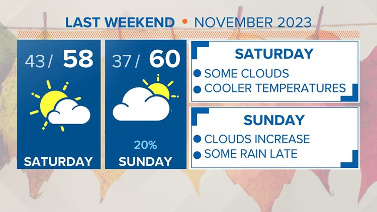
COLUMBIA, S.C. — A few clouds will be around today as an upper-level shortwave passes through the region. Drier air works in for Saturday before another trough approaches Sunday and Sunday night. Light rain is expected with this system. Dry and cool air stick around for the majority of the next workweek.
The clouds will decrease today. Highs will be in the lower to middle 60s. Our average high this time of the year is 64 degrees. A few more clouds will be possible tonight. Lows will start off in the lower 40s on Saturday morning. Temperatures Saturday afternoon will be in the middle to upper 50s under partly cloudy skies.

The clouds will increase for the second half of the weekend as a disturbance moves through the region. Highs will be in the upper 50s to near 60 degrees. A few isolated showers will be possible after sunset on Sunday. Some rain may linger into early Monday morning. Monday afternoon temperatures will rebound into the lower to middle 60s.
Quiet, dry, and cooler than normal conditions should dominate the period as a strong surface high pressure settles into the southeastern US. This will occur over the course of a few days, with the center of the high pressure settling into the Carolinas by Tuesday and Wednesday.

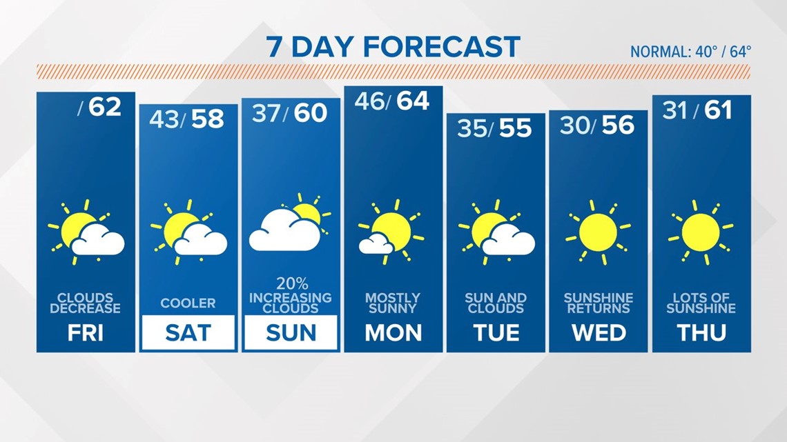
Temperatures Tuesday and Wednesday will be in the middle 50s, with mainly sunny to sunny skies. Lows will drop into the upper 20s and lower 30s. Gradually, things will moderate by Thursday. Rain chances will not increase until Friday, at the earliest.