
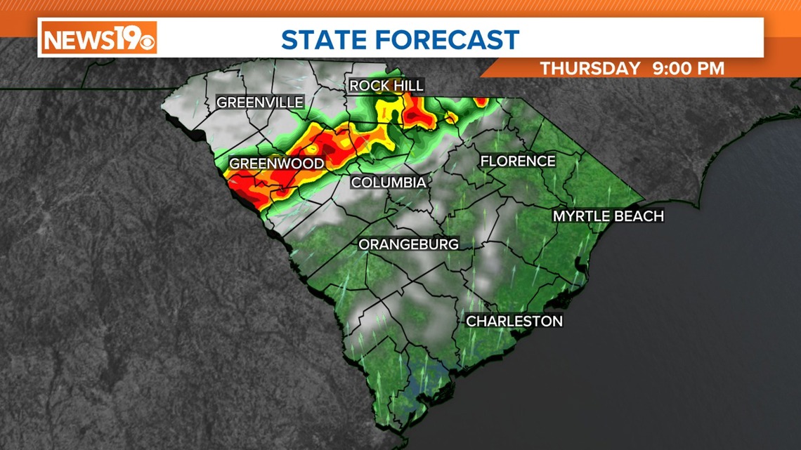
COLUMBIA, S.C. — A frontal boundary is expected to approach the region tonight, bringing with it increased chances of showers and thunderstorms from tonight through Monday. This front will likely stall near the area, creating persistent storm activity over the holiday weekend.
A disturbance will swing through the area later today, which will trigger some storms across South Carolina. Despite increased moisture, the lack of a significant trigger will limit showers and storms until this evening, when the shortwave moves into the state.
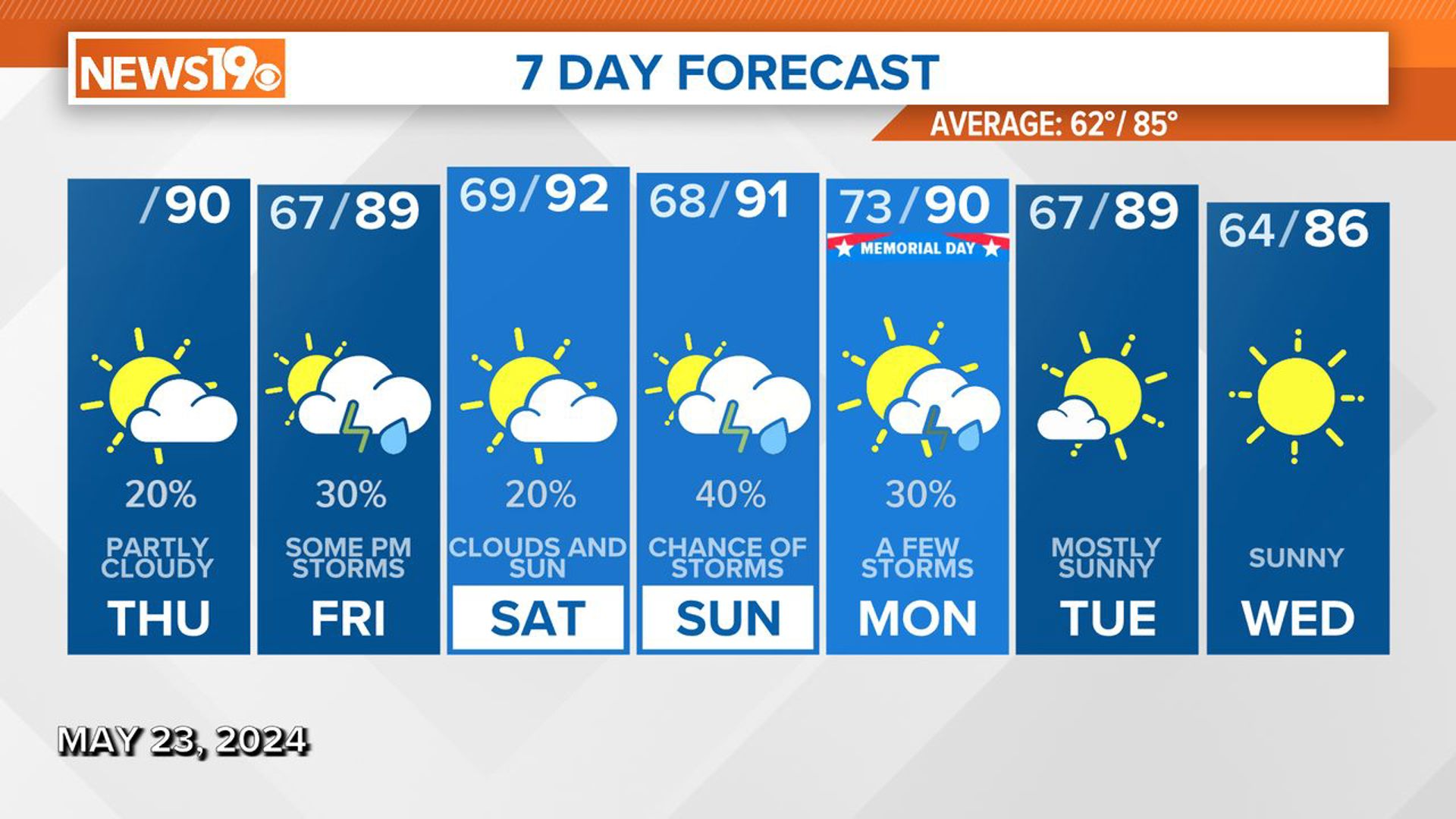
The area with the highest chances of showers and storms will be in the northern part of the Midlands. Although widespread severe weather is not expected, some storms may become strong. Isolated, stronger wind gusts are possible. Today's temperatures may be slightly warmer, around 90 degrees, with cloud cover keeping overnight lows mild in the upper 60s.

Friday through Saturday night will see a pattern more conducive to thunderstorm activity, with a weak frontal boundary stalled north of the area and several short waves moving through. A southerly surface flow will bring Gulf moisture into the region, increasing precipitation potential.
On Friday, the best chances for thunderstorms will be in the northern Midlands, with lower chances in the central Midlands through the southern parts of the state. Expect storms to initiate in the mid-afternoon and linger into the evening, especially in the northern Midlands. Temperatures will be in the upper 80s to low 90s, with overnight lows in the mid to upper 60s.
Saturday and Saturday night also present potential for thunderstorms, although upper-level high pressure may limit activity. With ample instability, any breaks in the clouds allowing for strong heating could trigger convection, especially with outflow boundaries or weak short waves crossing the area. High temperatures will be in the low 90s, with lows in the upper 60s to around 70.
The active weather pattern continues into Sunday through Monday. Another weak surface boundary will stretch across the region, with strong heating and instability likely initiating thunderstorms. The focus will be Monday, as a low-pressure system moves into the central Great Lakes and an upper-level trough digs into the mid-Mississippi Valley. There are differences in model forecasts regarding the timing and strength of this feature, but there is potential for strong thunderstorms.
By Tuesday night, the upper trough is expected to move offshore, bringing drier air into the region. Temperatures will start above normal on Sunday but will gradually cool to normal by Wednesday.