
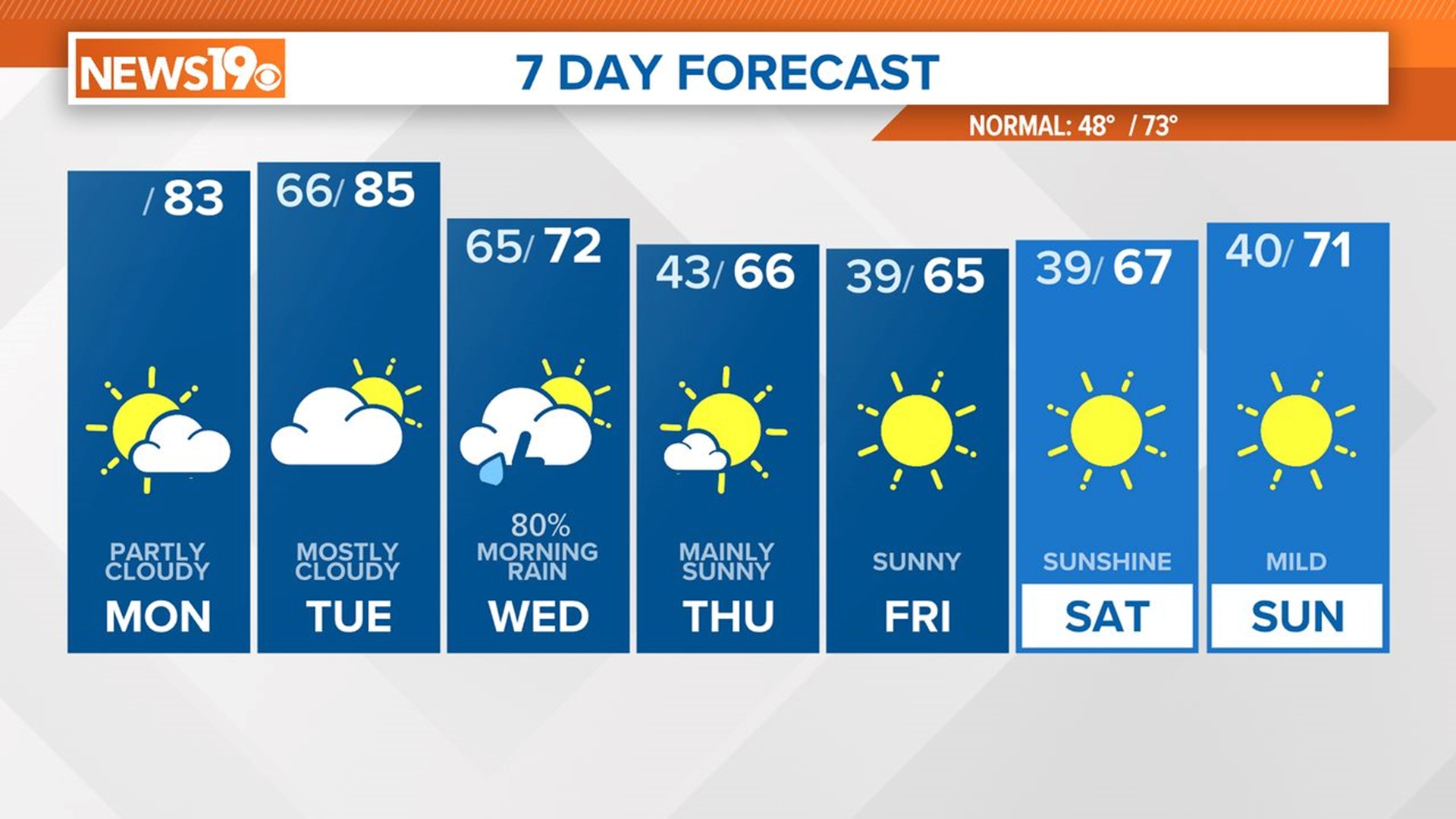
COLUMBIA, S.C. — Through the early part of the week, the region will remain dry and have temperatures above average due to high pressure off the southeast coast of the United States. A cold front moves across the region late Tuesday into Wednesday, bringing with it the possibility of showers and thunderstorms early Wednesday. After that, it will be cooler, dry, and breezy through the rest of the workweek. Temperatures will moderate over the weekend.
Very warm weather is forecast for today and Tuesday. High temperatures will be in the lower to middle 80s. We are expecting partly cloudy conditions today and mostly cloudy skies on Tuesday. Rain moves into the area very early on Wednesday.


Showers and storms are expected early Wednesday. As of now, severe weather is not expected for the Midlands, but this is something that will be monitored. If strong or severe storms do develop, the greatest threat will be damaging wind gusts.

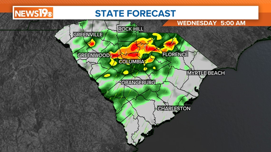
Wednesday through Sunday look pleasant, with much cooler than normal conditions expected Thursday through Saturday. Strong, gusty winds are expected behind the front on Wednesday as cool, dry air ushers into the forecast area.
The first weekend of April 2024 will be sunny and dry. Highs will be in the middle to upper 60s on Saturday. Temperatures on Sunday will be close to normal, peaking in the lower 70s.

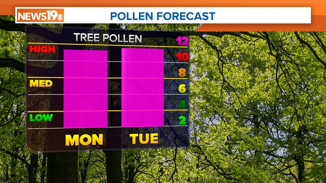
Pollen levels will be very high today and Tuesday. The pollen count will drop a little on Wednesday with the rain, but as things dry up, pollen levels will increase through the rest of the week.