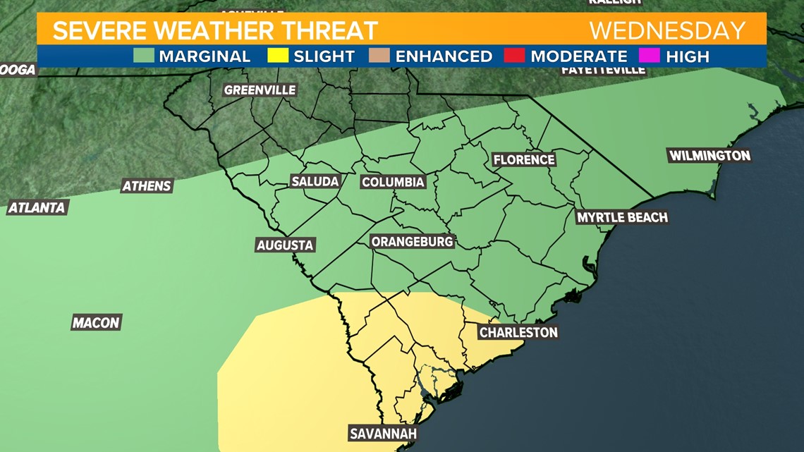
COLUMBIA, S.C. — Rain is expected throughout Wednesday in South Carolina with a risk for a few embedded strong thunderstorms. The Storm Prediction Center has issued a marginal risk for severe thunderstorms. These storms could be capable of producing damaging wind, and there's a chance for some hail in stronger storms to the south and east. Although rain will persist for most of the day, the greatest risk for thunderstorms will occur late in the morning into mid afternoon.
A marginal risk for severe weather from the Storm Prediction Center means there is a 5% chance for damaging wind within 25 miles of your neighborhood. This is the lowest risk level of the five risk levels the Storm Prediction Center issues. Under this risk level, any severe weather that occurs will be isolated.

The Setup
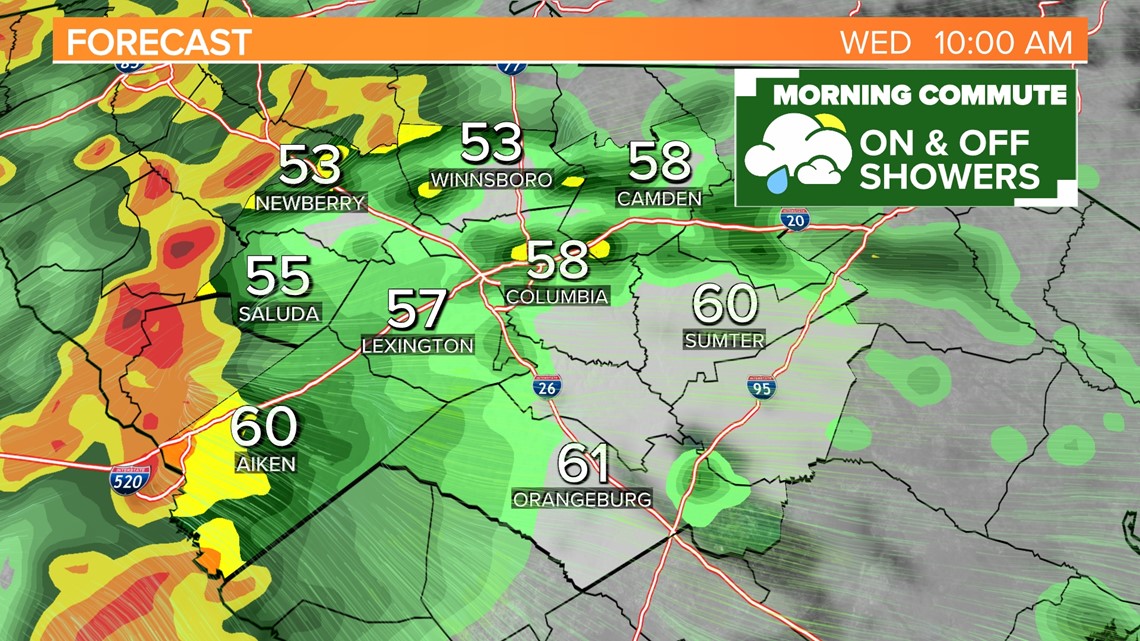
An area of low pressure over Georgia on Wednesday morning is increasing shower activity over the Midlands for the morning commute. Although the rain is mainly light during the early morning, showers are becoming widespread. To the south, downpours are developing in Georgia where slightly warmer temperatures and more moisture is present. This activity will move into the South Carolina Midlands later this morning through the afternoon.
The low pressure system is producing strong winds higher in the atmosphere will help enhance moisture transport. This will produce storms capable of heavy rain. Warm and humid air will rise rapidly and could create updrafts that produce pockets of damaging wind and isolated hail.
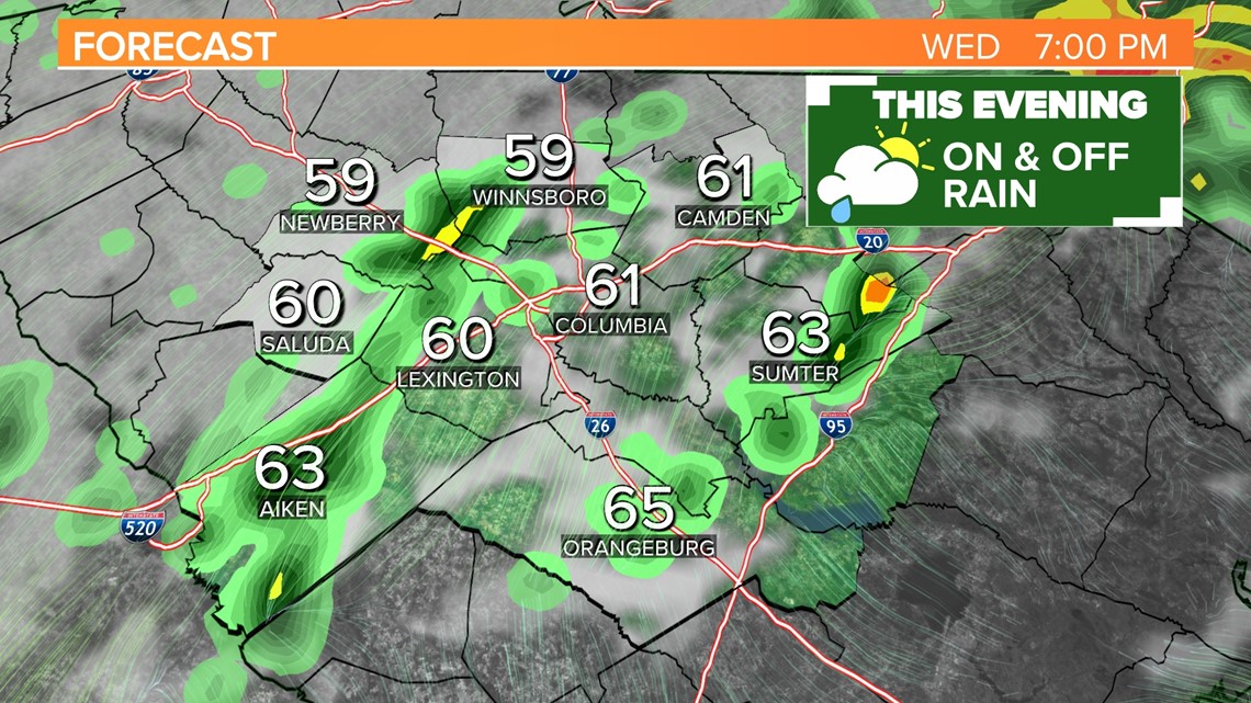
The Timing
A steady light rain will persist through the morning in the Midlands, but no severe weather is expected for most of the morning. In the early afternoon, pockets of heavy rain will move into the Midlands. These could develop into isolated thunderstorms. Rainfall is expected to reach more than 1 inch in some spots this afternoon.


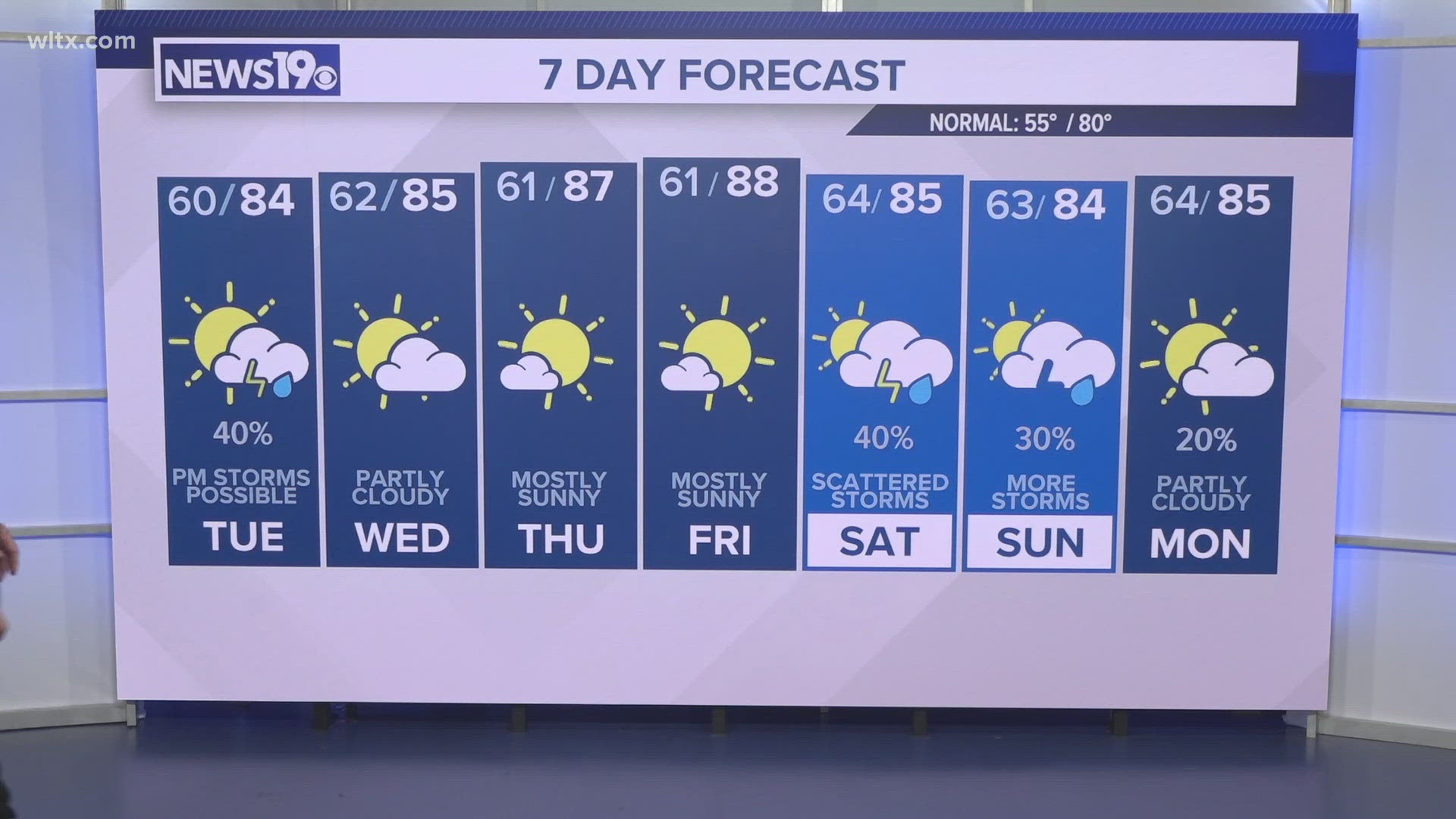
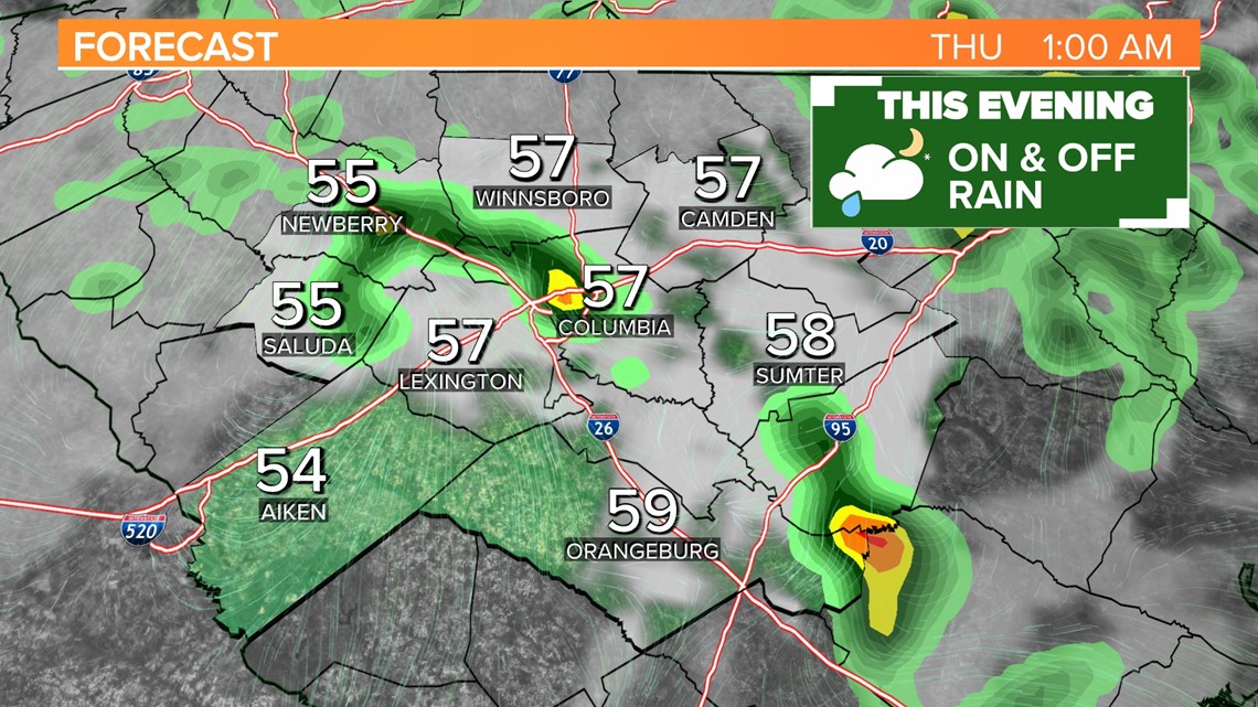
After 4 pm, model guidance indicates rain will be more scattered, but there is still a chance for a few isolated downpours until after midnight. Clouds will linger early Thursday morning, but the rest of Thursday will feature very pleasant weather.


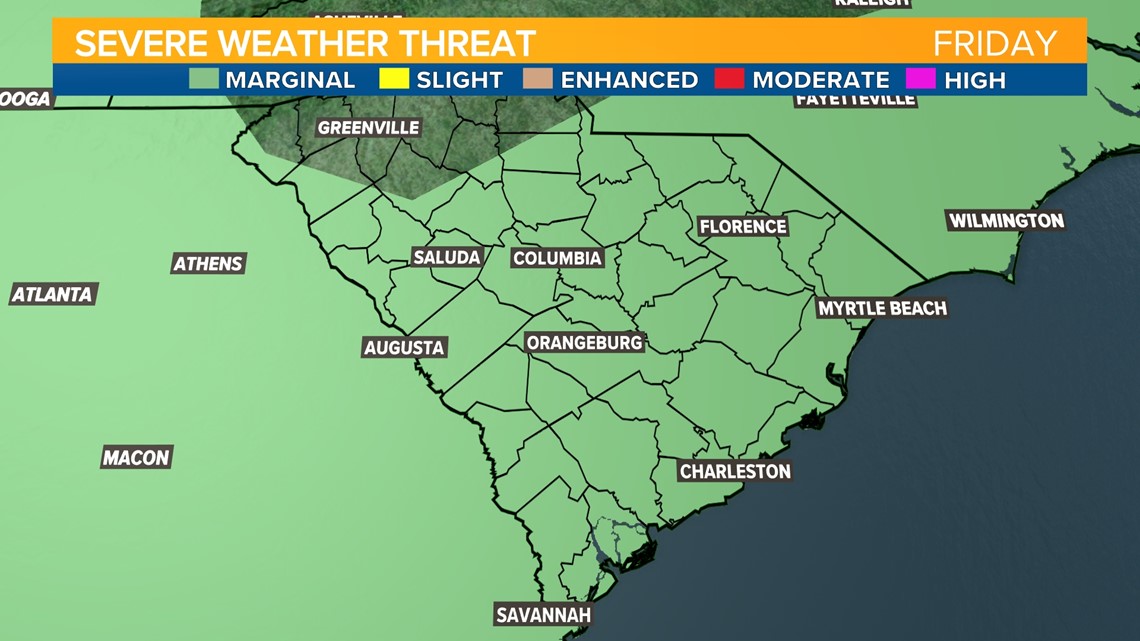
Friday will be warm and sunny through the first half of the afternoon, but another marginal risk for strong storms will return Friday late afternoon and early evening. Friday’s rain chance is much lower than Wednesday’s and any storms that develop will be brief.