
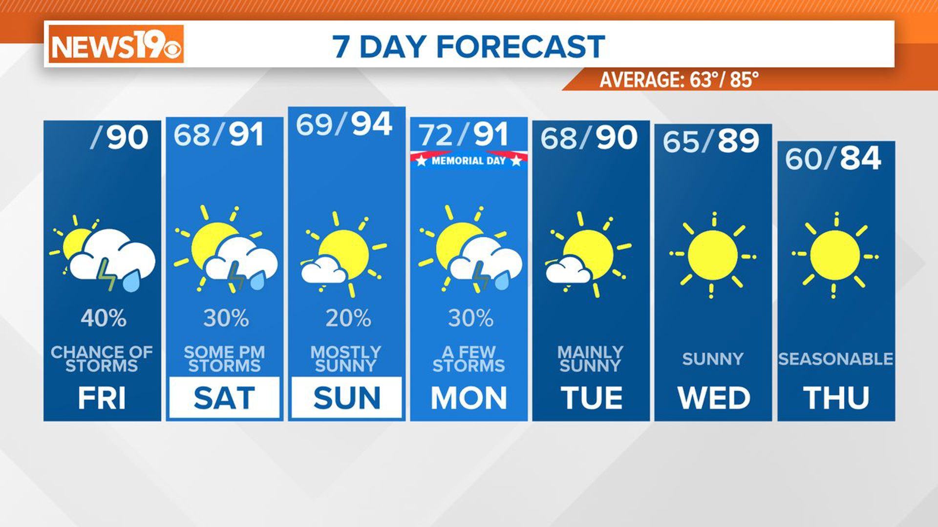
COLUMBIA, S.C. — A frontal boundary is set to approach the region today and is expected to stall near the area, bringing chances of showers and thunderstorms throughout the holiday weekend. A more organized weather system is forecast to cross the eastern U.S. on Monday, increasing the likelihood of additional thunderstorms. Drier weather is anticipated to return by Tuesday.
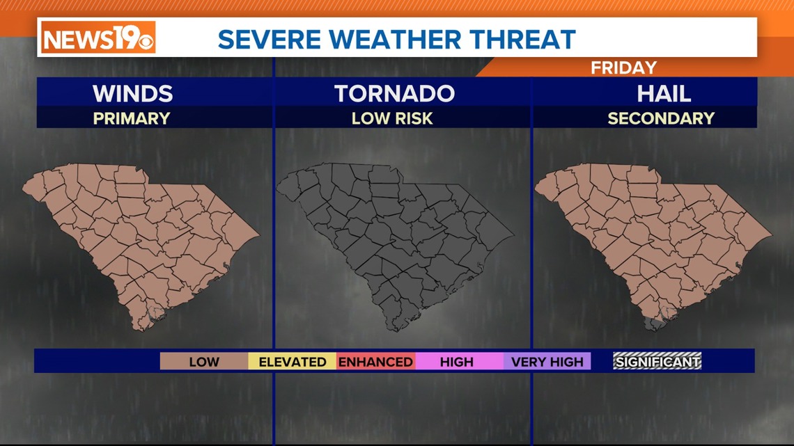
A moist airmass remains in place with high humidity levels. Temperatures are expected to be slightly above average, around 90 degrees, leading to possible thunderstorms this afternoon. Although model predictions vary, there is a marginal risk for severe weather today. The primary threat is damaging wind gusts. Overnight lows will be mild, ranging from the mid to upper 60s.

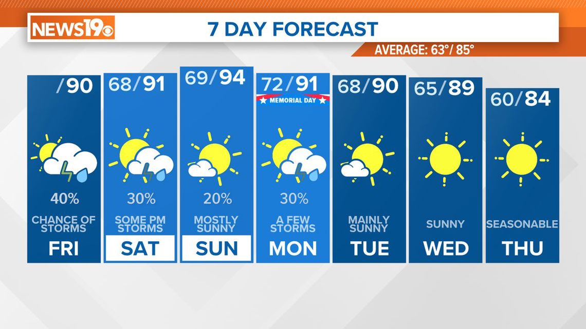
On Saturday, an upper trough will deepen over the Carolina coast, bringing drier air into the region and reducing the overall coverage of showers and thunderstorms. Moderate to strong instability could lead to isolated severe storms with damaging winds, especially in the southern half of the state.
Sunday will see upper-level ridging and a slight increase in moisture. Isolated to scattered showers and thunderstorms are expected, especially in northern South Carolina. The day could be one of the warmest of the period, with heat index values nearing triple digits. Damaging winds will again be the primary threat for any severe storms that develop.

An upper trough will dig over the Great Lakes and Ohio Valley on Monday, pushing a cold front toward the area. High instability levels could result in isolated to scattered thunderstorms, with a greater potential for severe weather.
The greatest coverage of showers and thunderstorms is expected on Monday as the upper trough passes over the area. However, instability will be lower, reducing the severe weather threat. Drier air will move in by Tuesday, significantly reducing the potential for rain.
High temperatures will decrease to the upper 80s by Wednesday and the middle 80s by Thursday.