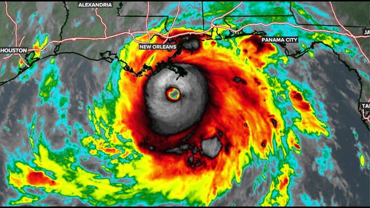
COLUMBIA, S.C. — Hurricane Ida is the second major hurricane of the 2021 season. Hurricane warnings are in effect for parts of the northern Gulf Coast.
Ida is rapidly intensifying as it moves over the Gulf of Mexico. It was located about 60 miles south-southwest of the mouth of the Mississippi River. It had sustained winds of 150 mph and stronger gusts.
The dangerous Category 4 storm was moving 15 mph towards the northwest.
Hurricane force winds extend outward up to 40 miles from the center and tropical storm force winds extend outward up to 140 miles.
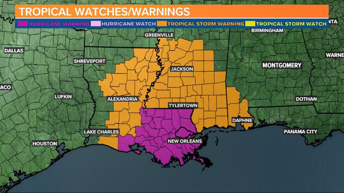
A hurricane warning is in effect for Intracoastal City, La. to the mouth of the Pearl River. A storm surge warning is in effect for east of Rockefeller Wildlife Refuge in Louisiana to the Alabama/Florida border.
There is a danger of life-threatening storm surge inundation today along the coasts of Louisiana and Mississippi within the storm surge warning area.
Extremely life-threatening inundation of 10 to 15 feet above ground level is possible within the area from Morgan City, La. to the mouth of the Mississippi River.

Hurricane Ida is an extremely dangerous major hurricane when it reaches the coast of Louisiana. Hurricane-force winds are expected today in portions of the hurricane warning, with potentially catastrophic wind damage possible where the core of Ida moves onshore.
The hurricane is likely to produce heavy rainfall later today into Monday across the central Gulf Coast from southeastern Louisiana to coastal Mississippi resulting in significant flash and river flooding impacts.


Tornadoes will be possible today through early Monday across southeast Louisiana and southern Mississippi.
As Ida moves inland, flooding impacts are possible across portions of the Lower Mississippi and Tennessee Valleys.
Tropical Depression Ten:
T.D. Ten formed in the Atlantic early Saturday morning. It is located over the central Atlantic. It may become a tropical storm this week.
There are no watches or warnings in effect for this storm.

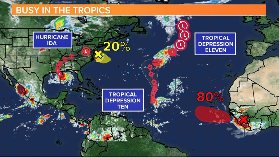
Tropical Depression Eleven:
T.D. Eleven formed in the Atlantic early Sunday morning. It is located over the central Atlantic. It is expected to become a tropical storm later today.
There are no watches or warnings in effect for this storm.
Elsewhere in the Tropics:
A weak trough of low pressure associated with a decaying frontal boundary is currently centered just east off the Mid-Atlantic United States coastline.
This system is producing a few disorganized showers and thunderstorms over the warm Gulf Stream waters.
Conditions appear favorable for some slow development over the next few days as this system drifts southeastward, remaining offshore of the eastern United States coastline.
A tropical wave is expected to emerge off the coast of west Africa by the middle of this week.
Environmental conditions appear conducive for gradual development, and a tropical depression is likely to form toward the end of the week as the system moves west-northwest to northwestward at 10 to 15 mph.
Here in the Midlands:
It will continue to be hot, humid. Temperatures will be in the lower to middle 90s over the next few days. Heat index values will likely be in the triple digits. Rain is not in the forecast through Tuesday.
RELATED: Local Forecast