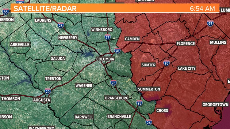
COLUMBIA, S.C. — All remaining tornado watches that had been in effect for the Midlands of South Carolina have now expired, as the threat of severe weather has begun to diminish from Tropical Depression Nicole.
The last remaining watch- which was for Clarendon, Kershaw, Lee, and Sumter--ended at 9 a.m.
A watch means conditions are favorable for severe weather. A warning would mean a tornado has been indicated on radar or spotted by someone on the ground.
Overnight, several tornado warnings were issued, including in Richland, Lexington, Sumter, Orangeburg Calhoun Counties. However, there are no storm damage reports as of yet confirming that a twister actually touched down. Survey teams from the National Weather Service are expected to investigate that area later in the day.
Nicole made landfall early Thursday morning as a Category 1 storm but by Thursday night it was downgraded to a depression. Moisture from Nicole moved into the area Thursday afternoon and some strong storms will be possible through this morning, including isolated tornadoes.
Heavy rain started in the afternoon and continued through the night. Total rainfall amounts will likely be between 1 and 2 inches.
Most of the tornadoes associated with tropical systems occur in the right front quadrant of the storm. This area typically has the best wind shear and instability.

Most of the tropical tornadoes that strike the Midlands are from tropical systems that make landfall in the Gulf of Mexico and continue along a path toward the north or northeast. These tornadoes produced by tropical cyclones are relatively weak and short-lived, but they still can be threatening.
RELATED: The severe side of tropical weather
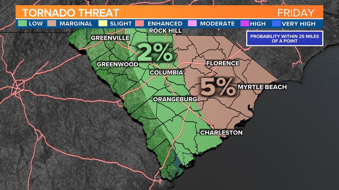
There will be a little drier air moving into the area by the late morning hours of Friday, but Friday afternoon showers will return to the Midlands. The threat for tornadoes will still be around early this afternoon, but it will be decreasing through the day from west to east.
Friday 3 PM

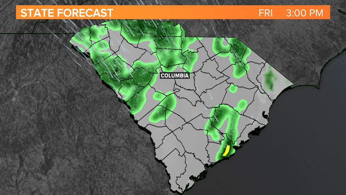
The rain will move out of the area by late this afternoon or early evening. Saturday will be mostly sunny and a little cooler with highs in the upper 60s to lower 70s. Colder air filters into the Midlands Sunday. Highs may only hit the middle 50s.