
COLUMBIA, S.C. — Tropical Depression Thirteen formed late Wednesday night and Tropical Depression Fourteen formed Thursday morning. The systems are expected to get stronger over the next several days.
Tropical Depression Thirteen was located about 750 miles east of the northern Leeward Islands Thursday. It was moving west-northwest at 21 mph. The disturbance had winds of 35 mph.
A tropical storm watch is in effect for Saba, St. Eustatius, St. Maarten, Antiqua, Barbuda, St. Kitts, Nevis and Anguilla. A tropical storm watch means that tropical storm conditions are possible within the watch area, generally within 48 hours.
Interests in the northern Leeward Islands, the Virgin Islands, and Puerto Rico should monitor the progress of this system, as additional tropical storm watches or warnings will be required for parts of those areas later today.
This system is expected to get stronger and become a tropical storm later today.
Details of the long-range track and intensity forecasts are uncertain since the system could move over portions of the Greater Antilles this weekend.


However, it still could bring some storm surge, rainfall and wind impacts to portions of Hispaniola, Cuba, the Bahamas, and Florida this weekend and early next week.
Interests in those areas should monitor this system's progress and updates to the forecast over the next few days.
Here are the spaghetti models for Tropical Depression Thirteen:


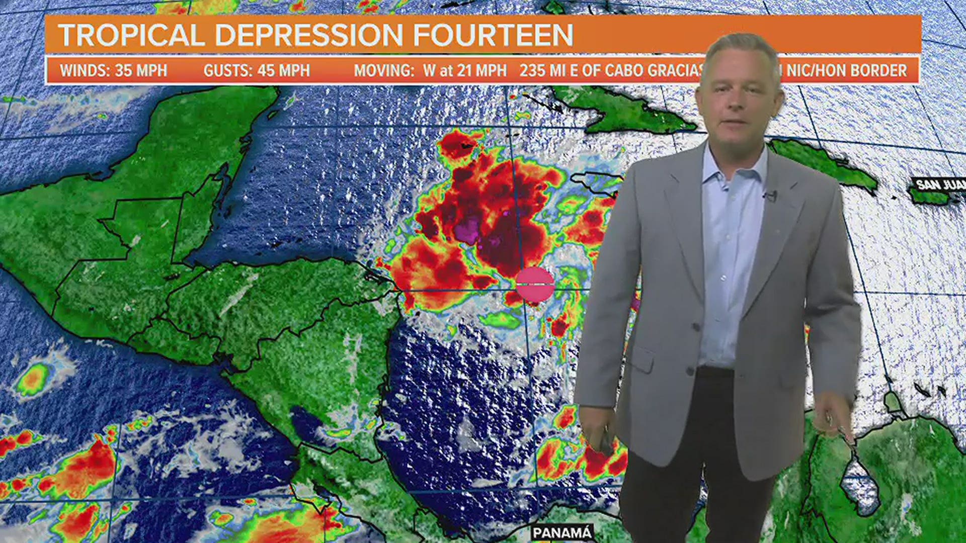
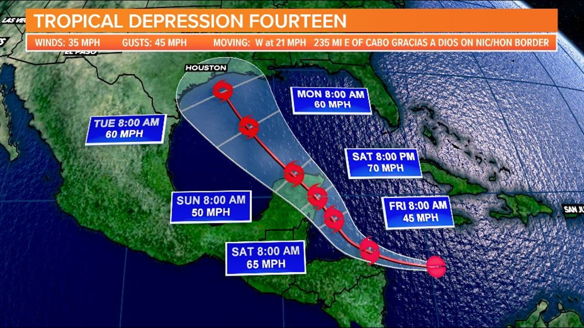
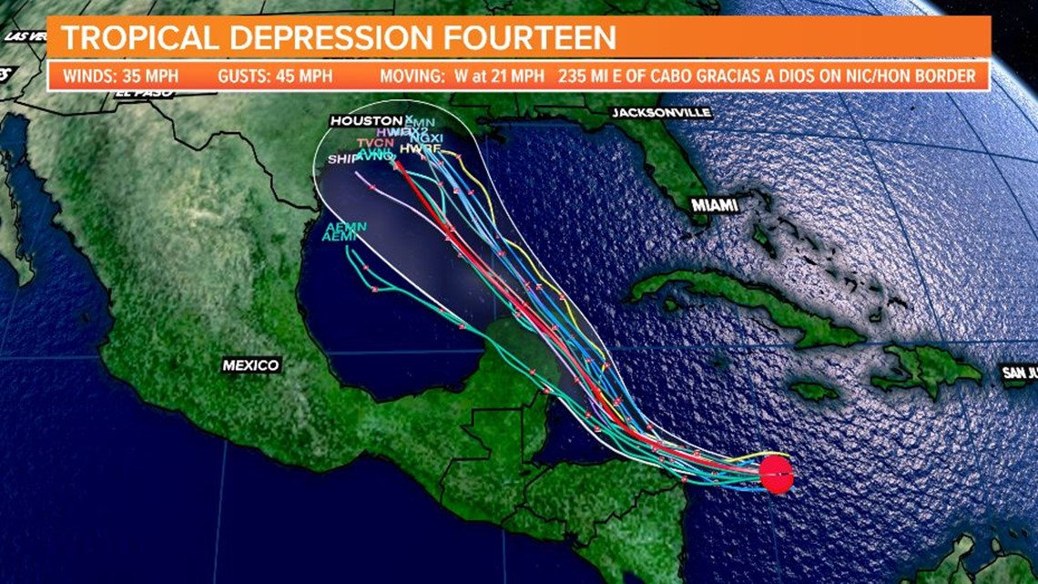
Tropical Depression Fourteen formed Thursday morning in the west-central Caribbean.
It was located about 235 miles east of the Nicaragua and Honduras border. It was moving west at 21 mph. The disturbance had winds of 35 mph.

The government of Honduras has issued a tropical storm watch for the coast of Honduras from the Honduras and Nicaragua border westward to Punta Castilla.
There is also tropical storm watch for the Bay Islands of Honduras.
Additional watches or warnings, including for the Yucatan Peninsula of Mexico, may be required later today.
Regardless of development, this disturbance will likely produce heavy rains across a large portion of Central America and southeastern Mexico late this week and this weekend.
Here are the spaghetti models for Tropical Depression Fourteen:

The third area being watched by the NHC is coming off the African coast. It will move over the extreme eastern Atlantic and may become better developed.
There is a medium chance of further development over the next five days. This disturbance is moving west-northwest at 15 to 20 mph.


The Atlantic has had 11 named storms so far this season, but only two hurricanes.
It is the first hurricane season on record in which nine tropical storms formed before August 1.
Hurricane season officially goes from June 1 to November 30. It sharply peaks from late August through September.
The season's climatological peak of activity occurs around September 10 each year.
To track these systems as well as any future tropical systems this season, download the WLTX App. Download the WLTX app for Android or iPhone: