

COLUMBIA, S.C. — A high-pressure system will dominate the region through early Thursday, bringing fair and dry conditions along with rising temperatures. However, changes are on the way as a frontal boundary is expected to approach the area by Thursday night, potentially leading to showers and thunderstorms through the weekend.
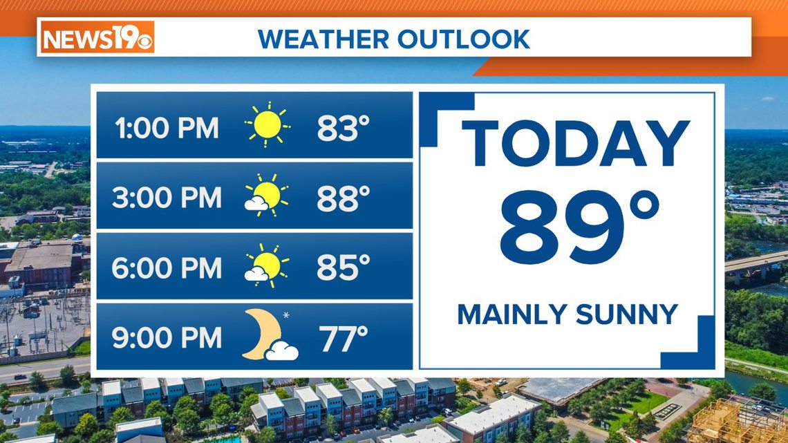
Today, high pressure continues to hold, leading to mostly sunny skies. Today we will see temperatures climbing to the upper 80s, with lows tonight around the mid-60s.
On Thursday, the weather pattern will begin to shift as a frontal boundary approaches from the northwest. This will bring a mix of sun and clouds with a slight chance of showers and thunderstorms, particularly in the northern Midlands and Pee Dee regions. Areas further south, including the central Midlands, should remain mostly dry.

The front is expected to stall north of the area, maintaining a risk of thunderstorms, especially near and north of I-20. Temperatures will stay warm, with highs in the upper 80s to low 90s and overnight lows around 70.
By Saturday, another weaker front will move through, bringing a chance of showers and thunderstorms, mainly in the central Midlands and northward. The upper-level support for these storms will be weaker, reducing the likelihood of severe weather.

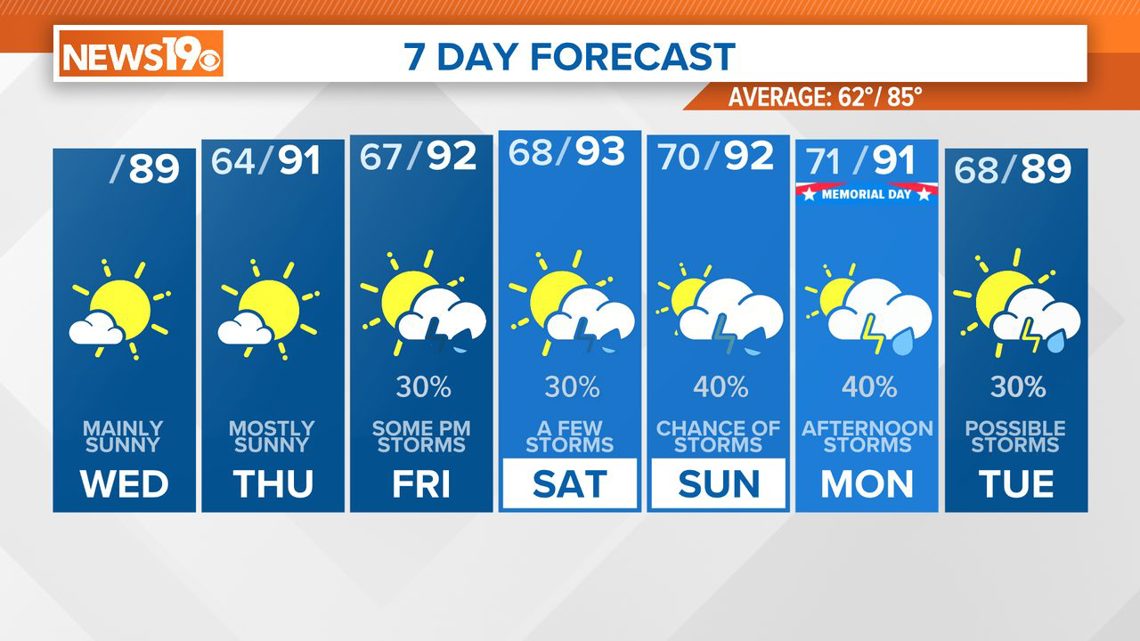
However, a stronger system is anticipated to arrive on Sunday and continue into early next week. A low-pressure system developing over the central U.S. will push another cold front toward the region, increasing the chances of thunderstorms. This system may bring more significant weather concerns, depending on its development and the strength of the associated upper-level trough.
Overall, temperatures through the weekend and into next week are expected to be near or slightly above normal, with highs generally in the low 90s.