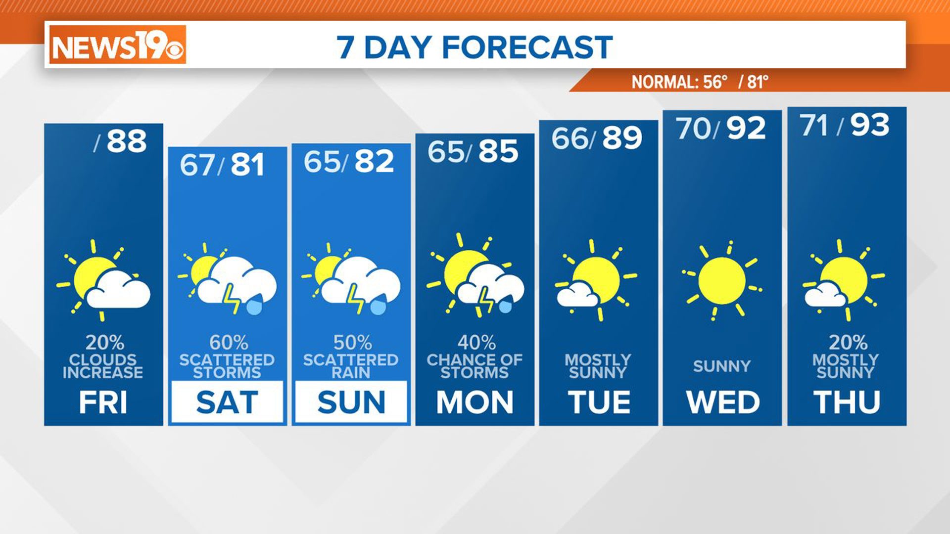
COLUMBIA, S.C. — It will be partly cloudy and seasonably warm this afternoon. A stray pop-up shower or storm will be possible, but we are not expecting a lot of rain. There will be a better chance for showers and storms Sunday afternoon and Sunday evening. A few storms are possible Monday evening. High temperatures will be heating up over the workweek.
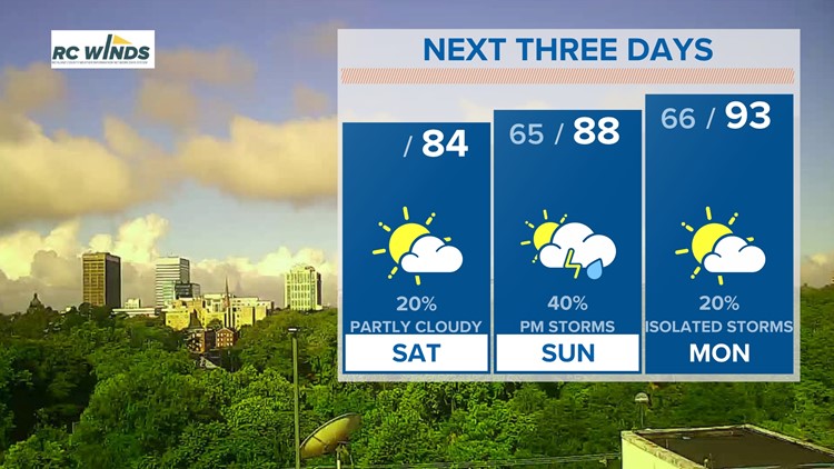
Isolated showers and a few storms will be possible this afternoon. Rain chances will be a lot lower than Friday. High temperatures will return to near-normal levels, topping out in the lower to middle 80s later today. Some fog will be possible late tonight and early Sunday. Lows will be in the lower to middle 60s Sunday morning.

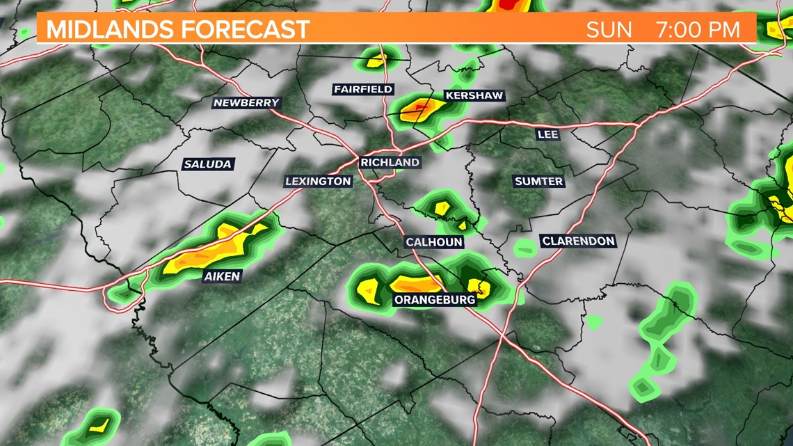
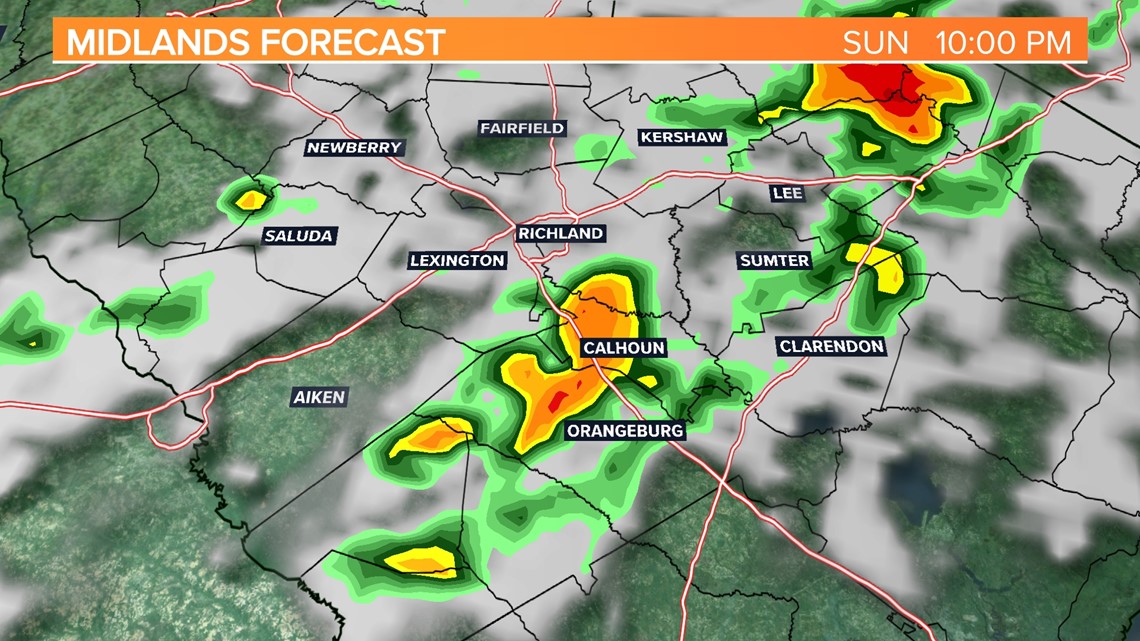
A disturbance will swing through the area Sunday afternoon through Sunday night. This will bring us a slightly better chance for showers and storms. Strong winds or some hail will be possible with the thunderstorms Sunday, but widespread severe weather is not anticipated. Highs will be in the middle to upper 80s Sunday afternoon.

Monday will be hot and humid. High temperatures are expected to hit the lower 90s. There will be an opportunity for some thunderstorms to develop in the afternoon and evening hours. Some of the storms could produce strong winds and hail.

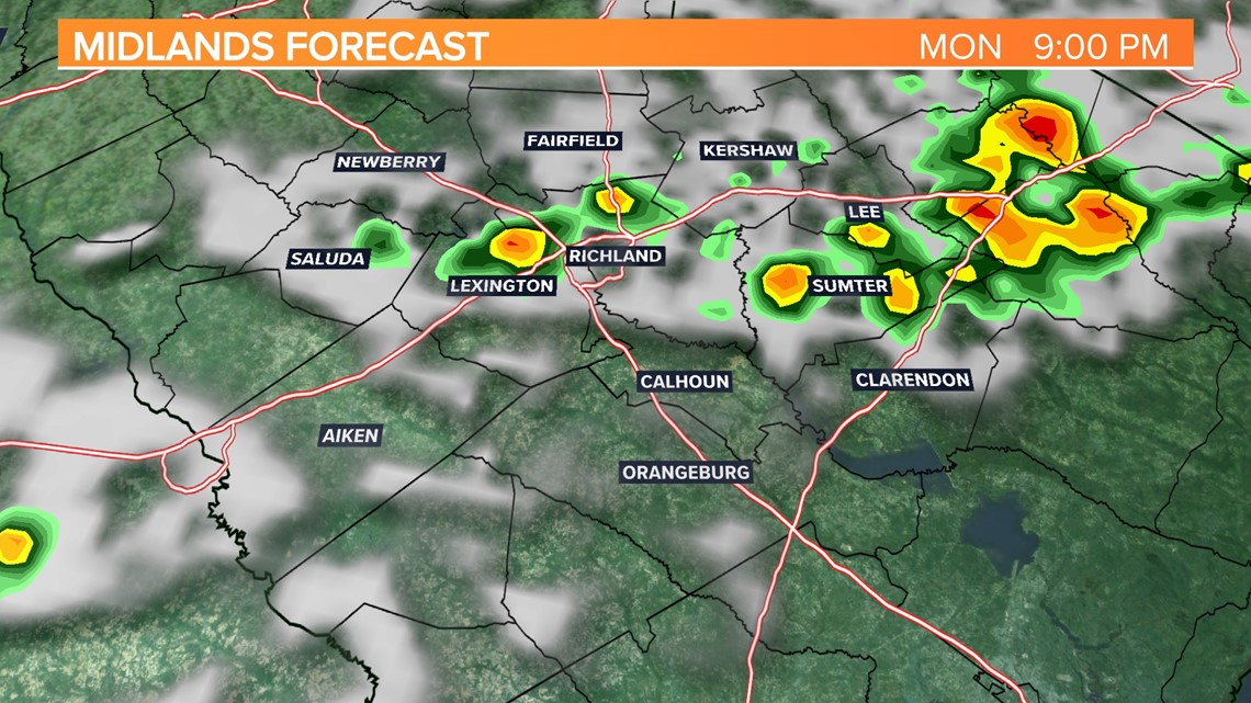
The Storm Prediction Center has the state under a marginal risk for severe weather. This is the lowest risk level. This is issued when strong to borderline severe storms are possible. Thunderstorms are expected to be limited in organization and only last a short time with a marginal risk level.
The heat and humidity will build in for the workweek. High temperatures for forecast to hit the upper 80s to lower 90s Tuesday and Wednesday. With the added humidity, it will likely feel even hotter.
Thursday and Friday high temperatures may climb into the middle 90s. A few isolated showers or storms may form during the heat of the day.

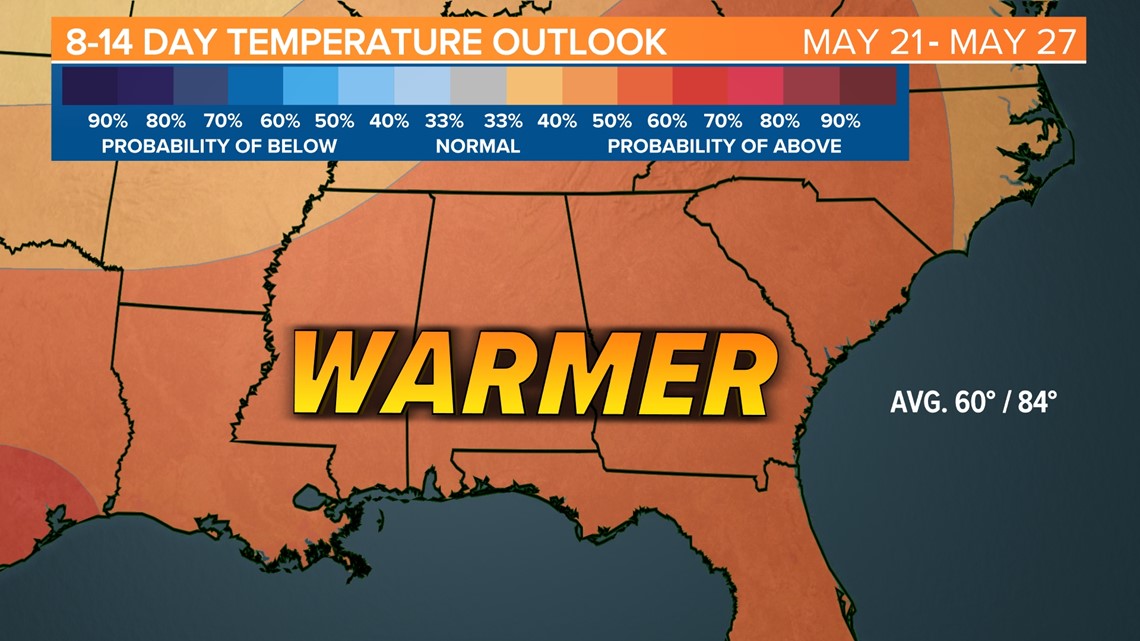
The warmer-than-normal temperatures are expected to stick around through at least May 27.