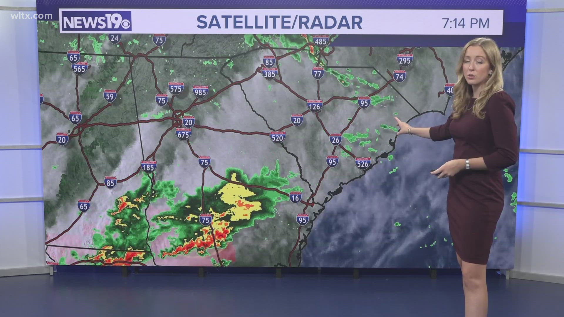
COLUMBIA, S.C. — A cold front will cross the area tonight. Showers and a few rumbles of thunder will be possible late this evening and tonight. Cool, high pressure will build back into the area Sunday. Temperatures will gradually moderate during the workweek.
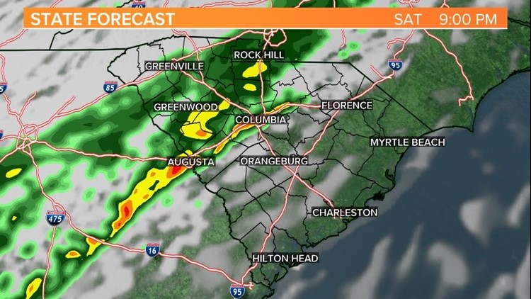
Saturday will be cloudy, breezy, and warm. Temperatures will be in the middle 70s later today as warm air streams northward. A few isolated showers are possible during the daylight hours, but most of the rain will hold off until after 6 p.m.
The Storm Prediction Center does have parts of the Midlands under a marginal risk for severe weather, but the potential for severe weather is low. A thunderstorm or two with gusty winds will be possible as the front approaches the state.


The rain will end early Sunday morning. Skies will gradually clear out from west to east. Lows will start off in the middle 40s to near 50 degrees Sunday.
Sunday afternoon will be a lot cooler with highs in the middle to upper 50s, to near 60 degrees with lots of sunshine. It may continue to be a bit breezy at times Sunday with winds out of the northeast at 5-10 mph.
High pressure will dominate the weather through the workweek. Highs on Monday and Tuesday will be in the lower 60s. Temperatures will climb into the middle 60s Wednesday.

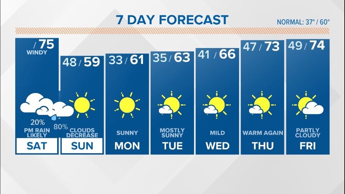
Thursday and Friday will feature some sun and clouds, along with spring-like temperatures. Highs will top out in the lower to middle 70s.
The 8-14 temperature outlook is indicating warmer-than-normal conditions for most of the US. This includes us here in South Carolina. The warmer-than-normal temperatures are expected to last through at least Christmas Eve.

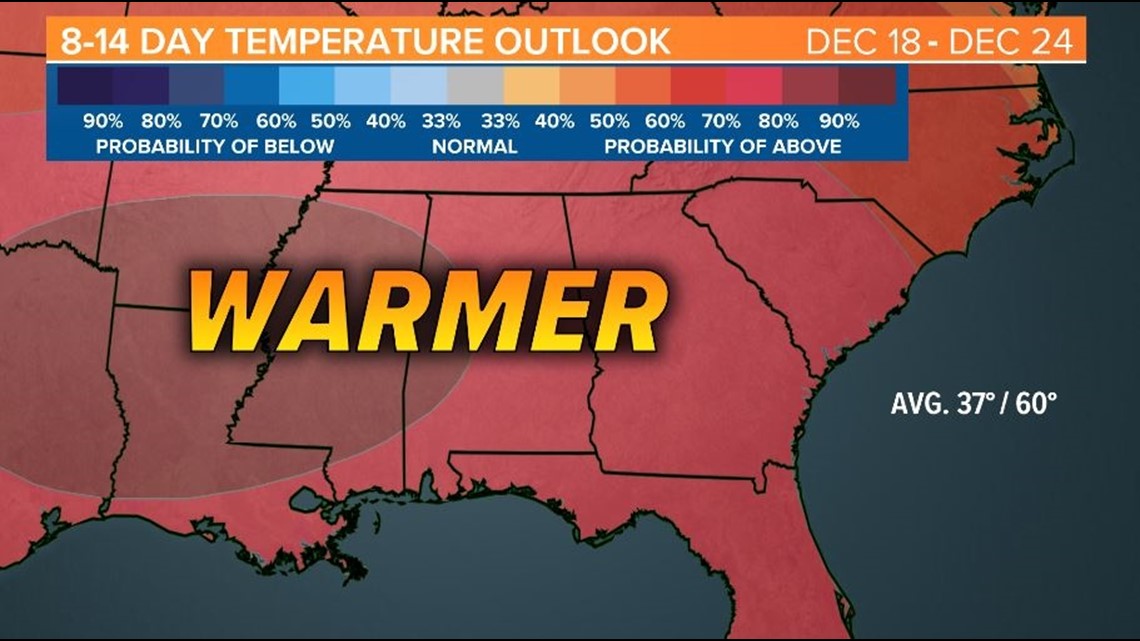
If you are looking for a white Christmas in South Carolina, it looks like you will be out of luck again this year.