COLUMBIA, S.C. — Hot weather continues as we close out the weekend and go into the beginning of this upcoming week. This weather, coupled with plenty of moisture, will lead to the threat of possibly widespread severe weather on Monday.
High temperatures are expected to reach the middle to upper 90s by Monday afternoon. These temperatures, tied with high dewpoints, could lead to the feels-like temperature reaching anywhere from 105 to 110 degrees in the afternoon. Because of this, the National Weather Service has issued a heat advisory for most of our viewing area.


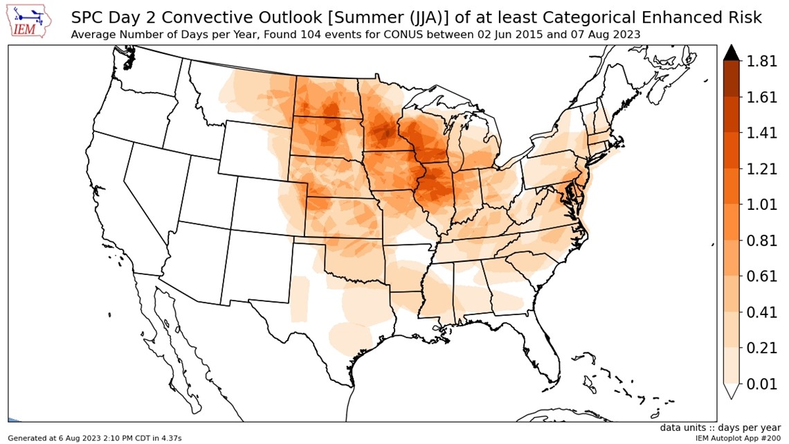
The Storm Prediction Center has issued a rare enhanced risk of severe weather for Monday. It's only the second time the Midlands have seen a Day 2 risk during the summer months over the past eight years.

Moving on to the storm threat for Monday, a cold front is expected to be sweeping through the south. With plenty of heat, moisture, and even wind support, there will be the chance of scattered to widespread severe weather in the Midlands. The biggest threat tomorrow will be the chance of strong, damaging winds as a line is expected to push from the west toward the coast. Large hail is something we will need to watch for as well. Any tornado risk should stay towards the Upstate.

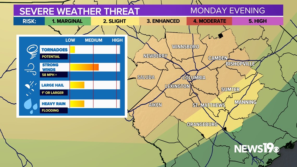
Let's talk timing. As of right now, this is a late afternoon to evening storm threat. The line should begin pushing out of the Upstate around 5 to 6 p.m. and move through the heart of the Midlands from 7 to 9 p.m. We should see the storm threat diminish as soon as 10 p.m., but we can't rule out any storms through midnight.


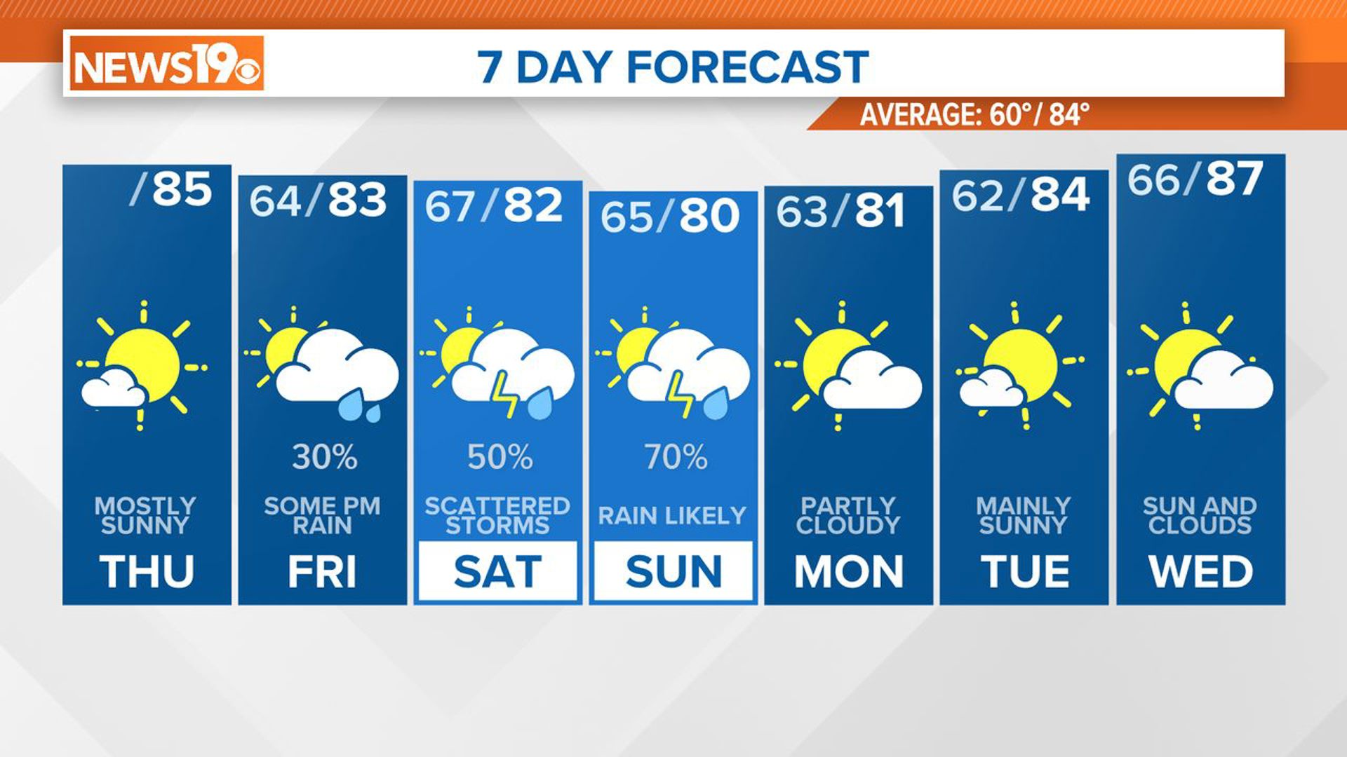
After Monday, we return to a more typical summer pattern here in the Midlands, with storm chances returning by the end of the week.