COLUMBIA, S.C. — South Carolina is expected to see severe weather Tuesday, including potentially high winds that could lead to power outages and some damage.
Showers and storms are expected Tuesday, carrying with it a potential for heavy rainfall and damaging winds and even tornadoes. Already all public school districts in the Midlands have switched to e-learning for the day and many other events are canceled due to the chance for rough weather in the afternoon and early evening.
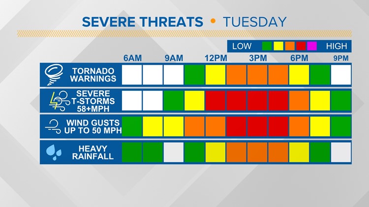
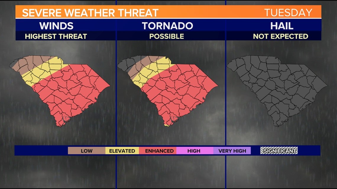
The highest potential for severe weather will be midday through Tuesday evening as a line of thunderstorms moves through the area. Damaging wind gusts and even a tornado will be possible as this line of storms pushes through South Carolina
The Storm Prediction Center has most of the Midlands under an enhanced risk of severe weather on Tuesday. This is the third highest risk category out of five that the center uses.

Some of the thunderstorms could produce localized flooding, but the threat appears to be low because the storms will be moving quickly.

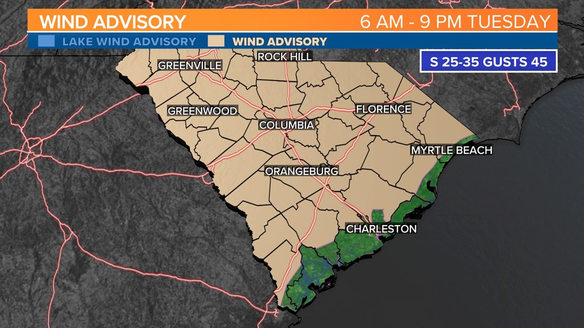
A wind advisory is in effect from 6 a.m. to 9 p.m. Tuesday for the majority of South Carolina. Winds will be out of the south at 25 to 35 mph, with gusts up to 45 mph.
Strong winds on Tuesday may cause unsecured outdoor items to be scattered or blown around. There could be a few power outages and tree limbs that are blown down. Driving in such strong winds can be challenging, particularly for vehicles with a high profile. Use extra caution if you are going to be travelling.
Timing of storms Tuesday:
Tuesday noon:

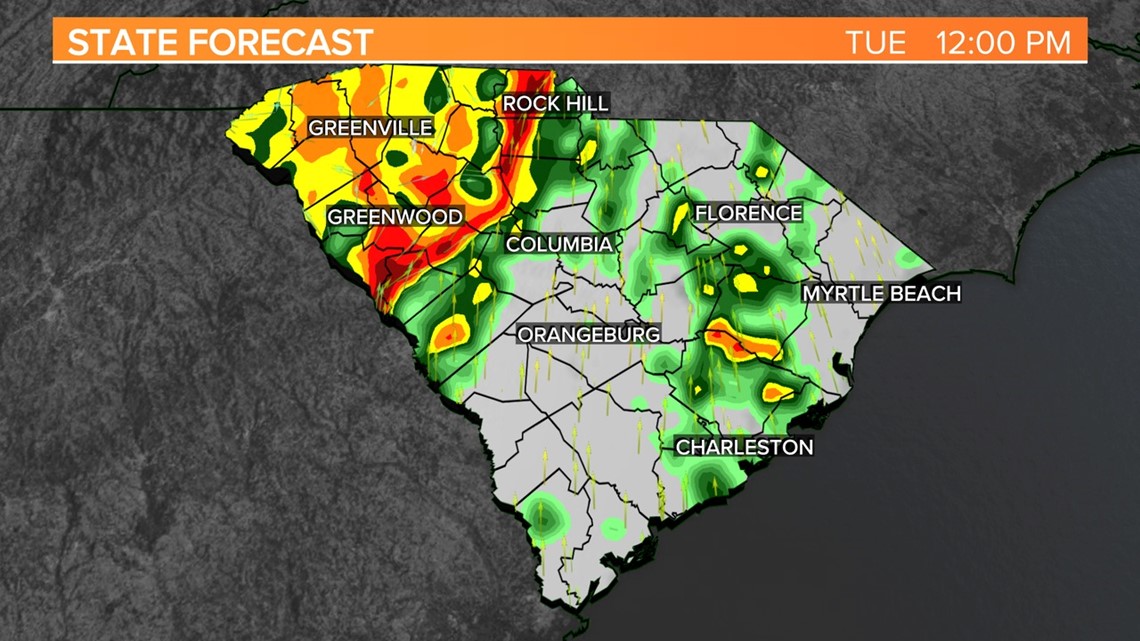
Storms start to develop by midday. The storms will be moving quickly from west to east. Severe weather will be possible.
Tuesday afternoon:

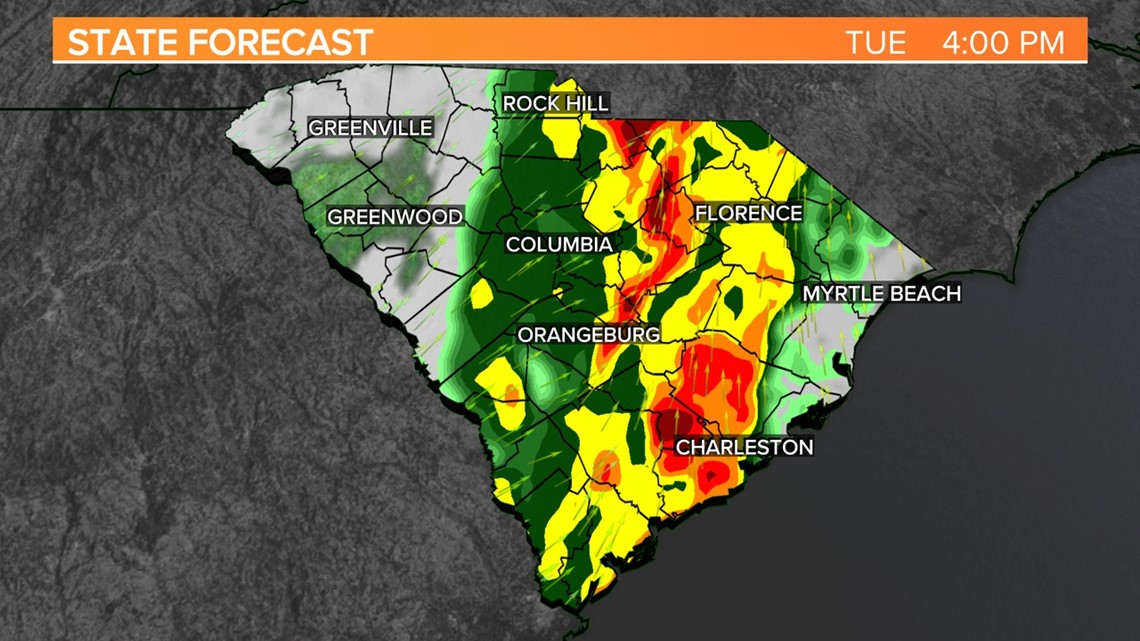
The storms will continue to move from west to east. Severe weather will be possible along and east of I-26 at this point. The severe weather threat will end in the western part of South Carolina.
Tuesday evening:

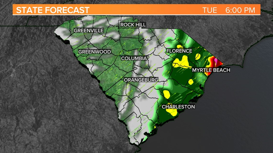
Most of the shower and thunderstorm activity will be outside of the Midlands. The severe weather threat will be over. It will continue to be a bit windy at times.