
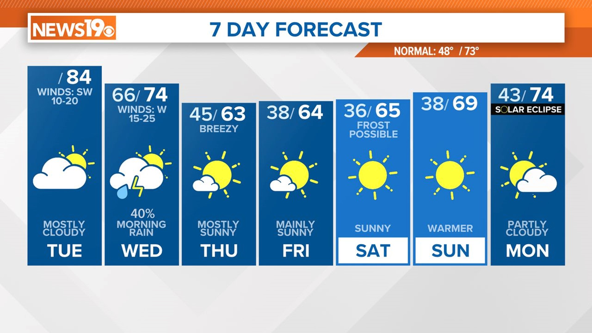
COLUMBIA, S.C. — High pressure off the Southeast will keep South Carolina dry with above-normal temperatures today. Showers and thunderstorms move into the area tonight and into Wednesday as a cold front crosses the region.
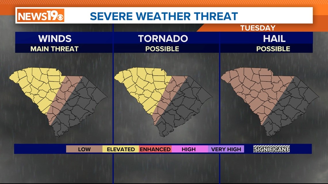
The Storm Prediction Center has included parts of the state at a slight risk for severe weather to account for the potential for strong thunderstorms early Wednesday. Cool, dry, and breezy weather then follows late this week, with continued cool temperatures through the end of the weekend.
Today will be very warm, with temperatures in the lower to middle 80s under mostly cloudy skies. It will be breezy today with winds out of the southwest at 10 to 20 mph.


Showers and storms are forecast for early Wednesday morning. Moving into the Midlands by 4 a.m. A few storms could be strong or even severe. The SPC has a large part of the state under a risk of severe weather.


A slight risk for severe weather means that scattered severe storms are possible but are usually short-lived and not widespread. Intense, severe thunderstorms are possible under this category but are isolated. Damaging winds and large hail become scattered in this category, with tornadoes still low in coverage.


A marginal risk for severe weather means that isolated severe thunderstorms are possible but are limited in coverage, intensity, or duration. At a marginal risk, damaging winds and large hail are possible but isolated. A tornado can also occur, but the chance is usually low.
The rain and storms will be out of the area very early Wednesday. The threat of severe weather will be gone by 9 a.m. Cooler, dry air will move into the state. Temperatures will be a lot cooler for the rest of the workweek.

Wednesday afternoon will be windy with winds out of the west at 15 to 25 mph with some stronger gusts. Thursday will be breezy too.
Some frost is possible early Saturday morning. This will have to be monitored, especially if you have tender spring plants. Temperatures will begin to moderate on Sunday.