
COLUMBIA, S.C. — South Carolina could see another round of hazardous weather, as another line of storms is expected to move through the state Friday.
The storms will be powered by another strong cold front that will approach the Midlands. Showers will be possible early in the day, but thunderstorms are expected during the afternoon and evening hours.
There was an update to the forecast late Thursday afternoon, as the Storm Prediction Center actually lessened the risk of severe weather from enhanced (3 out of 5 on the scale of storm risk) to slight (2 out of 5 on the scale).

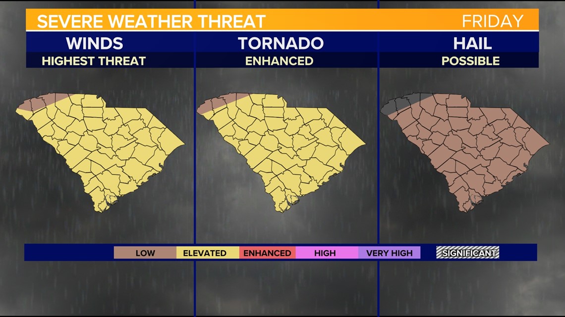

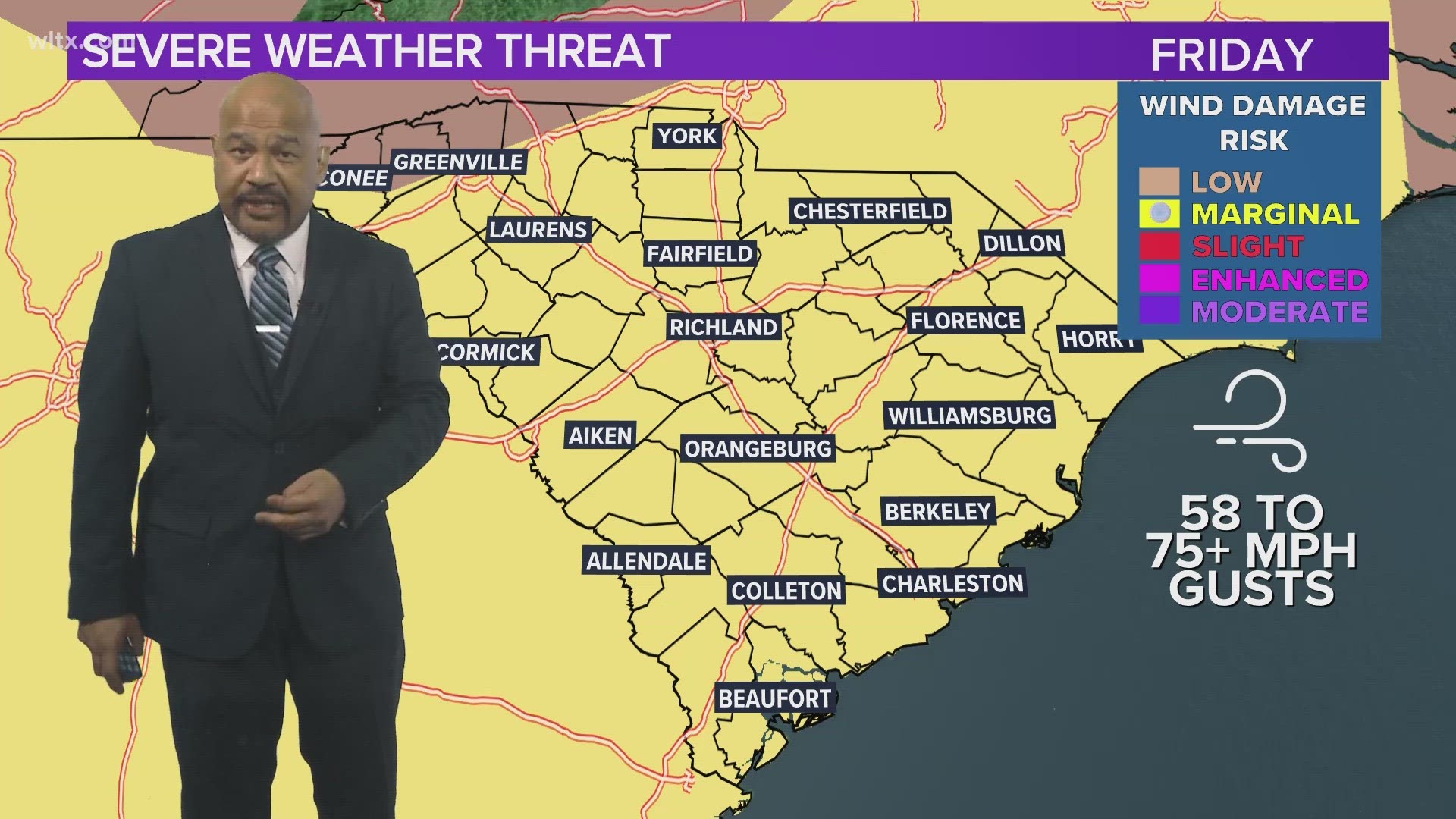
Threats to areas at slight risk typically include the potential for frequent lightning, damaging winds in excess of 58 mph and possibly in excess of 70 mph, hail with a diameter in excess of 1 inch, and the increased potential for 2-inch or larger hailstones. The threat of tornadoes is still there but did go down slightly when the Storm Prediction Center moved from an enhanced risk to slight.
Anyone in the risk area should be ready to seek cover at any time and should always have multiple ways to get severe weather warnings.
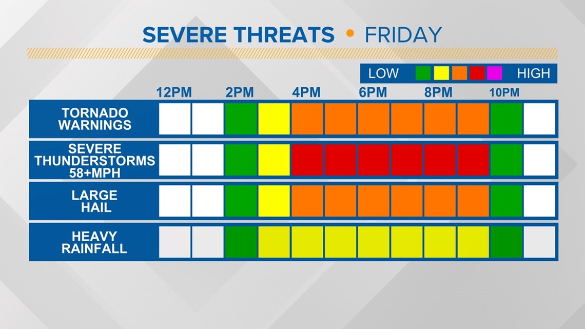
For Friday, it will be windy, and there is a potential for damaging winds and a few tornado warnings. Large hail is also possible Friday afternoon.
Friday's Timeline:
Friday, 3 p.m.

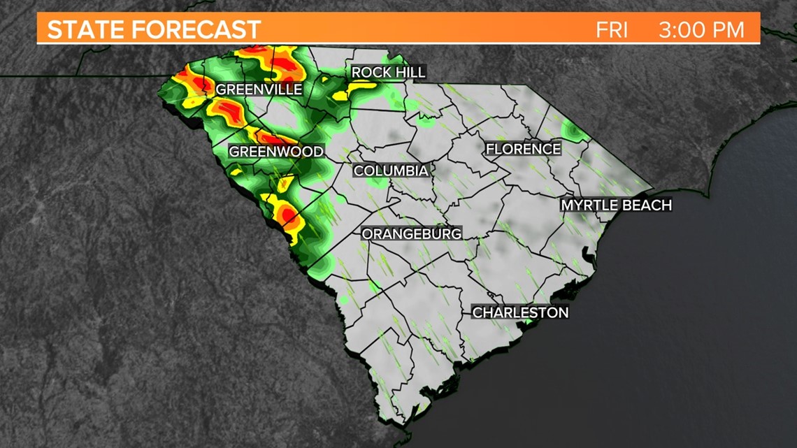
Storms begin to develop in the western part of South Carolina.
Friday, 5 p.m.


Scattered storms are expected. Some of the storms could be strong or even severe.
Friday, 7 p.m.


Another line of storms develops in the Upstate, and the storms will move across the Midlands during the evening hours.
Friday, 9 p.m.


Severe weather will be possible in the central Midlands. The chance for storms will be over in the western half of the state.
Friday, 11 p.m.

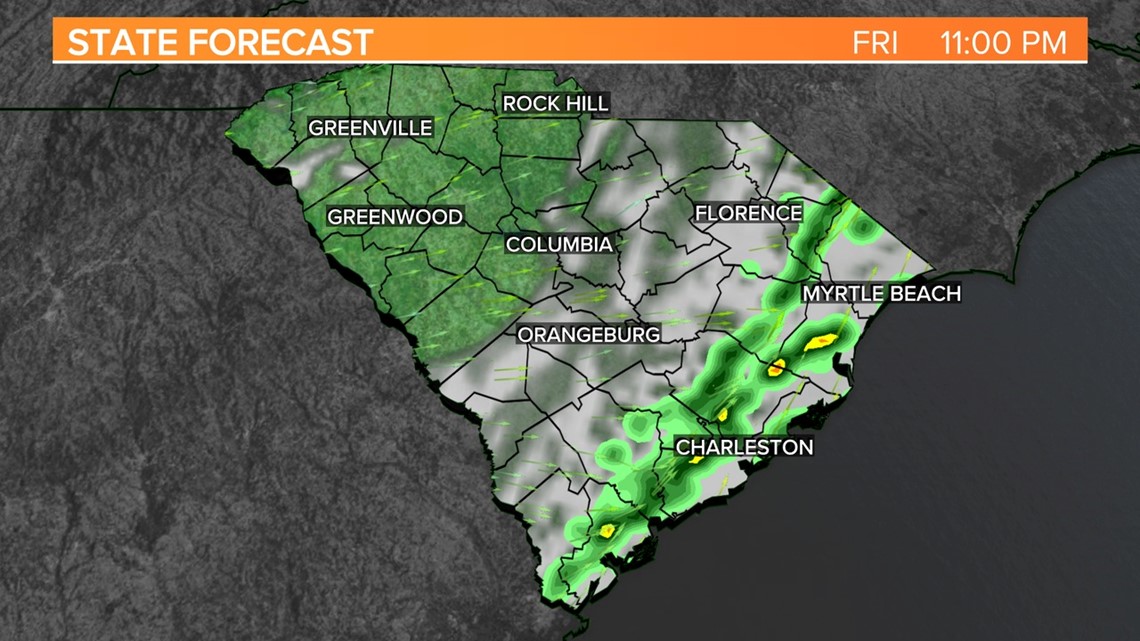
The threat of severe weather will likely be over for the Midlands at this point. Colder, dry air will be spilling in behind a cold front.
The weekend will be mainly sunny, cooler, and dry. Saturday will be a breezy day. Highs will be in the lower 50s on Saturday. Temperatures will be near normal on Sunday.
Some rain will be possible on Monday.
Temperatures will be significantly cooler by the middle of next week as cold air moves into South Carolina. High temperatures may struggle into the middle 40s on Wednesday afternoon.