COLUMBIA, S.C. — Get ready for some changes in the weather. Showers will be possible today. Friday afternoon, a cold front will move through the area, bringing with it showers, thunderstorms, and strong winds. These gusty winds could be powerful, so be sure to secure any outdoor furniture or objects that could be blown around.
The cold front will slowly move off the coast on Friday night, and by Saturday, the weather will start to clear up. High pressure and dry air will settle over the region, making for a pleasant and sunny weekend through Monday.
However, do not get too comfortable with the sunny weather. On Tuesday and Wednesday, another front will move into the region, bringing with it increased moisture and the potential for more showers and thunderstorms.

Expect mostly cloudy skies to persist throughout the day and into tonight. There is a weak frontal boundary just north of the area that will move back into the forecast area today, causing an increase in the chances of showers. Winds today will be southwest at 10 to 15 mph, with gusts up to 20 to 25 mph, then diminish late this afternoon.
This evening, the boundary will return northward as a warm front in advance of approaching low pressure. Shower chances will also move northward with the front. However, with weak forcing, rainfall amounts will generally be a couple of tenths of an inch or less.
High temperatures this afternoon will range from the middle 70s to around 80 degrees. Low temperatures tonight will generally be in the upper 50s to around 60.
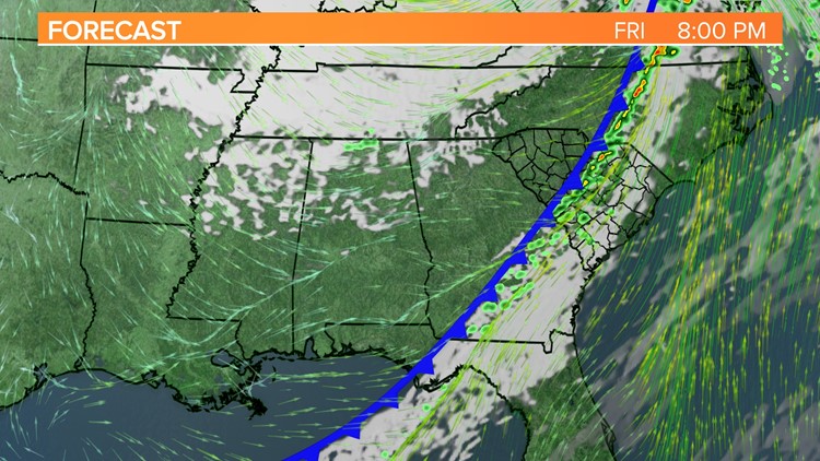
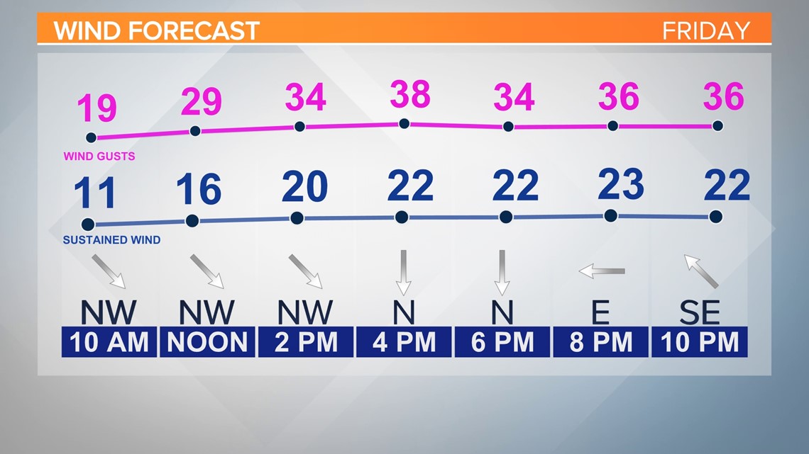
Warm air will continue to move into the area Friday. At the same time, an upper-level low over the Mississippi Valley and a deepening surface low will move towards the Ohio Valley, bringing a cold front into our area. A strengthening jet stream will shift over the area, increasing winds. At the surface, wind gusts of 35 to 40 mph are expected.

The cold front will likely approach the area by Friday evening in the western part of the forecast area. While the best chance of severe weather will likely be with convection ahead of the cold front, instability is expected to weaken as it moves through the area.
Damaging winds and a tornado remain possible in the western part of the state, but the highest chance of severe weather has shifted slightly.

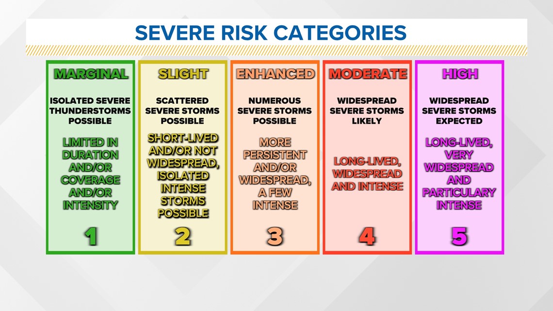
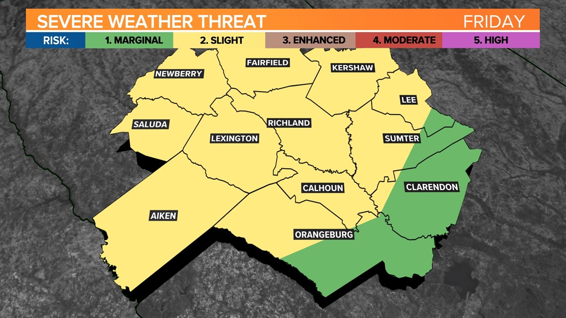
The Storm Prediction Center has parts of the Midlands under a slight risk (Level 2 out of 5) for severe storms Friday. This means scattered severe storms possible; short-lived and/or not widespread; isolated intense storms possible.
The cold front will move towards the coast on Friday night, bringing drier air behind it. Cooler conditions are expected on Saturday, with highs in the low to mid 70s and clear skies. Saturday night will be cooler, with lows dropping into the low to mid 40s.