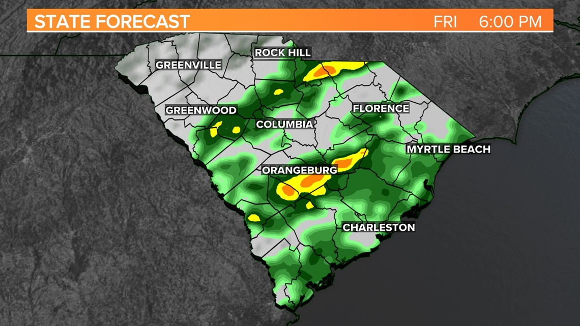
COLUMBIA, S.C. — Rain is likely later today and tomorrow. The rain will come in waves and affect a large part of the palmetto state. It will keep raining Saturday night through Sunday morning before finally stopping. Sunday is expected to be the coolest day of the week and then it will start getting warmer again next week.
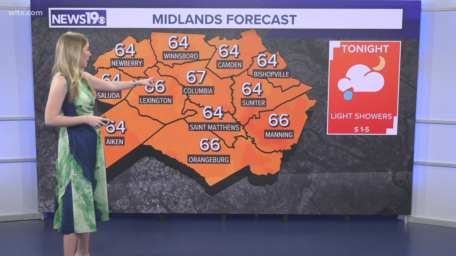
We had a few showers earlier today. The rain will return to the Midlands this afternoon. High temperatures will top out in the middle 60s to lower 70s. Showers will be likely this evening and tonight. Temperatures are forecast to drop into the upper 40s Saturday morning.

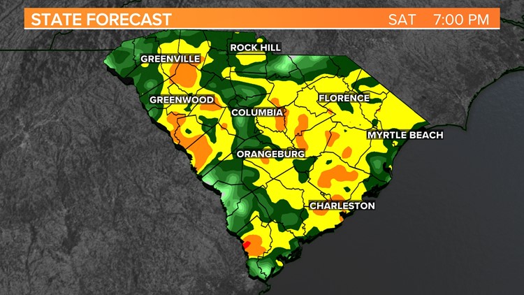
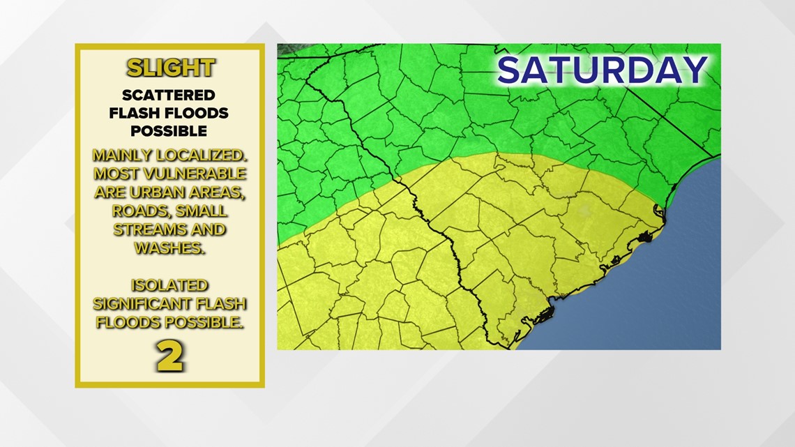
Saturday will start off quiet, but rain will return to the area later in the morning. Heavy rainfall, flash flooding is possible Saturday afternoon and Saturday night, especially in the southern half of the Midlands.
The southern Midlands is under a slight risk of excessive rainfall Saturday. This means that scattered flash flooding is possible, mainly in the areas most vulnerable to flooding. This is the second lowest (category 2 of 4) flooding risk category the Weather Prediction Center issues.

Total rainfall amounts are expected to reach up to 3 inches, some areas may get even more rainfall through early Sunday.
There may be a rumble of thunder or two Saturday, but the threat of widespread thunderstorm activity is small. Highs on Saturday will be in the lower 50s.
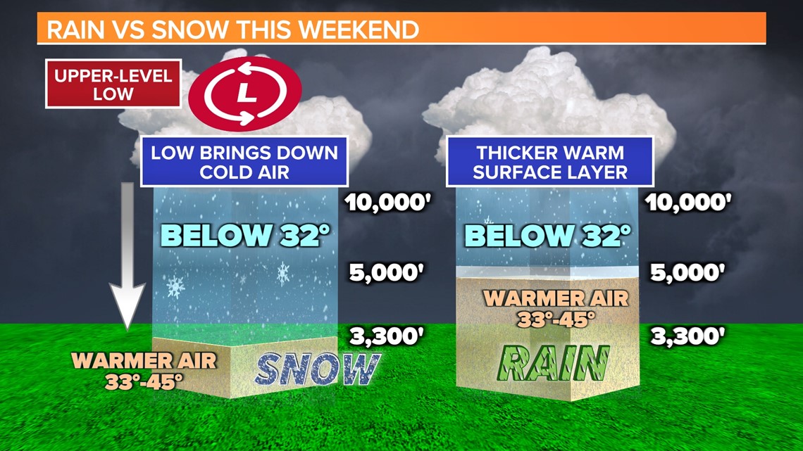
An upper-level low pressure system will be over the state Sunday. These cold core upper-level low pressure systems can be tough to predict. They have even been referred to as the “weatherman’s woe,” because how complex they can make a weather forecast.

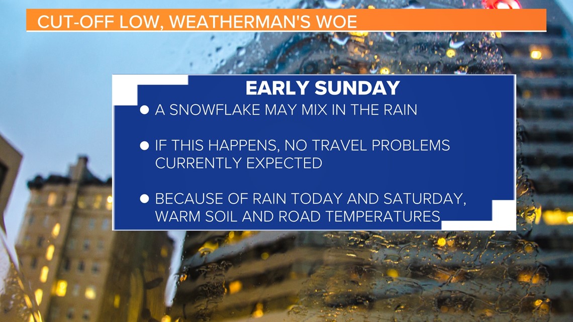
Colder air above us Sunday could produce a few snowflakes in the rainfall. There is a lot of uncertainty in the forecast for Sunday though. However, if a few snowflakes do fly, it is not expected to be an issue. The rain from today and Saturday, along with warm soil and road temperatures should prevent any travel problems.

There will be a much-higher chance for wintry weather in the mountains of North Carolina. There are currently no watches or warnings in effect, but that may change for that area. If you are travelling north, you may run into some road issues.
There is still a lot of uncertainty with this forecast. Small changes in the path or strength of the low could cause big weather changes.
Sunshine should return to the Midlands Monday and temperatures will start to moderate for the workweek.