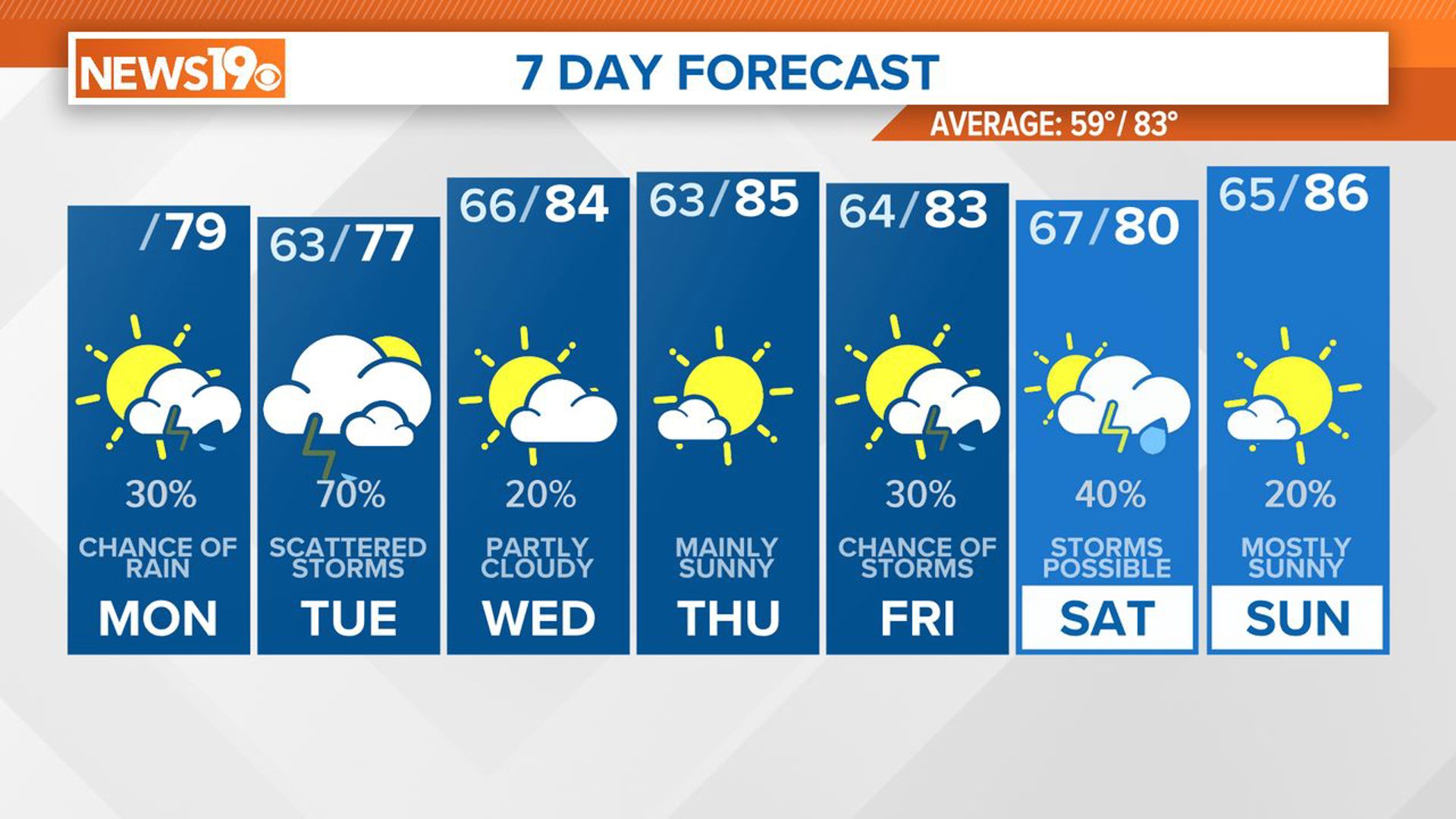
COLUMBIA, S.C. — Much of the Midlands of South Carolina could see scattered showers and thunderstorms in the afternoon and evening hours. The next round of rainfall will be late Friday night and Saturday, with periods of heavy rain and thunderstorms possible. Cooler and drier weather will move in behind the system on Sunday into early next week.
It has been a very rainy start to Wednesday; the Columbia Metropolitan Airport had recorded almost an inch of rain by 6:00 a.m. There will be a break in the rain early this afternoon, but showers and some storms are possible late in the afternoon and this evening.


A significant part of South Carolina is at a marginal risk of severe weather, according to the Storm Prediction Center today. This is the lowest risk category.
This means that there is a possibility of isolated severe thunderstorms, but the overall risk is relatively low. It suggests that severe weather conditions are not expected to be widespread or intense, but there is still a chance of some isolated severe storms with potentially damaging winds, hail, or brief tornadoes.


In our case today, the greatest threat of severe weather will be damaging wind gusts and large hail. Our in-house forecast model brings the storms mainly in the southern half of the Midlands, along and south of I-20, by about 5 p.m.
Cooler, drier air will filter into the Midlands tonight. Lows will be in the upper 40s to lower 50s Thursday morning. Skies will be mostly sunny Thursday afternoon. Temperatures will be warm again.
Cloudy skies are forecast on Friday. Rain returns to the state on Saturday. Sunday will be mainly sunny and dry.