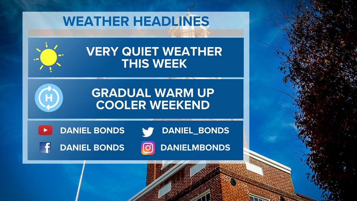
COLUMBIA, S.C. — Dry, sunny, quiet weather will continue over the next seven days. Temperatures will gradually warm up through the rest of the workweek. A cold front will move through the area by early Saturday. Cooler weather will return to the Midlands for the weekend.
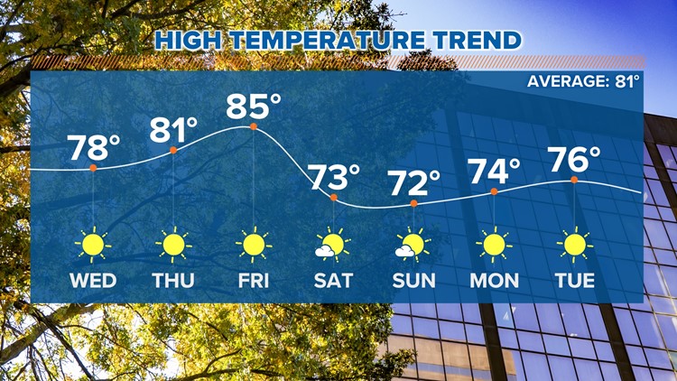
Tuesday was sunny and mild. Highs were in the lower to middle 70s. The Columbia airport reported a high temperature of 76 degrees. Temperatures should be a few degrees warmer today as high pressure continues to build in. Look for afternoon temperatures in the middle to upper 70s today.
Morning lows Thursday will drop into the upper 40s to near 50° with clear skies and calm winds. Thursday afternoon will be seasonable as highs climb into the upper 70s and lower 80s.

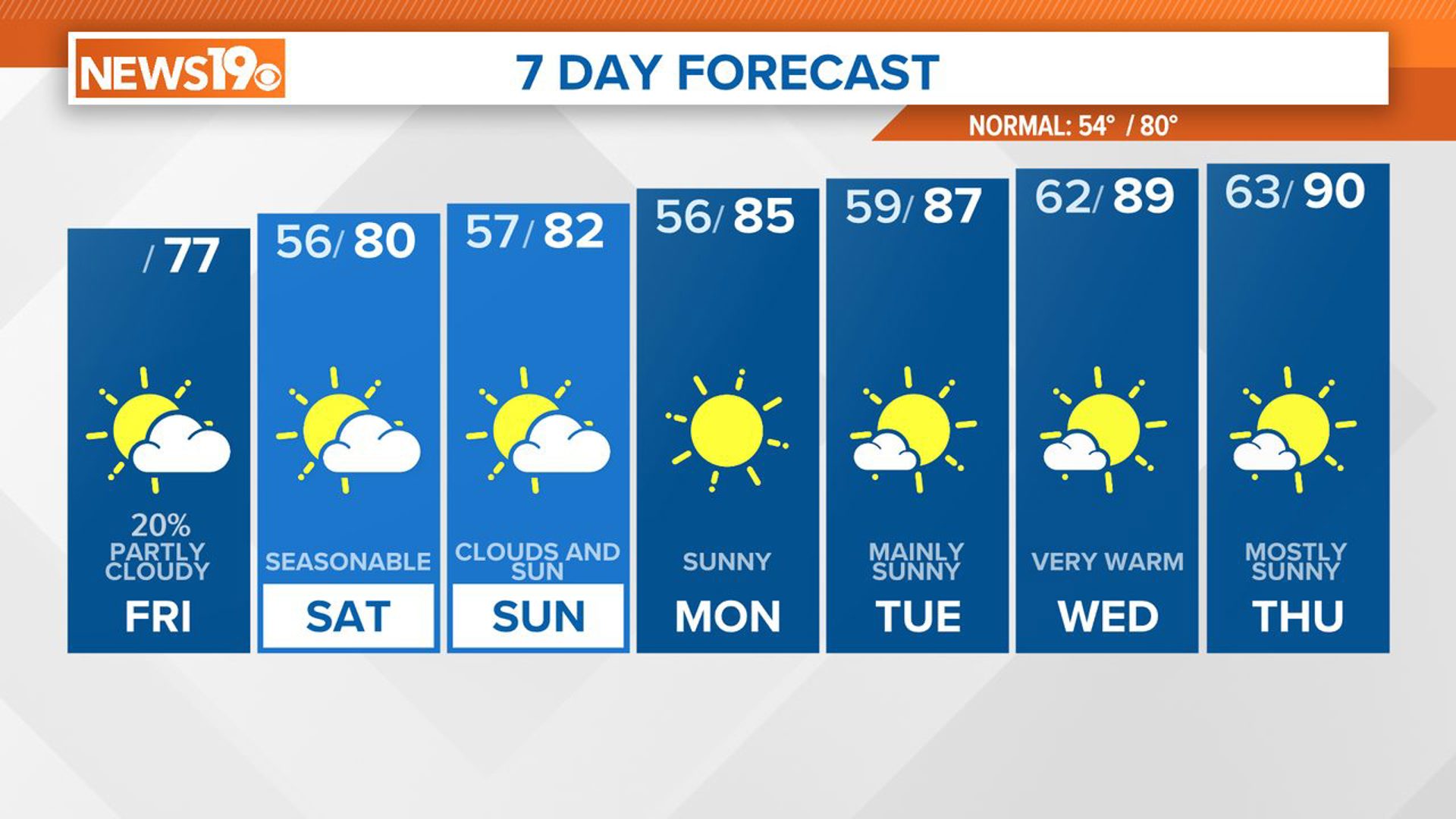
Friday will be our warmest day of the week. It will be a sunny day across the area. Highs will climb into the middle to possibly upper 80s for some areas. A front will move through the Midlands late Friday or early Saturday. This cold front will be a dry frontal passage, but it will bring in some noticeably cooler air in for the weekend.
Saturday and Sunday will be mostly sunny. Temperatures will be below normal. Highs will top out in the lower 70s both weekend days. The start of the new workweek will be sunny and dry. Highs Monday and Tuesday will be in the middle 70s under mainly sunny conditions.
Tracking the Tropics:
Tropical Depression Twelve is in the eastern Atlantic, but it will not be a big deal to anyone.
A broad area of low pressure located east of the Windward Islands continues to produce a large area of showers and thunderstorms. Satellite-derived wind data and radar images indicate this system does not have a well-defined circulation center.


However, upper-level winds are forecast to become more conducive for development, and a tropical depression is likely to form over the next few days if the system remains over open waters while moving generally west at about 15 mph through the Windward Islands and into the Caribbean Sea.